Property Record
2823 W Orange Ave, Apopka, FL 32703


NEARBY LISTINGS FOR SALE OR LEASE
Property Detail
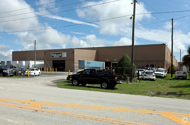
2823 W Orange Ave
Orlando-Kissimmee-Sanford, FL
Plymouth
06-2128-7172-02-074
MAP OF PLYMOUTH B/17 BEG N 89 DEG E 476.02 FT FROM W1/4 COR RUN N 56 DEG W 9.56 FT NWLY ALONG CURVE 3.9 FT N 35 DEG E 52 3.87 FT S 55 DEG E 405.29 FT S 35 DEG W 523.1 FT N 55 DEG W
Warehouse
Orange
X
Florida
12095C0110H
4,7,8
2024
4.62 AC
2025
NW Orange County
017810
Orlando
117,023 SF
DEMOGRAPHICS near 2823 W Orange Ave
1 Mile
3 Mile
5 Mile
2024 Total Population
3,398
37,910
76,198
2029 Population
3,565
39,416
79,040
Pop Growth 2024-2029
+ 4.91%
+ 3.97%
+ 3.73%
Average Age
40
40
40
2024 Total Households
1,178
12,910
25,807
HH Growth 2024-2029
+ 4.75%
+ 3.96%
+ 3.70%
Median Household Inc
$52,374
$77,708
$74,375
Avg Household Size
2.90
2.90
2.90
2024 Avg HH Vehicles
2.00
2.00
2.00
Median Home Value
$306,302
$302,918
$302,949
Median Year Built
1997
2000
1996
Nearby Places
Map Layers
Map Styles
 Street
 Aerial
- Restaurants
- Banks
- Shops
- Fitness
- Groceries
PUBLIC TRANSPORTATION
AIRPORT
Orlando Sanford International
DRIVE
WALK
Distance
Orlando Sanford International
45 min
25.9 mi
Orlando International
DRIVE
WALK
Distance
Orlando International
43 min
33.7 mi
Freight Ports
Port Canaveral
DRIVE
WALK
Distance
Port Canaveral
91 min
76.2 mi
Nearby Properties
Address
Land Use
TOTAL SIZE
Lot Size
Zoning
Address
Land Use
TOTAL SIZE
Lot Size
Zoning
1,245,060 SF
90.98 AC
PD
Address
Land Use
TOTAL SIZE
Lot Size
Zoning
1,208,378 SF
57.24 AC
PD
Address
Land Use
TOTAL SIZE
Lot Size
Zoning
722,019 SF
35.47 AC
PD
Address
Land Use
TOTAL SIZE
Lot Size
Zoning
792,152 SF
53.04 AC
O
Address
Land Use
TOTAL SIZE
Lot Size
Zoning
588,076 SF
38.89 AC
PD
Address
Land Use
TOTAL SIZE
Lot Size
Zoning
537,895 SF
55.19 AC
I-L
Address
Land Use
TOTAL SIZE
Lot Size
Zoning
272,340 SF
10.78 AC
PD
Address
Land Use
TOTAL SIZE
Lot Size
Zoning
361,418 SF
18.88 AC
MU-ES-GT
Address
Land Use
TOTAL SIZE
Lot Size
Zoning
343,587 SF
9.67 AC
MU-ES-GT
Address
Land Use
TOTAL SIZE
Lot Size
Zoning
265,125 SF
16.27 AC
MU-ES-GT
Address
Land Use
TOTAL SIZE
Lot Size
Zoning
348,560 SF
12.96 AC
PD
Address
Land Use
TOTAL SIZE
Lot Size
Zoning
299,743 SF
PD
Address
Land Use
TOTAL SIZE
Lot Size
Zoning
323,161 SF
43.61 AC
PD
Address
Land Use
TOTAL SIZE
Lot Size
Zoning
347,706 SF
40.19 AC
PD
Address
Land Use
TOTAL SIZE
Lot Size
Zoning
293,305 SF
21.60 AC
PD
Address
Land Use
TOTAL SIZE
Lot Size
Zoning
278,981 SF
51.18 AC
I-L
Address
Land Use
TOTAL SIZE
Lot Size
Zoning
189,514 SF
12.70 AC
MU-ES-GT
Address
Land Use
TOTAL SIZE
Lot Size
Zoning
589,600 SF
19.60 AC
I-L
Address
Land Use
TOTAL SIZE
Lot Size
Zoning
341,131 SF
39.88 AC
O
Address
Land Use
TOTAL SIZE
Lot Size
Zoning
313,324 SF
32.44 AC
PR
Address
Land Use
TOTAL SIZE
Lot Size
Zoning
255,880 SF
15.73 AC
PD
Address
Land Use
TOTAL SIZE
Lot Size
Zoning
133,960 SF
17.21 AC
PD
Address
Land Use
TOTAL SIZE
Lot Size
Zoning
805,668 SF
19.32 AC
I-L
Address
Land Use
TOTAL SIZE
Lot Size
Zoning
275,446 SF
12.81 AC
I-L
Address
Land Use
TOTAL SIZE
Lot Size
Zoning
193,525 SF
10.07 AC
D-APK-I-L
Address
Land Use
TOTAL SIZE
Lot Size
Zoning
503,677 SF
27.63 AC
I-L
Address
Land Use
TOTAL SIZE
Lot Size
Zoning
184,786 SF
16.44 AC
I-L
Address
Land Use
TOTAL SIZE
Lot Size
Zoning
75.90 AC
MU-KPI
Address
Land Use
TOTAL SIZE
Lot Size
Zoning
67,945 SF
18.66 AC
O
Address
Land Use
TOTAL SIZE
Lot Size
Zoning
3,688 SF
71.90 AC
MU-KPI
The World's #1 Commercial Real Estate Marketplace
Connect with us
© 2025 CoStar Group
The information above has been obtained from sources believed reliable. While we do not doubt its accuracy we have not verified it and make no guarantee, warranty or representation about it. It is your responsibility to independently confirm its accuracy and completeness. Any projections, opinions, assumptions, or estimates used are for example only and do not represent the current or future performance of the property. The value of this transaction to you depends on tax and other factors which should be evaluated by your tax, financial, and legal advisors. You and your advisors should conduct a careful, independent investigation of the property to determine to your satisfaction the suitability of the property for your needs.