Property Record
28235 Al Highway 53, Ardmore, AL 35739
NEARBY LISTINGS FOR SALE OR LEASE
Property Detail
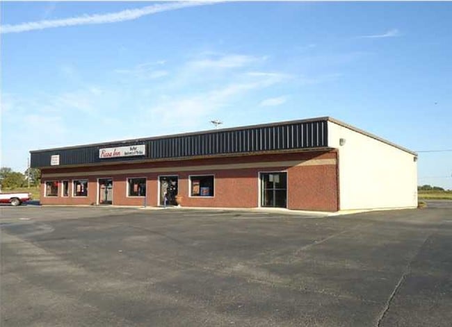
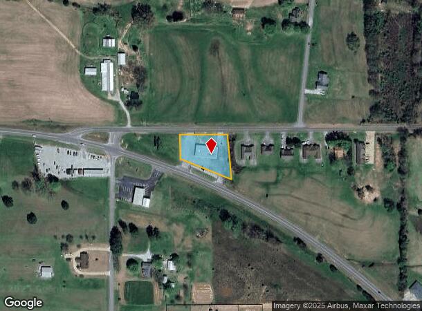
28235 Al Highway 53
01-01-02-0-000-008.000
Alg Sd
Medicalbuilding
COM INT NELY R/W ST HWY 53 & SLY R/W CO RD 110 TH E 280 ALGSD SLY R/W TO POB S 115 (133)TO NELY R/W
X
Limestone
01083C0080F
Alabama
0
0.92 AC
2025
Outlying Limestone County
020103
Huntsville
5,000 SF
Huntsville, AL
DEMOGRAPHICS near 28235 Al Highway 53
1 Mile
3 Mile
5 Mile
2024 Total Population
511
5,684
11,172
2029 Population
581
6,402
12,597
Pop Growth 2024-2029
+ 13.70%
+ 12.63%
+ 12.76%
Average Age
42
42
42
2024 Total Households
206
2,325
4,511
HH Growth 2024-2029
+ 13.59%
+ 12.86%
+ 13.06%
Median Household Inc
$61,731
$57,830
$58,979
Avg Household Size
2.50
2.40
2.50
2024 Avg HH Vehicles
2.00
2.00
2.00
Median Home Value
$217,592
$202,459
$200,552
Median Year Built
1987
1990
1992
Nearby Places
Map Layers
Map Styles
 Street
 Aerial
- Restaurants
- Banks
- Shops
- Fitness
- Groceries
PUBLIC TRANSPORTATION
AIRPORT
Huntsville International-Carl T Jones Field
DRIVE
WALK
Distance
Huntsville International-Carl T Jones Field
44 min
31.1 mi
Nearby Properties
Address
Land Use
TOTAL SIZE
Lot Size
Zoning
Address
Land Use
TOTAL SIZE
Lot Size
Zoning
5.30 AC
Address
Land Use
TOTAL SIZE
Lot Size
Zoning
75.76 AC
Address
Land Use
TOTAL SIZE
Lot Size
Zoning
21.62 AC
Address
Land Use
TOTAL SIZE
Lot Size
Zoning
24,973 SF
3.80 AC
Address
Land Use
TOTAL SIZE
Lot Size
Zoning
9,120 SF
2.57 AC
Address
Land Use
TOTAL SIZE
Lot Size
Zoning
42,890 SF
9.80 AC
Address
Land Use
TOTAL SIZE
Lot Size
Zoning
34,662 SF
4.87 AC
Address
Land Use
TOTAL SIZE
Lot Size
Zoning
36,000 SF
5.70 AC
Address
Land Use
TOTAL SIZE
Lot Size
Zoning
1,420 SF
5.69 AC
Address
Land Use
TOTAL SIZE
Lot Size
Zoning
73,788 SF
8.50 AC
Address
Land Use
TOTAL SIZE
Lot Size
Zoning
13,912 SF
1.40 AC
Address
Land Use
TOTAL SIZE
Lot Size
Zoning
7,904 SF
3.09 AC
Address
Land Use
TOTAL SIZE
Lot Size
Zoning
9,779 SF
0.21 AC
Address
Land Use
TOTAL SIZE
Lot Size
Zoning
44,365 SF
8.50 AC
Address
Land Use
TOTAL SIZE
Lot Size
Zoning
7,320 SF
3.14 AC
Address
Land Use
TOTAL SIZE
Lot Size
Zoning
56,315 SF
5.20 AC
Address
Land Use
TOTAL SIZE
Lot Size
Zoning
17,388 SF
1.80 AC
Address
Land Use
TOTAL SIZE
Lot Size
Zoning
5,412 SF
1.99 AC
Address
Land Use
TOTAL SIZE
Lot Size
Zoning
4,200 SF
1.50 AC
Address
Land Use
TOTAL SIZE
Lot Size
Zoning
5,260 SF
2.25 AC
Address
Land Use
TOTAL SIZE
Lot Size
Zoning
39,400 SF
9.30 AC
Address
Land Use
TOTAL SIZE
Lot Size
Zoning
5,477 SF
0.77 AC
Address
Land Use
TOTAL SIZE
Lot Size
Zoning
10,222 SF
2.50 AC
Address
Land Use
TOTAL SIZE
Lot Size
Zoning
504 SF
2.10 AC
Address
Land Use
TOTAL SIZE
Lot Size
Zoning
14,000 SF
4 AC
Address
Land Use
TOTAL SIZE
Lot Size
Zoning
22,500 SF
2.78 AC
Address
Land Use
TOTAL SIZE
Lot Size
Zoning
38.70 AC
Address
Land Use
TOTAL SIZE
Lot Size
Zoning
8,784 SF
1.06 AC
Address
Land Use
TOTAL SIZE
Lot Size
Zoning
30,000 SF
5.79 AC
Address
Land Use
TOTAL SIZE
Lot Size
Zoning
8,640 SF
1.40 AC
The World's #1 Commercial Real Estate Marketplace
Connect with us
© 2026 CoStar Group
The information above has been obtained from sources believed reliable. While we do not doubt its accuracy we have not verified it and make no guarantee, warranty or representation about it. It is your responsibility to independently confirm its accuracy and completeness. Any projections, opinions, assumptions, or estimates used are for example only and do not represent the current or future performance of the property. The value of this transaction to you depends on tax and other factors which should be evaluated by your tax, financial, and legal advisors. You and your advisors should conduct a careful, independent investigation of the property to determine to your satisfaction the suitability of the property for your needs.