Property Record
2825 W State St, Eagle, ID 83616
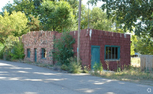


Property Detail
2825 W State St
S0507336310
PAR #6310 OF SW4SW4 SEC 7 4N 1E
Commercialnec
Ada
RUT
Idaho
B and X Area of moderate flood hazard, usually the area between the limits of the 100-year and 500-year floods.
1.26 AC
2024
Eagle
2025
Boise City/Nampa
010233
Boise City, ID
2,888 SF
NEARBY LISTINGS FOR SALE OR LEASE
DEMOGRAPHICS near 2825 W State St
1 mile
3 mile
5 mile
2025 Total Population
3,297
40,936
130,260
2030 Population
3,504
43,457
137,542
Pop Growth 2025-2030
+ 6.28%
+ 6.16%
+ 5.59%
Average Age
43
44
41
2025 Total Households
1,099
14,588
45,945
HH Growth 2025-2030
+ 6.64%
+ 6.66%
+ 6.04%
Median Household Inc
$106,060
$120,922
$108,938
Avg Household Size
2.90
2.80
2.80
2025 Avg HH Vehicles
3.00
2.00
2.00
Median Home Value
$850,342
$791,358
$661,514
Median Year Built
2007
2008
2006
Nearby Places
Map Layers
Map Styles
 Street
 Aerial
Transit
 Traffic
 Biking
Places
Listings with unknown addresses are not visible on the map
- Restaurants
- Banks
- Shops
- Fitness
- Groceries
PUBLIC TRANSPORTATION
AIRPORT
Boise Air Trml/Gowen Field
Drive
Walk
Distance
Boise Air Trml/Gowen Field
28 min
17.9 mi
Nearby Properties
Address
Land Use
TOTAL SIZE
Lot Size
Zoning
Address
Land Use
TOTAL SIZE
Lot Size
Zoning
342,567 SF
19.16 AC
MU-DA
Address
Land Use
TOTAL SIZE
Lot Size
Zoning
265.60 AC
R-2-DA
Address
Land Use
TOTAL SIZE
Lot Size
Zoning
98,738 SF
4.25 AC
CBD
Address
Land Use
TOTAL SIZE
Lot Size
Zoning
152,123 SF
6 AC
MU-DA
Address
Land Use
TOTAL SIZE
Lot Size
Zoning
170,333 SF
14.65 AC
C-3-DA
Address
Land Use
TOTAL SIZE
Lot Size
Zoning
69,546 SF
4.26 AC
MU-DA
Address
Land Use
TOTAL SIZE
Lot Size
Zoning
65,034 SF
4.44 AC
MU-DA
Address
Land Use
TOTAL SIZE
Lot Size
Zoning
98,612 SF
5.38 AC
MU-DA
Address
Land Use
TOTAL SIZE
Lot Size
Zoning
36,454 SF
3.18 AC
MU
Address
Land Use
TOTAL SIZE
Lot Size
Zoning
81,591 SF
2.88 AC
MU-DA
Address
Land Use
TOTAL SIZE
Lot Size
Zoning
165,295 SF
7.01 AC
MU-DA
Address
Land Use
TOTAL SIZE
Lot Size
Zoning
59,778 SF
3.68 AC
C-3-DA
Address
Land Use
TOTAL SIZE
Lot Size
Zoning
68,707 SF
2.83 AC
C-3-DA
Address
Land Use
TOTAL SIZE
Lot Size
Zoning
74,296 SF
4.86 AC
CBD
Address
Land Use
TOTAL SIZE
Lot Size
Zoning
2,496 SF
222.96 AC
R-2-DA
Address
Land Use
TOTAL SIZE
Lot Size
Zoning
80,913 SF
8 AC
C-C
Address
Land Use
TOTAL SIZE
Lot Size
Zoning
34,602 SF
2.61 AC
MU-DA
Address
Land Use
TOTAL SIZE
Lot Size
Zoning
56,809 SF
5.95 AC
C-1-DA
Address
Land Use
TOTAL SIZE
Lot Size
Zoning
93,791 SF
6.41 AC
MU-DA
Address
Land Use
TOTAL SIZE
Lot Size
Zoning
56,382 SF
3.94 AC
C-C
Address
Land Use
TOTAL SIZE
Lot Size
Zoning
58,267 SF
3.65 AC
MU-DA
Address
Land Use
TOTAL SIZE
Lot Size
Zoning
104,234 SF
8 AC
MU-DA
Address
Land Use
TOTAL SIZE
Lot Size
Zoning
49,508 SF
1.34 AC
MU-DA
Address
Land Use
TOTAL SIZE
Lot Size
Zoning
85,852 SF
10.04 AC
MU
Address
Land Use
TOTAL SIZE
Lot Size
Zoning
3,840 SF
19.22 AC
R-3-DA-P
Address
Land Use
TOTAL SIZE
Lot Size
Zoning
6,237 SF
1.83 AC
C-C
Address
Land Use
TOTAL SIZE
Lot Size
Zoning
33,881 SF
3.68 AC
MU-DA
Address
Land Use
TOTAL SIZE
Lot Size
Zoning
48,943 SF
4.41 AC
MU
Address
Land Use
TOTAL SIZE
Lot Size
Zoning
40,340 SF
2.63 AC
R-15
Address
Land Use
TOTAL SIZE
Lot Size
Zoning
54,604 SF
2.72 AC
MU-DA
The World's #1 Commercial Real Estate Marketplace
Connect with us
© 2026 CoStar Group
The information above has been obtained from sources believed reliable. While we do not doubt its accuracy we have not verified it and make no guarantee, warranty or representation about it. It is your responsibility to independently confirm its accuracy and completeness. Any projections, opinions, assumptions, or estimates used are for example only and do not represent the current or future performance of the property. The value of this transaction to you depends on tax and other factors which should be evaluated by your tax, financial, and legal advisors. You and your advisors should conduct a careful, independent investigation of the property to determine to your satisfaction the suitability of the property for your needs.