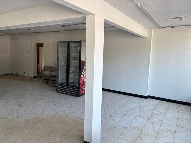
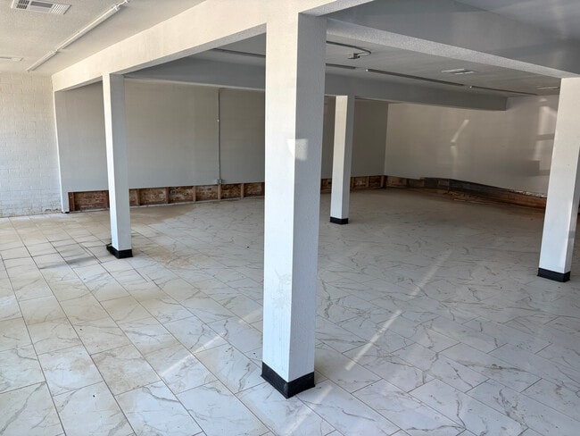
Property Record
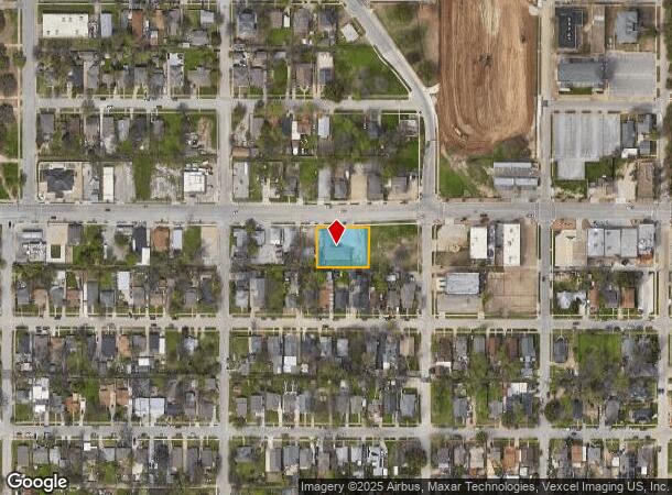
2826 E Rosedale St, Fort Worth, TX 76105
Current Lease Availabilities
NEARBY LISTINGS FOR SALE OR LEASE
Property Detail
2826 E Rosedale St
Dallas-Fort Worth-Arlington, TX
Polytechnic Heights Addition
02235455
POLYTECHNIC HEIGHTS ADDITION BLOCK 31 LOT 4R E1504R BLK 31
Commercialnec
Tarrant
X
Texas
48439C0310L
4r
2024
0.40 AC
2025
Southeast Fort Worth
103500
Dallas/Ft Worth
3,324 SF
DEMOGRAPHICS near 2826 E Rosedale St
1 Mile
3 Mile
5 Mile
2024 Total Population
14,490
107,640
280,037
2029 Population
15,392
114,907
297,533
Pop Growth 2024-2029
+ 6.22%
+ 6.75%
+ 6.25%
Average Age
35
36
36
2024 Total Households
4,242
34,041
96,008
HH Growth 2024-2029
+ 6.34%
+ 7.00%
+ 6.67%
Median Household Inc
$51,469
$53,287
$56,955
Avg Household Size
3.20
2.90
2.70
2024 Avg HH Vehicles
2.00
2.00
2.00
Median Home Value
$146,180
$173,550
$202,271
Median Year Built
1955
1962
1970
Nearby Places
- Restaurants
- Banks
- Shops
- Fitness
- Groceries
PUBLIC TRANSPORTATION
COMMUTER RAIL
Texas And Pacific (T&P) (Trinity Railway Express - Dallas Area Rapid Transit (DART))
DRIVE
WALK
Distance
Texas And Pacific (T&P) (Trinity Railway Express - Dallas Area Rapid Transit (DART))
6 min
3.4 mi
DRIVE
WALK
Distance
7 min
3.4 mi
AIRPORT
Dallas-Fort Worth International
DRIVE
WALK
Distance
Dallas-Fort Worth International
35 min
24.9 mi
Dallas Love Field
DRIVE
WALK
Distance
Dallas Love Field
46 min
33.6 mi
Nearby Properties
Address
Land Use
TOTAL SIZE
Lot Size
Zoning
Address
Land Use
TOTAL SIZE
Lot Size
Zoning
738,487 SF
2.11 AC
Address
Land Use
TOTAL SIZE
Lot Size
Zoning
650,744 SF
15.68 AC
Address
Land Use
TOTAL SIZE
Lot Size
Zoning
928,562 SF
17.47 AC
Address
Land Use
TOTAL SIZE
Lot Size
Zoning
433,672 SF
6.37 AC
Address
Land Use
TOTAL SIZE
Lot Size
Zoning
1,054,538 SF
6.23 AC
Address
Land Use
TOTAL SIZE
Lot Size
Zoning
386,125 SF
3.54 AC
Address
Land Use
TOTAL SIZE
Lot Size
Zoning
275,486 SF
9.12 AC
Address
Land Use
TOTAL SIZE
Lot Size
Zoning
276,500 SF
7.21 AC
Address
Land Use
TOTAL SIZE
Lot Size
Zoning
477,750 SF
1.72 AC
Address
Land Use
TOTAL SIZE
Lot Size
Zoning
320,000 SF
2.03 AC
Address
Land Use
TOTAL SIZE
Lot Size
Zoning
305,580 SF
1.77 AC
Address
Land Use
TOTAL SIZE
Lot Size
Zoning
295,784 SF
8.87 AC
Address
Land Use
TOTAL SIZE
Lot Size
Zoning
374,346 SF
2.32 AC
Address
Land Use
TOTAL SIZE
Lot Size
Zoning
284,049 SF
2.10 AC
Address
Land Use
TOTAL SIZE
Lot Size
Zoning
221,946 SF
31.17 AC
Address
Land Use
TOTAL SIZE
Lot Size
Zoning
302,868 SF
0.92 AC
Address
Land Use
TOTAL SIZE
Lot Size
Zoning
358,966 SF
1.90 AC
Address
Land Use
TOTAL SIZE
Lot Size
Zoning
195,529 SF
5.79 AC
Address
Land Use
TOTAL SIZE
Lot Size
Zoning
578,886 SF
23.05 AC
Address
Land Use
TOTAL SIZE
Lot Size
Zoning
215,253 SF
0.92 AC
Address
Land Use
TOTAL SIZE
Lot Size
Zoning
277,795 SF
1.74 AC
Address
Land Use
TOTAL SIZE
Lot Size
Zoning
286,000 SF
2.08 AC
Address
Land Use
TOTAL SIZE
Lot Size
Zoning
114,603 SF
1.53 AC
Address
Land Use
TOTAL SIZE
Lot Size
Zoning
171,769 SF
4.96 AC
Address
Land Use
TOTAL SIZE
Lot Size
Zoning
292,810 SF
2.17 AC
Address
Land Use
TOTAL SIZE
Lot Size
Zoning
131,582 SF
10.61 AC
Address
Land Use
TOTAL SIZE
Lot Size
Zoning
63,462 SF
4.43 AC
Address
Land Use
TOTAL SIZE
Lot Size
Zoning
228,667 SF
12.17 AC
Address
Land Use
TOTAL SIZE
Lot Size
Zoning
214,240 SF
1.96 AC
Address
Land Use
TOTAL SIZE
Lot Size
Zoning
202,695 SF
23.56 AC
The World's #1 Commercial Real Estate Marketplace
Connect with us
© 2025 CoStar Group
The information above has been obtained from sources believed reliable. While we do not doubt its accuracy we have not verified it and make no guarantee, warranty or representation about it. It is your responsibility to independently confirm its accuracy and completeness. Any projections, opinions, assumptions, or estimates used are for example only and do not represent the current or future performance of the property. The value of this transaction to you depends on tax and other factors which should be evaluated by your tax, financial, and legal advisors. You and your advisors should conduct a careful, independent investigation of the property to determine to your satisfaction the suitability of the property for your needs.