Property Record
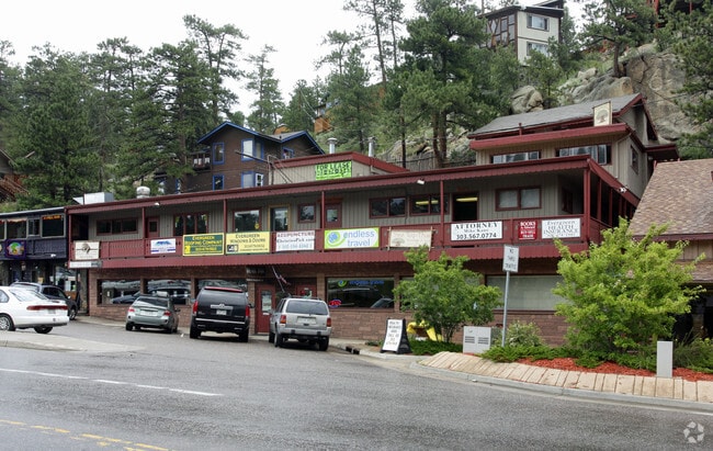
28265 Highway 74, Evergreen, CO 80439


Property Detail
28265 Highway 74
51-101-99-008
SECTION 10 TOWNSHIP 05 RANGE 71 QTR NE SUBDIVISIONCD 505400 SUBDIVISIONNAME MARY N WILLIAMS ESTATE ADD BLOCK 00A LOT SIZE: 150 TRACT VALUE: .003 SECTION 10 TOWNSHIP 05 RANGE 71 QTR NE SIZE: 7485 VALUE: .172 KEY=061
Commercialnec
JEFFERSON
C1
Colorado
B and X Area of moderate flood hazard, usually the area between the limits of the 100-year and 500-year floods.
0.18 AC
2023
West Denver
2024
Denver
009846
Denver-Aurora-Centennial, CO
7,347 SF
NEARBY LISTINGS FOR SALE OR LEASE
DEMOGRAPHICS near 28265 Highway 74
1 mile
3 mile
5 mile
2024 Total Population
2,856
12,426
24,245
2029 Population
2,857
12,335
24,063
Pop Growth 2024-2029
+ 0.04%
(0.73%)
(0.75%)
Average Age
45
46
47
2024 Total Households
1,202
5,045
9,788
HH Growth 2024-2029
+ 0.08%
(0.77%)
(0.86%)
Median Household Inc
$124,249
$148,302
$154,616
Avg Household Size
2.30
2.40
2.40
2024 Avg HH Vehicles
2.00
2.00
2.00
Median Home Value
$790,957
$860,113
$921,718
Median Year Built
1971
1978
1979
Nearby Places
Map Layers
Map Styles
 Street
 Aerial
Transit
 Traffic
 Biking
Places
Listings with unknown addresses are not visible on the map
- Restaurants
- Banks
- Shops
- Fitness
- Groceries
SALE & LEASE HISTORY
LISTING DATE
SALE/LEASE

Jan 22, 2025
For Lease
Nearby Properties
Address
Land Use
TOTAL SIZE
Lot Size
Zoning
Address
Land Use
TOTAL SIZE
Lot Size
Zoning
769.90 AC
CO
Address
Land Use
TOTAL SIZE
Lot Size
Zoning
681.88 AC
CO
Address
Land Use
TOTAL SIZE
Lot Size
Zoning
134,644 SF
51.80 AC
A2
Address
Land Use
TOTAL SIZE
Lot Size
Zoning
480 AC
CO
Address
Land Use
TOTAL SIZE
Lot Size
Zoning
54,443 SF
4.16 AC
PD
Address
Land Use
TOTAL SIZE
Lot Size
Zoning
44,100 SF
4.86 AC
PD
Address
Land Use
TOTAL SIZE
Lot Size
Zoning
116.70 AC
CO
Address
Land Use
TOTAL SIZE
Lot Size
Zoning
17,554 SF
25.57 AC
A2
Address
Land Use
TOTAL SIZE
Lot Size
Zoning
320 AC
CO
Address
Land Use
TOTAL SIZE
Lot Size
Zoning
400 SF
427.06 AC
CO
Address
Land Use
TOTAL SIZE
Lot Size
Zoning
53,371 SF
3.69 AC
C1
Address
Land Use
TOTAL SIZE
Lot Size
Zoning
59,012 SF
2.40 AC
PD
Address
Land Use
TOTAL SIZE
Lot Size
Zoning
34,581 SF
1.98 AC
PD
Address
Land Use
TOTAL SIZE
Lot Size
Zoning
51,104 SF
5.57 AC
PD
Address
Land Use
TOTAL SIZE
Lot Size
Zoning
53,106 SF
3.19 AC
C1
Address
Land Use
TOTAL SIZE
Lot Size
Zoning
37,332 SF
5.06 AC
PD
Address
Land Use
TOTAL SIZE
Lot Size
Zoning
5,298 SF
147.29 AC
CO
Address
Land Use
TOTAL SIZE
Lot Size
Zoning
70.88 AC
A2
Address
Land Use
TOTAL SIZE
Lot Size
Zoning
999.86 AC
Address
Land Use
TOTAL SIZE
Lot Size
Zoning
256.19 AC
CO
Address
Land Use
TOTAL SIZE
Lot Size
Zoning
25,104 SF
1.47 AC
PD
Address
Land Use
TOTAL SIZE
Lot Size
Zoning
23,124 SF
5 AC
A2
Address
Land Use
TOTAL SIZE
Lot Size
Zoning
11,317 SF
1.45 AC
C1
Address
Land Use
TOTAL SIZE
Lot Size
Zoning
17,230 SF
1.85 AC
C1
Address
Land Use
TOTAL SIZE
Lot Size
Zoning
5,753 SF
1.37 AC
PD
Address
Land Use
TOTAL SIZE
Lot Size
Zoning
35,890 SF
1.84 AC
PD
Address
Land Use
TOTAL SIZE
Lot Size
Zoning
32,461 SF
3.92 AC
C1
Address
Land Use
TOTAL SIZE
Lot Size
Zoning
15,005 SF
1.17 AC
Address
Land Use
TOTAL SIZE
Lot Size
Zoning
42,360 SF
3.02 AC
PD
Address
Land Use
TOTAL SIZE
Lot Size
Zoning
27,699 SF
2.59 AC
PD
The World's #1 Commercial Real Estate Marketplace
Connect with us
© 2026 CoStar Group
The information above has been obtained from sources believed reliable. While we do not doubt its accuracy we have not verified it and make no guarantee, warranty or representation about it. It is your responsibility to independently confirm its accuracy and completeness. Any projections, opinions, assumptions, or estimates used are for example only and do not represent the current or future performance of the property. The value of this transaction to you depends on tax and other factors which should be evaluated by your tax, financial, and legal advisors. You and your advisors should conduct a careful, independent investigation of the property to determine to your satisfaction the suitability of the property for your needs.