Property Record
2827 S 2300 E, Salt Lake City, UT 84109


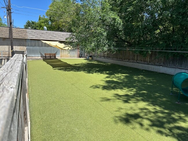

This Property Is For Sale
Current Lease Availabilities
NEARBY LISTINGS FOR SALE OR LEASE
Property Detail
2827 S 2300 E
Salt Lake City, UT
Harriman Sub
16-27-202-002-0000
W 50 FT OF LOT 18 & S 1/2 OF LOTS 19 & 20 HARRIMAN SUB & COM583.5 FT S FR N 1/4 COR SEC 27 T 1S R 1E SL MER S 69.5 FT E 230 FT N 69.5 FT W 230 FT TO BEG 5434-1113, 1118 5434-1119 6119-2920 6124-1574 8312-1848 9637-7888 09637-7892
Storebuilding
Salt Lake
X
Utah
49035C0304H
18-20
2024
0.63 AC
2025
Foothill Corridor
110200
Salt Lake City
11,000 SF
DEMOGRAPHICS near 2827 S 2300 E
1 Mile
3 Mile
5 Mile
2024 Total Population
14,233
120,199
254,865
2029 Population
14,333
121,124
257,885
Pop Growth 2024-2029
+ 0.70%
+ 0.77%
+ 1.18%
Average Age
38
39
38
2024 Total Households
5,322
47,559
107,696
HH Growth 2024-2029
+ 0.68%
+ 0.78%
+ 1.34%
Median Household Inc
$101,418
$93,059
$70,733
Avg Household Size
2.60
2.40
2.20
2024 Avg HH Vehicles
2.00
2.00
2.00
Median Home Value
$659,430
$625,833
$579,445
Median Year Built
1958
1961
1968
Nearby Places
Map Layers
Map Styles
 Street
 Aerial
- Restaurants
- Banks
- Shops
- Fitness
- Groceries
PUBLIC TRANSPORTATION
COMMUTER RAIL
DRIVE
WALK
Distance
13 min
9.0 mi
AIRPORT
Salt Lake City International
DRIVE
WALK
Distance
Salt Lake City International
17 min
12.9 mi
Provo Municipal
DRIVE
WALK
Distance
Provo Municipal
59 min
47.0 mi
Nearby Properties
Address
Land Use
TOTAL SIZE
Lot Size
Zoning
Address
Land Use
TOTAL SIZE
Lot Size
Zoning
298,628 SF
27.30 AC
I
Address
Land Use
TOTAL SIZE
Lot Size
Zoning
254,939 SF
34.68 AC
I
Address
Land Use
TOTAL SIZE
Lot Size
Zoning
207,140 SF
23.06 AC
P
Address
Land Use
TOTAL SIZE
Lot Size
Zoning
257,003 SF
25.87 AC
1108
Address
Land Use
TOTAL SIZE
Lot Size
Zoning
691,463 SF
17.80 AC
RM
Address
Land Use
TOTAL SIZE
Lot Size
Zoning
183,600 SF
10.70 AC
RMF-35
Address
Land Use
TOTAL SIZE
Lot Size
Zoning
297,476 SF
1.62 AC
CSHBD2
Address
Land Use
TOTAL SIZE
Lot Size
Zoning
369,717 SF
2.50 AC
RO
Address
Land Use
TOTAL SIZE
Lot Size
Zoning
412,006 SF
1.70 AC
C3
Address
Land Use
TOTAL SIZE
Lot Size
Zoning
369,377 SF
1.65 AC
Address
Land Use
TOTAL SIZE
Lot Size
Zoning
426,600 SF
1.61 AC
CSHBD1
Address
Land Use
TOTAL SIZE
Lot Size
Zoning
903,167 SF
1.90 AC
CSHBD1
Address
Land Use
TOTAL SIZE
Lot Size
Zoning
125,518 SF
11.03 AC
RMZC
Address
Land Use
TOTAL SIZE
Lot Size
Zoning
107,416 SF
5.46 AC
CSHBD2
Address
Land Use
TOTAL SIZE
Lot Size
Zoning
303,240 SF
29.21 AC
1205
Address
Land Use
TOTAL SIZE
Lot Size
Zoning
109,159 SF
32.02 AC
OS
Address
Land Use
TOTAL SIZE
Lot Size
Zoning
299,673 SF
2.16 AC
C3
Address
Land Use
TOTAL SIZE
Lot Size
Zoning
266,380 SF
2.09 AC
CSHBD1
Address
Land Use
TOTAL SIZE
Lot Size
Zoning
295,307 SF
2.46 AC
C-B
Address
Land Use
TOTAL SIZE
Lot Size
Zoning
386,512 SF
9.66 AC
C-SHDB
Address
Land Use
TOTAL SIZE
Lot Size
Zoning
621,969 SF
10.17 AC
CS
Address
Land Use
TOTAL SIZE
Lot Size
Zoning
256,179 SF
0.87 AC
CSHBD2
Address
Land Use
TOTAL SIZE
Lot Size
Zoning
147,742 SF
1.52 AC
CSH BD
Address
Land Use
TOTAL SIZE
Lot Size
Zoning
132,942 SF
18 AC
1108
Address
Land Use
TOTAL SIZE
Lot Size
Zoning
517,619 SF
4.20 AC
CSHBD1
Address
Land Use
TOTAL SIZE
Lot Size
Zoning
180,596 SF
1.27 AC
FBSC
Address
Land Use
TOTAL SIZE
Lot Size
Zoning
130,948 SF
18.95 AC
1107
Address
Land Use
TOTAL SIZE
Lot Size
Zoning
106,467 SF
4.41 AC
2000
Address
Land Use
TOTAL SIZE
Lot Size
Zoning
42,523 SF
13.70 AC
OS
Address
Land Use
TOTAL SIZE
Lot Size
Zoning
345,554 SF
3.21 AC
RO
The World's #1 Commercial Real Estate Marketplace
Connect with us
© 2026 CoStar Group
The information above has been obtained from sources believed reliable. While we do not doubt its accuracy we have not verified it and make no guarantee, warranty or representation about it. It is your responsibility to independently confirm its accuracy and completeness. Any projections, opinions, assumptions, or estimates used are for example only and do not represent the current or future performance of the property. The value of this transaction to you depends on tax and other factors which should be evaluated by your tax, financial, and legal advisors. You and your advisors should conduct a careful, independent investigation of the property to determine to your satisfaction the suitability of the property for your needs.