Property Record
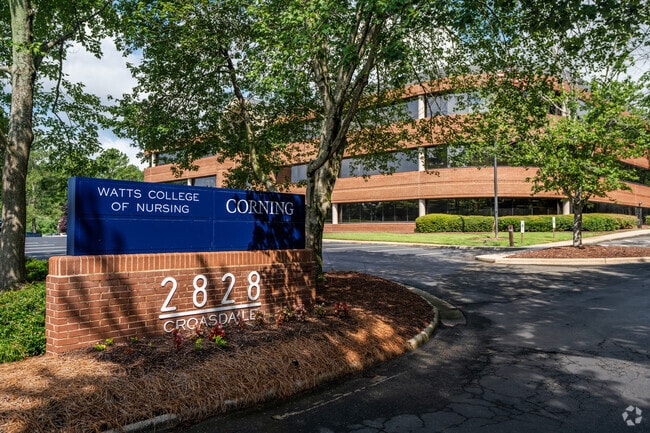
2828 Croasdaile Dr, Durham, NC 27705


Save to a Folder
{{folder.Name}}
{{folder.ListingIds.length}} Properties
{{folder.ListingIds.length}} Property
Create a New Folder
This Property Is For Sale
Current Lease Availabilities
Property Detail
2828 Croasdaile Dr
130741
PROP-BEISCHER SUSAN-CROAS DAILE INC WATTS SCHOOL O PL:000096-000130
Officebuilding
Durham
OI
North Carolina
B and X Area of moderate flood hazard, usually the area between the limits of the 100-year and 500-year floods.
3.50 AC
2025
North Durham
2025
Raleigh/Durham
001705
Durham-Chapel Hill, NC
54,576 SF
NEARBY LISTINGS FOR SALE OR LEASE
DEMOGRAPHICS near 2828 Croasdaile Dr
1 mile
3 mile
5 mile
2025 Total Population
6,468
73,216
168,141
2030 Population
6,838
77,354
178,063
Pop Growth 2025-2030
+ 5.72%
+ 5.65%
+ 5.90%
Average Age
40
37
38
2025 Total Households
3,013
32,444
69,221
HH Growth 2025-2030
+ 5.97%
+ 6.22%
+ 6.32%
Median Household Inc
$72,179
$69,588
$71,293
Avg Household Size
2.10
2.10
2.20
2025 Avg HH Vehicles
2.00
1.00
2.00
Median Home Value
$505,133
$454,848
$430,178
Median Year Built
1977
1984
1984
Nearby Places
Map Layers
Map Styles
 Street
 Aerial
Layers
 Traffic
 Biking
Places
Listings with unknown addresses are not visible on the map
- Restaurants
- Banks
- Shops
- Fitness
- Groceries
PUBLIC TRANSPORTATION
COMMUTER RAIL
Drive
Walk
Distance
9 min
3.9 mi
AIRPORT
Raleigh-Durham International
Drive
Walk
Distance
Raleigh-Durham International
27 min
16.9 mi
Nearby Properties
Address
Land Use
TOTAL SIZE
Lot Size
Zoning
Address
Land Use
TOTAL SIZE
Lot Size
Zoning
8,478 SF
676.09 AC
UC
Address
Land Use
TOTAL SIZE
Lot Size
Zoning
749,544 SF
100.49 AC
OI,RS-8
Address
Land Use
TOTAL SIZE
Lot Size
Zoning
26,512 SF
6.40 AC
CD-C
Address
Land Use
TOTAL SIZE
Lot Size
Zoning
758,666 SF
99.64 AC
PDR 2.000
Address
Land Use
TOTAL SIZE
Lot Size
Zoning
24,741 SF
5.67 AC
CD-S1
Address
Land Use
TOTAL SIZE
Lot Size
Zoning
63,921 SF
3.76 AC
DD-C
Address
Land Use
TOTAL SIZE
Lot Size
Zoning
416,469 SF
3.85 AC
MU(D)
Address
Land Use
TOTAL SIZE
Lot Size
Zoning
3.20 AC
CD-S1
Address
Land Use
TOTAL SIZE
Lot Size
Zoning
435.74 AC
UC(D)
Address
Land Use
TOTAL SIZE
Lot Size
Zoning
812,903 SF
9.31 AC
UC
Address
Land Use
TOTAL SIZE
Lot Size
Zoning
294,862 SF
2.37 AC
DD-C
Address
Land Use
TOTAL SIZE
Lot Size
Zoning
90,416 SF
3.87 AC
CD-S1
Address
Land Use
TOTAL SIZE
Lot Size
Zoning
132,520 SF
15.94 AC
RU-M(D)
Address
Land Use
TOTAL SIZE
Lot Size
Zoning
69,430 SF
2.61 AC
DD-C
Address
Land Use
TOTAL SIZE
Lot Size
Zoning
12,236 SF
43.44 AC
RU-M
Address
Land Use
TOTAL SIZE
Lot Size
Zoning
12,440 SF
36.51 AC
PDR 2.000
Address
Land Use
TOTAL SIZE
Lot Size
Zoning
125,552 SF
3.23 AC
UC(D)
Address
Land Use
TOTAL SIZE
Lot Size
Zoning
218,882 SF
3.10 AC
DD-S1
Address
Land Use
TOTAL SIZE
Lot Size
Zoning
441,868 SF
6.11 AC
MU(D)
Address
Land Use
TOTAL SIZE
Lot Size
Zoning
218,946 SF
1.91 AC
DD-S1
Address
Land Use
TOTAL SIZE
Lot Size
Zoning
234,754 SF
4.85 AC
UC
Address
Land Use
TOTAL SIZE
Lot Size
Zoning
368,569 SF
2.77 AC
Address
Land Use
TOTAL SIZE
Lot Size
Zoning
358,462 SF
1.48 AC
DD-C
Address
Land Use
TOTAL SIZE
Lot Size
Zoning
903.08 AC
RR,RS-20,U
Address
Land Use
TOTAL SIZE
Lot Size
Zoning
250,392 SF
16.67 AC
DD-S2
Address
Land Use
TOTAL SIZE
Lot Size
Zoning
485,295 SF
27.35 AC
RS-8
Address
Land Use
TOTAL SIZE
Lot Size
Zoning
296,580 SF
2.53 AC
MU(D)
Address
Land Use
TOTAL SIZE
Lot Size
Zoning
137,472 SF
1.04 AC
DD-C
Address
Land Use
TOTAL SIZE
Lot Size
Zoning
167,530 SF
1.46 AC
DD-S1
Address
Land Use
TOTAL SIZE
Lot Size
Zoning
6,753 SF
22.99 AC
OI(D)
The World's #1 Commercial Real Estate Marketplace
Connect with us
© 2026 CoStar Group
The information above has been obtained from sources believed reliable. While we do not doubt its accuracy we have not verified it and make no guarantee, warranty or representation about it. It is your responsibility to independently confirm its accuracy and completeness. Any projections, opinions, assumptions, or estimates used are for example only and do not represent the current or future performance of the property. The value of this transaction to you depends on tax and other factors which should be evaluated by your tax, financial, and legal advisors. You and your advisors should conduct a careful, independent investigation of the property to determine to your satisfaction the suitability of the property for your needs.