Property Record
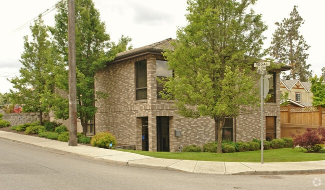
2828 E 32Nd Ave, Spokane, WA 99223


Property Detail
2828 E 32Nd Ave
35331.0401
SPRING PARK L1 B4
Financialbuilding
Spokane
O
Washington
B and X Area of moderate flood hazard, usually the area between the limits of the 100-year and 500-year floods.
1
2026
0.17 AC
2026
South Hill
004702
Spokane
1,564 SF
Spokane-Spokane Valley, WA
NEARBY LISTINGS FOR SALE OR LEASE
DEMOGRAPHICS near 2828 E 32Nd Ave
1 mile
3 mile
5 mile
2025 Total Population
15,882
79,288
169,655
2030 Population
16,105
80,781
172,829
Pop Growth 2025-2030
+ 1.40%
+ 1.88%
+ 1.87%
Average Age
43
42
40
2025 Total Households
6,939
33,121
71,252
HH Growth 2025-2030
+ 1.54%
+ 1.99%
+ 2.08%
Median Household Inc
$72,900
$81,058
$67,430
Avg Household Size
2.20
2.30
2.20
2025 Avg HH Vehicles
2.00
2.00
2.00
Median Home Value
$441,195
$466,537
$411,560
Median Year Built
1981
1975
1970
Nearby Places
Map Layers
Map Styles
 Street
 Aerial
Layers
 Traffic
 Biking
Places
Listings with unknown addresses are not visible on the map
- Restaurants
- Banks
- Shops
- Fitness
- Groceries
PUBLIC TRANSPORTATION
COMMUTER RAIL
Spokane (Empire Builder - Amtrak)
Drive
Walk
Distance
Spokane (Empire Builder - Amtrak)
10 min
3.9 mi
AIRPORT
Spokane International
Drive
Walk
Distance
Spokane International
19 min
10.0 mi
Freight Ports
Port of Everett
Drive
Walk
Distance
Port of Everett
347 min
305.6 mi
Nearby Properties
Address
Land Use
TOTAL SIZE
Lot Size
Zoning
Address
Land Use
TOTAL SIZE
Lot Size
Zoning
763,627 SF
12.44 AC
OR
Address
Land Use
TOTAL SIZE
Lot Size
Zoning
277,129 SF
49.25 AC
RSF
Address
Land Use
TOTAL SIZE
Lot Size
Zoning
365,804 SF
16.13 AC
RSF
Address
Land Use
TOTAL SIZE
Lot Size
Zoning
270,262 SF
29.10 AC
Address
Land Use
TOTAL SIZE
Lot Size
Zoning
251,542 SF
5.78 AC
DTG
Address
Land Use
TOTAL SIZE
Lot Size
Zoning
240,988 SF
13.29 AC
RMF
Address
Land Use
TOTAL SIZE
Lot Size
Zoning
231,197 SF
19.18 AC
RMF
Address
Land Use
TOTAL SIZE
Lot Size
Zoning
124,234 SF
13.54 AC
RSF
Address
Land Use
TOTAL SIZE
Lot Size
Zoning
107,240 SF
1.54 AC
CC1
Address
Land Use
TOTAL SIZE
Lot Size
Zoning
289,573 SF
7.73 AC
RMF
Address
Land Use
TOTAL SIZE
Lot Size
Zoning
119,933 SF
5.61 AC
Address
Land Use
TOTAL SIZE
Lot Size
Zoning
58,522 SF
19.91 AC
HI
Address
Land Use
TOTAL SIZE
Lot Size
Zoning
91,310 SF
2.34 AC
Address
Land Use
TOTAL SIZE
Lot Size
Zoning
135,715 SF
4.73 AC
RMF
Address
Land Use
TOTAL SIZE
Lot Size
Zoning
164,488 SF
13.59 AC
RSF
Address
Land Use
TOTAL SIZE
Lot Size
Zoning
81,833 SF
3.97 AC
OR
Address
Land Use
TOTAL SIZE
Lot Size
Zoning
108,237 SF
3.48 AC
LI
Address
Land Use
TOTAL SIZE
Lot Size
Zoning
119,910 SF
3.66 AC
OR
Address
Land Use
TOTAL SIZE
Lot Size
Zoning
138,840 SF
2.79 AC
DTU
Address
Land Use
TOTAL SIZE
Lot Size
Zoning
78,990 SF
5.58 AC
RSF
Address
Land Use
TOTAL SIZE
Lot Size
Zoning
66,193 SF
1.99 AC
OR
Address
Land Use
TOTAL SIZE
Lot Size
Zoning
60,724 SF
6.79 AC
RSF
Address
Land Use
TOTAL SIZE
Lot Size
Zoning
79,200 SF
OR
Address
Land Use
TOTAL SIZE
Lot Size
Zoning
142,500 SF
6.86 AC
RMF
Address
Land Use
TOTAL SIZE
Lot Size
Zoning
115,489 SF
6.84 AC
RMF
Address
Land Use
TOTAL SIZE
Lot Size
Zoning
172,734 SF
9.98 AC
HDR
Address
Land Use
TOTAL SIZE
Lot Size
Zoning
60,986 SF
4.46 AC
MU
Address
Land Use
TOTAL SIZE
Lot Size
Zoning
111,940 SF
13.07 AC
CB
Address
Land Use
TOTAL SIZE
Lot Size
Zoning
68,887 SF
0.86 AC
DTU
Address
Land Use
TOTAL SIZE
Lot Size
Zoning
107,442 SF
5.57 AC
MF-2
The World's #1 Commercial Real Estate Marketplace
Connect with us
© 2026 CoStar Group
The information above has been obtained from sources believed reliable. While we do not doubt its accuracy we have not verified it and make no guarantee, warranty or representation about it. It is your responsibility to independently confirm its accuracy and completeness. Any projections, opinions, assumptions, or estimates used are for example only and do not represent the current or future performance of the property. The value of this transaction to you depends on tax and other factors which should be evaluated by your tax, financial, and legal advisors. You and your advisors should conduct a careful, independent investigation of the property to determine to your satisfaction the suitability of the property for your needs.