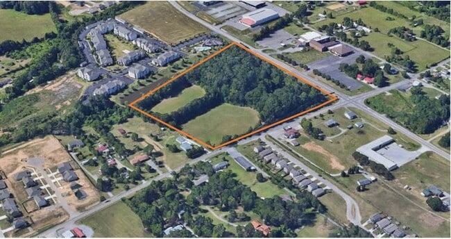
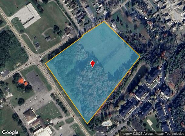
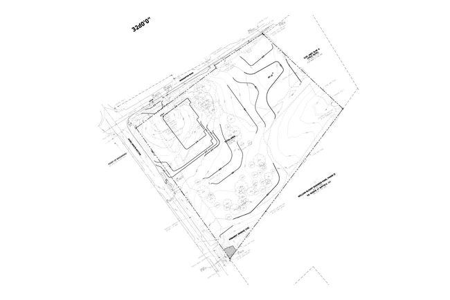
Property Record
2828 Morganton Rd, Maryville, TN 37801
This Property Is For Sale
NEARBY LISTINGS FOR SALE OR LEASE
Property Detail
2828 Morganton Rd
067-111.00
M. PRUETT-W SHOPE WILLIAM BLOUNT DRIVE
Residentialacreage
Blount
X
Tennessee
47009C0235C
12.20 AC
2024
Blount County
2025
Knoxville
011607
Knoxville, TN
864 SF
DEMOGRAPHICS near 2828 Morganton Rd
1 Mile
3 Mile
5 Mile
2024 Total Population
4,128
29,098
63,597
2029 Population
4,561
31,658
69,159
Pop Growth 2024-2029
+ 10.49%
+ 8.80%
+ 8.75%
Average Age
41
42
42
2024 Total Households
1,669
11,663
25,454
HH Growth 2024-2029
+ 10.61%
+ 8.86%
+ 8.81%
Median Household Inc
$76,614
$65,312
$63,618
Avg Household Size
2.50
2.40
2.40
2024 Avg HH Vehicles
2.00
2.00
2.00
Median Home Value
$269,211
$248,851
$252,788
Median Year Built
2009
1992
1989
Nearby Places
- Restaurants
- Banks
- Shops
- Fitness
- Groceries
PUBLIC TRANSPORTATION
AIRPORT
McGhee Tyson
DRIVE
WALK
Distance
McGhee Tyson
18 min
10.5 mi
Freight Ports
Georgia Ports - Savannah
DRIVE
WALK
Distance
Georgia Ports - Savannah
497 min
422.6 mi
Nearby Properties
Address
Land Use
TOTAL SIZE
Lot Size
Zoning
Address
Land Use
TOTAL SIZE
Lot Size
Zoning
325,748 SF
IND
Address
Land Use
TOTAL SIZE
Lot Size
Zoning
558,604 SF
83.49 AC
IND
Address
Land Use
TOTAL SIZE
Lot Size
Zoning
194,268 SF
33.99 AC
IND
Address
Land Use
TOTAL SIZE
Lot Size
Zoning
10,061 SF
22.74 AC
SPLIT
Address
Land Use
TOTAL SIZE
Lot Size
Zoning
78,099 SF
20 AC
S
Address
Land Use
TOTAL SIZE
Lot Size
Zoning
279,826 SF
50.95 AC
IND
Address
Land Use
TOTAL SIZE
Lot Size
Zoning
33,912 SF
19.91 AC
HDR
Address
Land Use
TOTAL SIZE
Lot Size
Zoning
74,071 SF
5.19 AC
HIC
Address
Land Use
TOTAL SIZE
Lot Size
Zoning
41,938 SF
7.42 AC
BT
Address
Land Use
TOTAL SIZE
Lot Size
Zoning
323,040 SF
87.30 AC
IND
Address
Land Use
TOTAL SIZE
Lot Size
Zoning
55,708 SF
6.95 AC
BT
Address
Land Use
TOTAL SIZE
Lot Size
Zoning
161,251 SF
IND
Address
Land Use
TOTAL SIZE
Lot Size
Zoning
15,340 SF
5 AC
F
Address
Land Use
TOTAL SIZE
Lot Size
Zoning
156,000 SF
45.10 AC
IND
Address
Land Use
TOTAL SIZE
Lot Size
Zoning
533,928 SF
97.90 AC
IND
Address
Land Use
TOTAL SIZE
Lot Size
Zoning
295,555 SF
IND
Address
Land Use
TOTAL SIZE
Lot Size
Zoning
60,328 SF
4.41 AC
F
Address
Land Use
TOTAL SIZE
Lot Size
Zoning
129,809 SF
11.37 AC
BT
Address
Land Use
TOTAL SIZE
Lot Size
Zoning
223,912 SF
25.83 AC
BT
Address
Land Use
TOTAL SIZE
Lot Size
Zoning
103,689 SF
5.12 AC
R
Address
Land Use
TOTAL SIZE
Lot Size
Zoning
52,162 SF
3.30 AC
R
Address
Land Use
TOTAL SIZE
Lot Size
Zoning
42,735 SF
IND
Address
Land Use
TOTAL SIZE
Lot Size
Zoning
42,735 SF
Address
Land Use
TOTAL SIZE
Lot Size
Zoning
183,772 SF
20.32 AC
IND
Address
Land Use
TOTAL SIZE
Lot Size
Zoning
45.20 AC
BT
Address
Land Use
TOTAL SIZE
Lot Size
Zoning
61,551 SF
6.53 AC
BT
Address
Land Use
TOTAL SIZE
Lot Size
Zoning
88,998 SF
1.98 AC
BT
Address
Land Use
TOTAL SIZE
Lot Size
Zoning
77,413 SF
8.50 AC
S
Address
Land Use
TOTAL SIZE
Lot Size
Zoning
24,773 SF
15.20 AC
BT
Address
Land Use
TOTAL SIZE
Lot Size
Zoning
124,412 SF
10.84 AC
HIC
The World's #1 Commercial Real Estate Marketplace
Connect with us
© 2025 CoStar Group
The information above has been obtained from sources believed reliable. While we do not doubt its accuracy we have not verified it and make no guarantee, warranty or representation about it. It is your responsibility to independently confirm its accuracy and completeness. Any projections, opinions, assumptions, or estimates used are for example only and do not represent the current or future performance of the property. The value of this transaction to you depends on tax and other factors which should be evaluated by your tax, financial, and legal advisors. You and your advisors should conduct a careful, independent investigation of the property to determine to your satisfaction the suitability of the property for your needs.