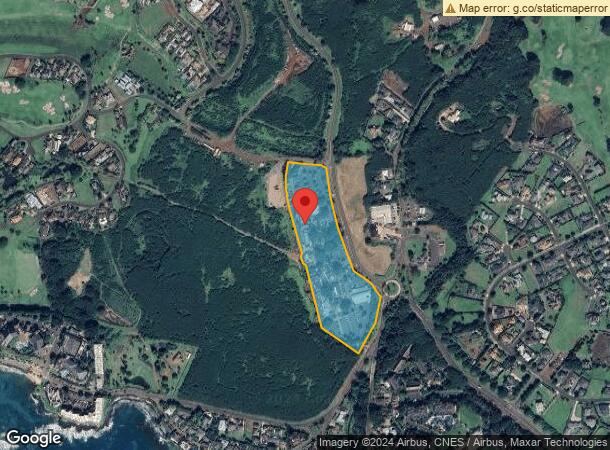
Property Record
2829 Ala Kalanikaumaka, Koloa, HI 96756


NEARBY LISTINGS FOR SALE OR LEASE
Property Detail
2829 Ala Kalanikaumaka
Kapaa, HI
Kukuiula Parcel X Subdivision
4-2-6-015-010-0000
LOT 10-A KUKUIULA PARCEL X SUBD 10.241 AC DES
Commercialnec
Kauai
AE
Hawaii
1500020313F
10-a
2024
10.24 AC
2025
Kauai
040604
Hawaii
88,361 SF
DEMOGRAPHICS near 2829 Ala Kalanikaumaka
1 Mile
3 Mile
5 Mile
2024 Total Population
2,719
6,896
12,765
2029 Population
2,810
7,179
12,807
Pop Growth 2024-2029
+ 3.35%
+ 4.10%
+ 0.33%
Average Age
43
46
45
2024 Total Households
1,031
2,626
4,700
HH Growth 2024-2029
+ 3.49%
+ 4.53%
+ 0.60%
Median Household Inc
$70,334
$78,432
$82,195
Avg Household Size
2.60
2.60
2.70
2024 Avg HH Vehicles
2.00
2.00
2.00
Median Home Value
$788,510
$850,393
$813,681
Median Year Built
1981
1982
1981
Nearby Places
Map Layers
Map Styles
 Street
 Aerial
- Restaurants
- Banks
- Shops
- Fitness
- Groceries
PUBLIC TRANSPORTATION
AIRPORT
Lihue
DRIVE
WALK
Distance
Lihue
39 min
16.2 mi
SALE & LEASE HISTORY
LISTING DATE
SALE/LEASE

Sep 25, 2016
For Lease
May 30, 2017
For Lease
Nearby Properties
Address
Land Use
TOTAL SIZE
Lot Size
Zoning
Address
Land Use
TOTAL SIZE
Lot Size
Zoning
605,103 SF
37.74 AC
RR-10
Address
Land Use
TOTAL SIZE
Lot Size
Zoning
170,120 SF
8.44 AC
RR-20
Address
Land Use
TOTAL SIZE
Lot Size
Zoning
38,142 SF
15.26 AC
SEE PLANNI
Address
Land Use
TOTAL SIZE
Lot Size
Zoning
4.21 AC
Address
Land Use
TOTAL SIZE
Lot Size
Zoning
17,928 SF
1.01 AC
RR-20
Address
Land Use
TOTAL SIZE
Lot Size
Zoning
41,596 SF
4.49 AC
SEE PLANNI
Address
Land Use
TOTAL SIZE
Lot Size
Zoning
Address
Land Use
TOTAL SIZE
Lot Size
Zoning
3.28 AC
O
Address
Land Use
TOTAL SIZE
Lot Size
Zoning
9,082 SF
0.80 AC
C-N
Address
Land Use
TOTAL SIZE
Lot Size
Zoning
11.20 AC
R-20
Address
Land Use
TOTAL SIZE
Lot Size
Zoning
16,472 SF
0.98 AC
RR-20
Address
Land Use
TOTAL SIZE
Lot Size
Zoning
10 AC
C-N/ST-P
Address
Land Use
TOTAL SIZE
Lot Size
Zoning
12,700 SF
148.14 AC
O
Address
Land Use
TOTAL SIZE
Lot Size
Zoning
9.72 AC
RR-20
Address
Land Use
TOTAL SIZE
Lot Size
Zoning
4,400 SF
7.98 AC
O/ST-P
Address
Land Use
TOTAL SIZE
Lot Size
Zoning
67.21 AC
O
Address
Land Use
TOTAL SIZE
Lot Size
Zoning
22,338 SF
RR-20
Address
Land Use
TOTAL SIZE
Lot Size
Zoning
1,062.29 AC
A
Address
Land Use
TOTAL SIZE
Lot Size
Zoning
6.12 AC
RR-10
Address
Land Use
TOTAL SIZE
Lot Size
Zoning
12,552 SF
0.80 AC
C-N
Address
Land Use
TOTAL SIZE
Lot Size
Zoning
20,055 SF
R-20
Address
Land Use
TOTAL SIZE
Lot Size
Zoning
102.02 AC
SEE PLANNI
Address
Land Use
TOTAL SIZE
Lot Size
Zoning
18,000 SF
1.07 AC
C-G
Address
Land Use
TOTAL SIZE
Lot Size
Zoning
3.82 AC
SEE PLANNI
Address
Land Use
TOTAL SIZE
Lot Size
Zoning
2,729 SF
0.41 AC
The World's #1 Commercial Real Estate Marketplace
Connect with us
© 2026 CoStar Group
The information above has been obtained from sources believed reliable. While we do not doubt its accuracy we have not verified it and make no guarantee, warranty or representation about it. It is your responsibility to independently confirm its accuracy and completeness. Any projections, opinions, assumptions, or estimates used are for example only and do not represent the current or future performance of the property. The value of this transaction to you depends on tax and other factors which should be evaluated by your tax, financial, and legal advisors. You and your advisors should conduct a careful, independent investigation of the property to determine to your satisfaction the suitability of the property for your needs.