Property Record
2829 Augusta Rd, West Columbia, SC 29170

Property Detail
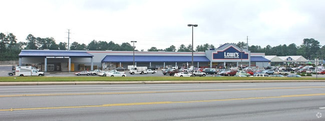
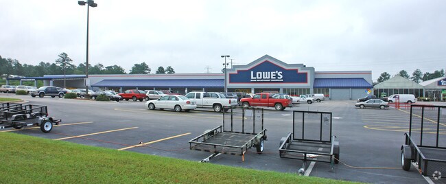
2829 Augusta Rd
Wholesaleoutletdiscountstore
Lexington
ID
South Carolina
AE The base floodplain where base flood elevations are provided. AE Zones are now used on new format FIRMs instead of A1-A30 Zones.
18.27 AC
2025
Cayce/West Columbia
2024
Columbia
020602
Columbia, SC
147,166 SF
004532-03-017
NEARBY LISTINGS FOR SALE OR LEASE
DEMOGRAPHICS near 2829 Augusta Rd
1 mile
3 mile
5 mile
2025 Total Population
5,501
43,199
119,984
2030 Population
5,799
45,346
125,000
Pop Growth 2025-2030
+ 5.42%
+ 4.97%
+ 4.18%
Average Age
41
41
37
2025 Total Households
2,307
19,267
51,810
HH Growth 2025-2030
+ 5.50%
+ 5.20%
+ 4.41%
Median Household Inc
$67,586
$59,525
$58,304
Avg Household Size
2.30
2.20
2.10
2025 Avg HH Vehicles
2.00
2.00
2.00
Median Home Value
$208,750
$199,633
$211,177
Median Year Built
1986
1977
1980
Nearby Places
Map Layers
Map Styles
 Street
 Aerial
Layers
 Traffic
 Biking
Places
Listings with unknown addresses are not visible on the map
- Restaurants
- Banks
- Shops
- Fitness
- Groceries
PUBLIC TRANSPORTATION
COMMUTER RAIL
Columbia Amtrak Station (Silver Star - Amtrak)
Drive
Walk
Distance
Columbia Amtrak Station (Silver Star - Amtrak)
7 min
4.9 mi
AIRPORT
Columbia Metro
Drive
Walk
Distance
Columbia Metro
16 min
6.4 mi
Freight Ports
North Charleston Terminal
Drive
Walk
Distance
North Charleston Terminal
115 min
102.7 mi
Nearby Properties
Address
Land Use
TOTAL SIZE
Lot Size
Zoning
Address
Land Use
TOTAL SIZE
Lot Size
Zoning
461,888 SF
61.50 AC
ID
Address
Land Use
TOTAL SIZE
Lot Size
Zoning
3,614 SF
1,444.32 AC
ID
Address
Land Use
TOTAL SIZE
Lot Size
Zoning
8,330 SF
19.10 AC
ID
Address
Land Use
TOTAL SIZE
Lot Size
Zoning
1,218 SF
8.99 AC
RG
Address
Land Use
TOTAL SIZE
Lot Size
Zoning
3,426 SF
20.31 AC
C2
Address
Land Use
TOTAL SIZE
Lot Size
Zoning
3,080 SF
18.07 AC
R
Address
Land Use
TOTAL SIZE
Lot Size
Zoning
8,118 SF
10.98 AC
RG
Address
Land Use
TOTAL SIZE
Lot Size
Zoning
222,557 SF
26.90 AC
ID
Address
Land Use
TOTAL SIZE
Lot Size
Zoning
10,304 SF
11.89 AC
R1
Address
Land Use
TOTAL SIZE
Lot Size
Zoning
107,890 SF
21.99 AC
C2
Address
Land Use
TOTAL SIZE
Lot Size
Zoning
1,386 SF
18.75 AC
R1
Address
Land Use
TOTAL SIZE
Lot Size
Zoning
257,688 SF
23.03 AC
ID
Address
Land Use
TOTAL SIZE
Lot Size
Zoning
99,628 SF
13.09 AC
RD
Address
Land Use
TOTAL SIZE
Lot Size
Zoning
318,309 SF
33.51 AC
ID
Address
Land Use
TOTAL SIZE
Lot Size
Zoning
41,860 SF
5.67 AC
C3
Address
Land Use
TOTAL SIZE
Lot Size
Zoning
7,383 SF
4.85 AC
ID
Address
Land Use
TOTAL SIZE
Lot Size
Zoning
34,267 SF
7.53 AC
ID
Address
Land Use
TOTAL SIZE
Lot Size
Zoning
70,740 SF
13 AC
ID
Address
Land Use
TOTAL SIZE
Lot Size
Zoning
430.11 AC
ID
Address
Land Use
TOTAL SIZE
Lot Size
Zoning
3,825 SF
18.45 AC
RD
Address
Land Use
TOTAL SIZE
Lot Size
Zoning
79,951 SF
3.31 AC
RD
Address
Land Use
TOTAL SIZE
Lot Size
Zoning
5.01 AC
MU-1
Address
Land Use
TOTAL SIZE
Lot Size
Zoning
48,751 SF
4.30 AC
ID
Address
Land Use
TOTAL SIZE
Lot Size
Zoning
86,711 SF
3.46 AC
ID
Address
Land Use
TOTAL SIZE
Lot Size
Zoning
54,000 SF
8.60 AC
ID
Address
Land Use
TOTAL SIZE
Lot Size
Zoning
33,268 SF
2.28 AC
ID
Address
Land Use
TOTAL SIZE
Lot Size
Zoning
202,029 SF
21.13 AC
ID
Address
Land Use
TOTAL SIZE
Lot Size
Zoning
14,169 SF
6.46 AC
ID
Address
Land Use
TOTAL SIZE
Lot Size
Zoning
44,958 SF
9 AC
C
The World's #1 Commercial Real Estate Marketplace
Connect with us
© 2026 CoStar Group
The information above has been obtained from sources believed reliable. While we do not doubt its accuracy we have not verified it and make no guarantee, warranty or representation about it. It is your responsibility to independently confirm its accuracy and completeness. Any projections, opinions, assumptions, or estimates used are for example only and do not represent the current or future performance of the property. The value of this transaction to you depends on tax and other factors which should be evaluated by your tax, financial, and legal advisors. You and your advisors should conduct a careful, independent investigation of the property to determine to your satisfaction the suitability of the property for your needs.