Property Record
2829 Pukoloa St, Honolulu, HI 96819


NEARBY LISTINGS FOR SALE OR LEASE
Property Detail
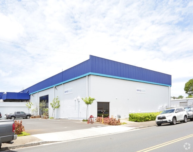
2829 Pukoloa St
Urban Honolulu, HI
Mapunapuna Industrial Subdivision
1-1-1-007-020-0000
LOT 1059, 39,600 SF MAP 217, LCAPP 1074
Industrialgeneral
Honolulu
AE
Hawaii
15003C0353G
1059
2024
0.91 AC
2025
Leeward
006203
Hawaii
17,960 SF
DEMOGRAPHICS near 2829 Pukoloa St
1 mile
3 mile
5 mile
2024 Total Population
21,311
135,836
270,371
2029 Population
20,923
130,952
263,795
Pop Growth 2024-2029
(1.82%)
(3.60%)
(2.43%)
Average Age
40
39
42
2024 Total Households
7,902
38,414
96,864
HH Growth 2024-2029
(2.52%)
(4.13%)
(2.58%)
Median Household Inc
$90,624
$83,844
$79,294
Avg Household Size
2.60
3.10
2.50
2024 Avg HH Vehicles
2.00
2.00
1.00
Median Home Value
$603,158
$772,580
$729,557
Median Year Built
1977
1972
1975
Nearby Places
Map Layers
Map Styles
 Street
 Aerial
Transit
 Traffic
 Biking
Places
Listings with unknown addresses are not visible on the map
- Restaurants
- Banks
- Shops
- Fitness
- Groceries
PUBLIC TRANSPORTATION
AIRPORT
Daniel K Inouye International
Drive
Walk
Distance
Daniel K Inouye International
8 min
2.8 mi
Freight Ports
Honolulu Harbor, Oahu
Drive
Walk
Distance
Honolulu Harbor, Oahu
12 min
4.6 mi
Nearby Properties
Address
Land Use
TOTAL SIZE
Lot Size
Zoning
Address
Land Use
TOTAL SIZE
Lot Size
Zoning
1,675.63 AC
C/61/60
Address
Land Use
TOTAL SIZE
Lot Size
Zoning
355.21 AC
U/63/80 -
Address
Land Use
TOTAL SIZE
Lot Size
Zoning
1,153,381 SF
425.42 AC
R-5
Address
Land Use
TOTAL SIZE
Lot Size
Zoning
1,069,312 SF
98.11 AC
F-1
Address
Land Use
TOTAL SIZE
Lot Size
Zoning
1,725,655 SF
11 AC
I-2
Address
Land Use
TOTAL SIZE
Lot Size
Zoning
1,725,655 SF
11 AC
I-2
Address
Land Use
TOTAL SIZE
Lot Size
Zoning
12,430 SF
86.69 AC
P-1
Address
Land Use
TOTAL SIZE
Lot Size
Zoning
309,307 SF
27.71 AC
A-2
Address
Land Use
TOTAL SIZE
Lot Size
Zoning
163,285 SF
15.08 AC
R-7.5
Address
Land Use
TOTAL SIZE
Lot Size
Zoning
838,015 SF
95.58 AC
F-1
Address
Land Use
TOTAL SIZE
Lot Size
Zoning
26,537 SF
2,470.86 AC
I-2
Address
Land Use
TOTAL SIZE
Lot Size
Zoning
1,447,909 SF
12.54 AC
IMX-1
Address
Land Use
TOTAL SIZE
Lot Size
Zoning
179.68 AC
P-1
Address
Land Use
TOTAL SIZE
Lot Size
Zoning
919,972 SF
14.45 AC
I-2
Address
Land Use
TOTAL SIZE
Lot Size
Zoning
748,905 SF
69.91 AC
F-1
Address
Land Use
TOTAL SIZE
Lot Size
Zoning
6.20 AC
I-2
Address
Land Use
TOTAL SIZE
Lot Size
Zoning
960 SF
71.97 AC
P-2
Address
Land Use
TOTAL SIZE
Lot Size
Zoning
492.38 AC
F-1
Address
Land Use
TOTAL SIZE
Lot Size
Zoning
16.46 AC
I-2
Address
Land Use
TOTAL SIZE
Lot Size
Zoning
24.43 AC
A-2
Address
Land Use
TOTAL SIZE
Lot Size
Zoning
40.76 AC
P-1
Address
Land Use
TOTAL SIZE
Lot Size
Zoning
750.28 AC
P-1
Address
Land Use
TOTAL SIZE
Lot Size
Zoning
281.27 AC
F-1
Address
Land Use
TOTAL SIZE
Lot Size
Zoning
187,487 SF
0.46 AC
BMX-3
Address
Land Use
TOTAL SIZE
Lot Size
Zoning
37.94 AC
I-3
Address
Land Use
TOTAL SIZE
Lot Size
Zoning
14.85 AC
A-2
Address
Land Use
TOTAL SIZE
Lot Size
Zoning
173,778 SF
16.41 AC
A-1
Address
Land Use
TOTAL SIZE
Lot Size
Zoning
267,131 SF
6.06 AC
I-2
Address
Land Use
TOTAL SIZE
Lot Size
Zoning
347,039 SF
12.61 AC
IMX-1
Address
Land Use
TOTAL SIZE
Lot Size
Zoning
619,404 SF
10.83 AC
IMX-1
The World's #1 Commercial Real Estate Marketplace
Connect with us
© 2026 CoStar Group
The information above has been obtained from sources believed reliable. While we do not doubt its accuracy we have not verified it and make no guarantee, warranty or representation about it. It is your responsibility to independently confirm its accuracy and completeness. Any projections, opinions, assumptions, or estimates used are for example only and do not represent the current or future performance of the property. The value of this transaction to you depends on tax and other factors which should be evaluated by your tax, financial, and legal advisors. You and your advisors should conduct a careful, independent investigation of the property to determine to your satisfaction the suitability of the property for your needs.