Property Record
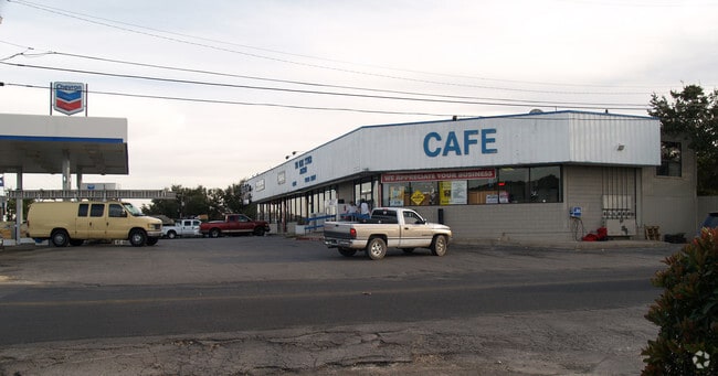
28295 Interstate 10 W, Boerne, TX 78006


NEARBY LISTINGS FOR SALE OR LEASE
Property Detail
28295 Interstate 10 W
San Antonio-New Braunfels, TX
Lake Side Acres Un 2
05996-012-0031
CB 5996 BLK 12 LOT 3 EXCEPT NE 24.06 FT (REMS) 2020 SPLIT/MERGE PER DEED 20190044421 CR 47039 2006 RESURVEY FROM .801 TO .804 ACRES PER DEED 11557/1519
Commercialnec
Bexar
X
Texas
48259C0525F
12
2024
0.63 AC
2025
Far Northwest
182102
San Antonio
176 SF
DEMOGRAPHICS near 28295 Interstate 10 W
1 mile
3 mile
5 mile
2024 Total Population
5,956
29,447
53,385
2029 Population
6,434
32,525
60,176
Pop Growth 2024-2029
+ 8.03%
+ 10.45%
+ 12.72%
Average Age
38
38
39
2024 Total Households
2,040
10,165
18,420
HH Growth 2024-2029
+ 8.19%
+ 10.80%
+ 13.06%
Median Household Inc
$128,361
$131,932
$127,623
Avg Household Size
2.90
2.90
2.90
2024 Avg HH Vehicles
2.00
2.00
2.00
Median Home Value
$432,069
$430,322
$431,995
Median Year Built
2010
2010
2009
Nearby Places
Map Layers
Map Styles
 Street
 Aerial
Transit
 Traffic
 Biking
Places
Listings with unknown addresses are not visible on the map
- Restaurants
- Banks
- Shops
- Fitness
- Groceries
PUBLIC TRANSPORTATION
AIRPORT
San Antonio International
Drive
Walk
Distance
San Antonio International
27 min
22.0 mi
Freight Ports
Calhoun Port
Drive
Walk
Distance
Calhoun Port
206 min
173.6 mi
Nearby Properties
Address
Land Use
TOTAL SIZE
Lot Size
Zoning
Address
Land Use
TOTAL SIZE
Lot Size
Zoning
260,536 SF
10.71 AC
Address
Land Use
TOTAL SIZE
Lot Size
Zoning
282,991 SF
26.41 AC
Address
Land Use
TOTAL SIZE
Lot Size
Zoning
265,093 SF
12.55 AC
Address
Land Use
TOTAL SIZE
Lot Size
Zoning
255,907 SF
19.93 AC
Address
Land Use
TOTAL SIZE
Lot Size
Zoning
215,736 SF
10.06 AC
Address
Land Use
TOTAL SIZE
Lot Size
Zoning
126,885 SF
16 AC
Address
Land Use
TOTAL SIZE
Lot Size
Zoning
49,164 SF
11.98 AC
Address
Land Use
TOTAL SIZE
Lot Size
Zoning
46,562 SF
3.02 AC
Address
Land Use
TOTAL SIZE
Lot Size
Zoning
145,171 SF
13.65 AC
Address
Land Use
TOTAL SIZE
Lot Size
Zoning
91,013 SF
6.45 AC
Address
Land Use
TOTAL SIZE
Lot Size
Zoning
43,422 SF
6.38 AC
Address
Land Use
TOTAL SIZE
Lot Size
Zoning
297,618 SF
13.20 AC
Address
Land Use
TOTAL SIZE
Lot Size
Zoning
71,658 SF
16.58 AC
Address
Land Use
TOTAL SIZE
Lot Size
Zoning
36,632 SF
142.92 AC
Address
Land Use
TOTAL SIZE
Lot Size
Zoning
1,183 SF
610.48 AC
Address
Land Use
TOTAL SIZE
Lot Size
Zoning
142,425 SF
3.08 AC
Address
Land Use
TOTAL SIZE
Lot Size
Zoning
28,398 SF
5.04 AC
Address
Land Use
TOTAL SIZE
Lot Size
Zoning
11,844 SF
160.22 AC
Address
Land Use
TOTAL SIZE
Lot Size
Zoning
1,882 SF
167.78 AC
Address
Land Use
TOTAL SIZE
Lot Size
Zoning
175.13 AC
Address
Land Use
TOTAL SIZE
Lot Size
Zoning
159.74 AC
Address
Land Use
TOTAL SIZE
Lot Size
Zoning
103,963 SF
1.98 AC
Address
Land Use
TOTAL SIZE
Lot Size
Zoning
11,429 SF
144 AC
Address
Land Use
TOTAL SIZE
Lot Size
Zoning
10,078 SF
15.47 AC
Address
Land Use
TOTAL SIZE
Lot Size
Zoning
42,442 SF
119.10 AC
Address
Land Use
TOTAL SIZE
Lot Size
Zoning
14,155 SF
124.35 AC
Address
Land Use
TOTAL SIZE
Lot Size
Zoning
7,537 SF
111.13 AC
Address
Land Use
TOTAL SIZE
Lot Size
Zoning
24,336 SF
1.95 AC
Address
Land Use
TOTAL SIZE
Lot Size
Zoning
47,942 SF
19.90 AC
Address
Land Use
TOTAL SIZE
Lot Size
Zoning
16,110 SF
1.78 AC
The World's #1 Commercial Real Estate Marketplace
Connect with us
© 2026 CoStar Group
The information above has been obtained from sources believed reliable. While we do not doubt its accuracy we have not verified it and make no guarantee, warranty or representation about it. It is your responsibility to independently confirm its accuracy and completeness. Any projections, opinions, assumptions, or estimates used are for example only and do not represent the current or future performance of the property. The value of this transaction to you depends on tax and other factors which should be evaluated by your tax, financial, and legal advisors. You and your advisors should conduct a careful, independent investigation of the property to determine to your satisfaction the suitability of the property for your needs.