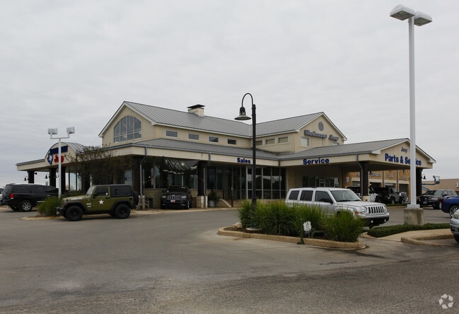
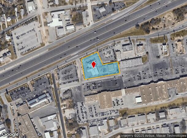
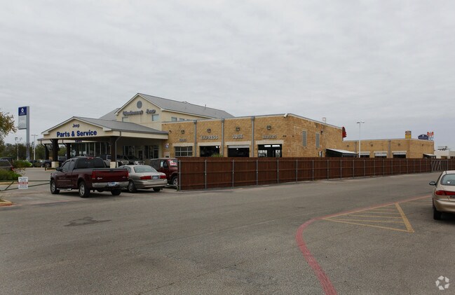
Property Record
283 S Interstate 35 S, New Braunfels, TX 78130
NEARBY LISTINGS FOR SALE OR LEASE
Property Detail
283 S Interstate 35 S
San Antonio-New Braunfels, TX
R H Routh
45-0060-0005-00
R H ROUTH, LOT 5C, ACRES 1.862
Commercialnec
Comal
X
Texas
48091C0455G
5c
2024
1.86 AC
2025
Comal County
310404
San Antonio
15,468 SF
DEMOGRAPHICS near 283 S Interstate 35 S
1 Mile
3 Mile
5 Mile
2024 Total Population
9,339
75,676
119,965
2029 Population
12,785
99,216
158,216
Pop Growth 2024-2029
+ 36.90%
+ 31.11%
+ 31.89%
Average Age
40
38
38
2024 Total Households
3,696
28,481
45,056
HH Growth 2024-2029
+ 36.77%
+ 31.75%
+ 32.46%
Median Household Inc
$73,669
$81,336
$83,256
Avg Household Size
2.40
2.60
2.60
2024 Avg HH Vehicles
2.00
2.00
2.00
Median Home Value
$248,258
$265,094
$276,083
Median Year Built
1982
1999
2005
Nearby Places
Map Layers
Map Styles
 Street
 Aerial
- Restaurants
- Banks
- Shops
- Fitness
- Groceries
PUBLIC TRANSPORTATION
AIRPORT
San Antonio International
DRIVE
WALK
Distance
San Antonio International
33 min
26.9 mi
Nearby Properties
Address
Land Use
TOTAL SIZE
Lot Size
Zoning
Address
Land Use
TOTAL SIZE
Lot Size
Zoning
111.44 AC
Address
Land Use
TOTAL SIZE
Lot Size
Zoning
350,595 SF
21.78 AC
Address
Land Use
TOTAL SIZE
Lot Size
Zoning
234,823 SF
72.17 AC
Address
Land Use
TOTAL SIZE
Lot Size
Zoning
248,377 SF
23.66 AC
Address
Land Use
TOTAL SIZE
Lot Size
Zoning
381,528 SF
82.50 AC
Address
Land Use
TOTAL SIZE
Lot Size
Zoning
225,158 SF
52.63 AC
Address
Land Use
TOTAL SIZE
Lot Size
Zoning
170,266 SF
16.78 AC
Address
Land Use
TOTAL SIZE
Lot Size
Zoning
269,288 SF
16.32 AC
Address
Land Use
TOTAL SIZE
Lot Size
Zoning
103,782 SF
105.82 AC
Address
Land Use
TOTAL SIZE
Lot Size
Zoning
186,838 SF
14.53 AC
Address
Land Use
TOTAL SIZE
Lot Size
Zoning
135,975 SF
39.25 AC
Address
Land Use
TOTAL SIZE
Lot Size
Zoning
145,856 SF
9.52 AC
Address
Land Use
TOTAL SIZE
Lot Size
Zoning
152,240 SF
14.13 AC
Address
Land Use
TOTAL SIZE
Lot Size
Zoning
397,600 SF
25.95 AC
Address
Land Use
TOTAL SIZE
Lot Size
Zoning
170,019 SF
4.46 AC
Address
Land Use
TOTAL SIZE
Lot Size
Zoning
3,937 SF
87.21 AC
Address
Land Use
TOTAL SIZE
Lot Size
Zoning
188,600 SF
4.61 AC
Address
Land Use
TOTAL SIZE
Lot Size
Zoning
132,319 SF
8.80 AC
Address
Land Use
TOTAL SIZE
Lot Size
Zoning
97,200 SF
12.87 AC
Address
Land Use
TOTAL SIZE
Lot Size
Zoning
180,795 SF
8.29 AC
Address
Land Use
TOTAL SIZE
Lot Size
Zoning
198,793 SF
9.38 AC
Address
Land Use
TOTAL SIZE
Lot Size
Zoning
143,206 SF
23.54 AC
Address
Land Use
TOTAL SIZE
Lot Size
Zoning
191,652 SF
19.03 AC
Address
Land Use
TOTAL SIZE
Lot Size
Zoning
76,180 SF
5.74 AC
Address
Land Use
TOTAL SIZE
Lot Size
Zoning
117,201 SF
4.72 AC
Address
Land Use
TOTAL SIZE
Lot Size
Zoning
61,079 SF
2.53 AC
Address
Land Use
TOTAL SIZE
Lot Size
Zoning
130,210 SF
13.57 AC
Address
Land Use
TOTAL SIZE
Lot Size
Zoning
205,071 SF
23.66 AC
Address
Land Use
TOTAL SIZE
Lot Size
Zoning
44.42 AC
Address
Land Use
TOTAL SIZE
Lot Size
Zoning
223,550 SF
11.80 AC
The World's #1 Commercial Real Estate Marketplace
Connect with us
© 2026 CoStar Group
The information above has been obtained from sources believed reliable. While we do not doubt its accuracy we have not verified it and make no guarantee, warranty or representation about it. It is your responsibility to independently confirm its accuracy and completeness. Any projections, opinions, assumptions, or estimates used are for example only and do not represent the current or future performance of the property. The value of this transaction to you depends on tax and other factors which should be evaluated by your tax, financial, and legal advisors. You and your advisors should conduct a careful, independent investigation of the property to determine to your satisfaction the suitability of the property for your needs.