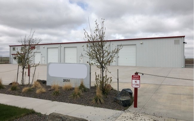
Property Record
2830 Granite Peak Dr, Cheyenne, WY 82007


NEARBY LISTINGS FOR SALE OR LEASE
Property Detail
2830 Granite Peak Dr
Cheyenne, WY
Overland Trails Business Park, 3Rd Filin
1-6799-0001-0002-0
PRIOR REF 757068 07/11/2019
Commercialnec
Laramie
X
Wyoming
08123C0025E
2
2024
4.77 AC
2025
I-80 Corridor/Cheyenne
001902
Other Market Areas
17,564 SF
DEMOGRAPHICS near 2830 Granite Peak Dr
1 Mile
3 Mile
5 Mile
2024 Total Population
86
12,782
38,361
2029 Population
87
13,013
39,037
Pop Growth 2024-2029
+ 1.16%
+ 1.81%
+ 1.76%
Average Age
40
36
38
2024 Total Households
33
5,254
16,511
HH Growth 2024-2029
0.00%
+ 1.96%
+ 1.88%
Median Household Inc
$63,750
$46,026
$48,741
Avg Household Size
2.40
2.30
2.20
2024 Avg HH Vehicles
2.00
2.00
2.00
Median Home Value
$260,714
$220,509
$223,131
Median Year Built
1977
1983
1965
Nearby Places
Map Layers
Map Styles
 Street
 Aerial
- Restaurants
- Banks
- Shops
- Fitness
- Groceries
SALE & LEASE HISTORY
LISTING DATE
SALE/LEASE

Jun 24, 2019
For Sale
Dec 16, 2019
For Lease
Nearby Properties
Address
Land Use
TOTAL SIZE
Lot Size
Zoning
Address
Land Use
TOTAL SIZE
Lot Size
Zoning
57.50 AC
HI
Address
Land Use
TOTAL SIZE
Lot Size
Zoning
71,000 SF
Address
Land Use
TOTAL SIZE
Lot Size
Zoning
353,004 SF
30.26 AC
PUD
Address
Land Use
TOTAL SIZE
Lot Size
Zoning
189,952 SF
11.15 AC
HR2
Address
Land Use
TOTAL SIZE
Lot Size
Zoning
135,427 SF
6.61 AC
Address
Land Use
TOTAL SIZE
Lot Size
Zoning
150,675 SF
33.41 AC
PUD
Address
Land Use
TOTAL SIZE
Lot Size
Zoning
71,000 SF
40 AC
PUD
Address
Land Use
TOTAL SIZE
Lot Size
Zoning
225,824 SF
32.58 AC
CB
Address
Land Use
TOTAL SIZE
Lot Size
Zoning
56,724 SF
2.25 AC
Address
Land Use
TOTAL SIZE
Lot Size
Zoning
32,141 SF
36.55 AC
Address
Land Use
TOTAL SIZE
Lot Size
Zoning
210,518 SF
20.50 AC
LI
Address
Land Use
TOTAL SIZE
Lot Size
Zoning
71,841 SF
8.11 AC
Address
Land Use
TOTAL SIZE
Lot Size
Zoning
30,024 SF
9.53 AC
Address
Land Use
TOTAL SIZE
Lot Size
Zoning
55,750 SF
1.58 AC
Address
Land Use
TOTAL SIZE
Lot Size
Zoning
20,000 SF
54.97 AC
PUD
Address
Land Use
TOTAL SIZE
Lot Size
Zoning
56,714 SF
5.69 AC
CB
Address
Land Use
TOTAL SIZE
Lot Size
Zoning
91,109 SF
24.34 AC
LI
Address
Land Use
TOTAL SIZE
Lot Size
Zoning
43,820 SF
4.34 AC
Address
Land Use
TOTAL SIZE
Lot Size
Zoning
58,352 SF
2.28 AC
Address
Land Use
TOTAL SIZE
Lot Size
Zoning
103,144 SF
10.24 AC
LI
Address
Land Use
TOTAL SIZE
Lot Size
Zoning
51,723 SF
2.71 AC
Address
Land Use
TOTAL SIZE
Lot Size
Zoning
116,121 SF
12.45 AC
CB
Address
Land Use
TOTAL SIZE
Lot Size
Zoning
46,094 SF
1.63 AC
CB
Address
Land Use
TOTAL SIZE
Lot Size
Zoning
52,023 SF
2.42 AC
CB
Address
Land Use
TOTAL SIZE
Lot Size
Zoning
25,477 SF
5.37 AC
CB
Address
Land Use
TOTAL SIZE
Lot Size
Zoning
50,076 SF
2 AC
CB
Address
Land Use
TOTAL SIZE
Lot Size
Zoning
55.55 AC
MR
Address
Land Use
TOTAL SIZE
Lot Size
Zoning
28,809 SF
8.45 AC
Address
Land Use
TOTAL SIZE
Lot Size
Zoning
126,799 SF
22.86 AC
MR1
Address
Land Use
TOTAL SIZE
Lot Size
Zoning
82,592 SF
6.50 AC
HR2
The World's #1 Commercial Real Estate Marketplace
Connect with us
© 2026 CoStar Group
The information above has been obtained from sources believed reliable. While we do not doubt its accuracy we have not verified it and make no guarantee, warranty or representation about it. It is your responsibility to independently confirm its accuracy and completeness. Any projections, opinions, assumptions, or estimates used are for example only and do not represent the current or future performance of the property. The value of this transaction to you depends on tax and other factors which should be evaluated by your tax, financial, and legal advisors. You and your advisors should conduct a careful, independent investigation of the property to determine to your satisfaction the suitability of the property for your needs.