Property Record
2835 Contra Costa Blvd, Pleasant Hill, CA 94523


Save to a Folder
{{folder.Name}}
{{folder.ListingIds.length}} Properties
{{folder.ListingIds.length}} Property
Create a New Folder
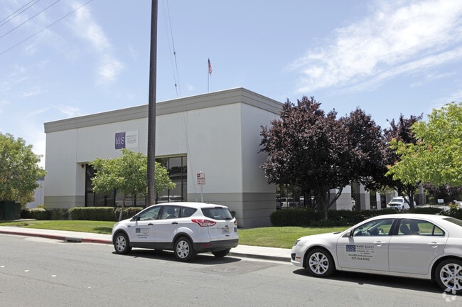
Property Detail
2835 Contra Costa Blvd
Oakland-Fremont-Berkeley, CA
PRIOR REF 146659 06/23/2009
149-122-021-4
CONTRA COSTA
Storebuilding
California
B and X Area of moderate flood hazard, usually the area between the limits of the 100-year and 500-year floods.
24
2025
0.46 AC
2026
Concord/Pleasant Hill
324002
East Bay/Oakland
16,127 SF
NEARBY LISTINGS FOR SALE OR LEASE
DEMOGRAPHICS near 2835 Contra Costa Blvd
1 mile
3 mile
5 mile
2025 Total Population
24,627
147,037
278,927
2030 Population
24,978
148,580
281,260
Pop Growth 2025-2030
+ 1.43%
+ 1.05%
+ 0.84%
Average Age
41
42
43
2025 Total Households
10,725
59,482
110,772
HH Growth 2025-2030
+ 1.62%
+ 1.24%
+ 0.97%
Median Household Inc
$118,789
$126,968
$130,626
Avg Household Size
2.20
2.40
2.40
2025 Avg HH Vehicles
2.00
2.00
2.00
Median Home Value
$927,478
$958,031
$916,474
Median Year Built
1978
1973
1972
Nearby Places
Map Layers
Map Styles
 Street
 Aerial
Layers
 Traffic
 Biking
Places
Listings with unknown addresses are not visible on the map
- Restaurants
- Banks
- Shops
- Fitness
- Groceries
PUBLIC TRANSPORTATION
COMMUTER RAIL
Martinez (California Zephyr - Amtrak, Capitol Corridor - Amtrak, Coast Starlight - Amtrak)
Drive
Walk
Distance
Martinez (California Zephyr - Amtrak, Capitol Corridor - Amtrak, Coast Starlight - Amtrak)
14 min
9.4 mi
AIRPORT
Metro Oakland International
Drive
Walk
Distance
Metro Oakland International
36 min
26.1 mi
San Francisco International
Drive
Walk
Distance
San Francisco International
54 min
38.0 mi
Freight Ports
Port of Oakland
Drive
Walk
Distance
Port of Oakland
26 min
18.9 mi
Nearby Properties
Address
Land Use
TOTAL SIZE
Lot Size
Zoning
Address
Land Use
TOTAL SIZE
Lot Size
Zoning
Address
Land Use
TOTAL SIZE
Lot Size
Zoning
Address
Land Use
TOTAL SIZE
Lot Size
Zoning
155,176 SF
3.34 AC
Address
Land Use
TOTAL SIZE
Lot Size
Zoning
489,813 SF
38.82 AC
Address
Land Use
TOTAL SIZE
Lot Size
Zoning
34,226 SF
30 AC
Address
Land Use
TOTAL SIZE
Lot Size
Zoning
428,476 SF
3.56 AC
Address
Land Use
TOTAL SIZE
Lot Size
Zoning
295,561 SF
3.80 AC
Address
Land Use
TOTAL SIZE
Lot Size
Zoning
213,500 SF
3.02 AC
Address
Land Use
TOTAL SIZE
Lot Size
Zoning
337,980 SF
5.08 AC
Address
Land Use
TOTAL SIZE
Lot Size
Zoning
254,940 SF
1.61 AC
P1
Address
Land Use
TOTAL SIZE
Lot Size
Zoning
31,614 SF
24.46 AC
Address
Land Use
TOTAL SIZE
Lot Size
Zoning
174,951 SF
1.82 AC
Address
Land Use
TOTAL SIZE
Lot Size
Zoning
264,873 SF
2.19 AC
P1
Address
Land Use
TOTAL SIZE
Lot Size
Zoning
203,454 SF
2.33 AC
Address
Land Use
TOTAL SIZE
Lot Size
Zoning
5.52 AC
P1
Address
Land Use
TOTAL SIZE
Lot Size
Zoning
235,495 SF
2.51 AC
P1
Address
Land Use
TOTAL SIZE
Lot Size
Zoning
250,032 SF
7.95 AC
P1
Address
Land Use
TOTAL SIZE
Lot Size
Zoning
153,137 SF
1.22 AC
Address
Land Use
TOTAL SIZE
Lot Size
Zoning
393,680 SF
2.29 AC
Address
Land Use
TOTAL SIZE
Lot Size
Zoning
249,628 SF
3.64 AC
P1
Address
Land Use
TOTAL SIZE
Lot Size
Zoning
234,624 SF
6.63 AC
Address
Land Use
TOTAL SIZE
Lot Size
Zoning
112,000 SF
18.40 AC
Address
Land Use
TOTAL SIZE
Lot Size
Zoning
157,352 SF
0.98 AC
Address
Land Use
TOTAL SIZE
Lot Size
Zoning
118,596 SF
1.20 AC
Address
Land Use
TOTAL SIZE
Lot Size
Zoning
168,606 SF
2.42 AC
Address
Land Use
TOTAL SIZE
Lot Size
Zoning
192,387 SF
17.42 AC
M17
Address
Land Use
TOTAL SIZE
Lot Size
Zoning
187,156 SF
5.92 AC
P1
Address
Land Use
TOTAL SIZE
Lot Size
Zoning
12,864 SF
5.62 AC
Address
Land Use
TOTAL SIZE
Lot Size
Zoning
237,656 SF
7.16 AC
P1
Address
Land Use
TOTAL SIZE
Lot Size
Zoning
100,627 SF
6.47 AC
The World's #1 Commercial Real Estate Marketplace
Connect with us
© 2026 CoStar Group
The information above has been obtained from sources believed reliable. While we do not doubt its accuracy we have not verified it and make no guarantee, warranty or representation about it. It is your responsibility to independently confirm its accuracy and completeness. Any projections, opinions, assumptions, or estimates used are for example only and do not represent the current or future performance of the property. The value of this transaction to you depends on tax and other factors which should be evaluated by your tax, financial, and legal advisors. You and your advisors should conduct a careful, independent investigation of the property to determine to your satisfaction the suitability of the property for your needs.