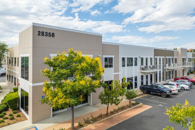
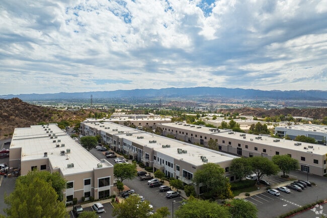
Property Record
28348 Constellation Rd, Valencia, CA 91355
NEARBY LISTINGS FOR SALE OR LEASE
Property Detail
28348 Constellation Rd
Los Angeles-Long Beach-Glendale, CA
Discovery Gateway Spectrum Ii
2866-047-167
P M 349-1-6 LOT 1 CONDO UNIT A3/870 ( AIRSPACE AND 1/45 INT IN COMMON AREA)
Industrialcondominium
Los Angeles
X
California
06037C0805G
1
2024
20.60 AC
2025
Santa Clarita Valley
920121
Los Angeles
4,674 SF
DEMOGRAPHICS near 28348 Constellation Rd
1 mile
3 mile
5 mile
2024 Total Population
7,657
58,496
140,494
2029 Population
7,310
56,366
135,480
Pop Growth 2024-2029
(4.53%)
(3.64%)
(3.57%)
Average Age
35
39
40
2024 Total Households
2,386
19,893
47,304
HH Growth 2024-2029
(4.82%)
(3.87%)
(3.84%)
Median Household Inc
$148,376
$134,881
$127,412
Avg Household Size
3.20
2.90
2.90
2024 Avg HH Vehicles
2.00
2.00
2.00
Median Home Value
$741,966
$755,757
$740,135
Median Year Built
2008
1997
1991
Nearby Places
Map Layers
Map Styles
 Street
 Aerial
Transit
 Traffic
 Biking
Places
Listings with unknown addresses are not visible on the map
- Restaurants
- Banks
- Shops
- Fitness
- Groceries
PUBLIC TRANSPORTATION
COMMUTER RAIL
Santa Clarita (Antelope Valley Line - Southern California Regional Rail Authority (Metrolink))
Drive
Walk
Distance
Santa Clarita (Antelope Valley Line - Southern California Regional Rail Authority (Metrolink))
11 min
5.5 mi
Newhall (Antelope Valley Line - Southern California Regional Rail Authority (Metrolink))
Drive
Walk
Distance
Newhall (Antelope Valley Line - Southern California Regional Rail Authority (Metrolink))
16 min
7.7 mi
AIRPORT
Bob Hope
Drive
Walk
Distance
Bob Hope
34 min
25.0 mi
Freight Ports
The Port of Hueneme
Drive
Walk
Distance
The Port of Hueneme
72 min
50.3 mi
SALE & LEASE HISTORY
LISTING DATE
SALE/LEASE

Sep 05, 2025
For Lease
Oct 23, 2023
For Lease
Oct 17, 2020
For Lease
May 21, 2021
For Lease
Mar 21, 2017
For Lease
Mar 09, 2021
For Lease
Jun 13, 2018
For Lease
Feb 14, 2018
For Lease
Feb 02, 2024
For Lease
Aug 29, 2018
For Lease
Nearby Properties
Address
Land Use
TOTAL SIZE
Lot Size
Zoning
Address
Land Use
TOTAL SIZE
Lot Size
Zoning
479,178 SF
14.17 AC
SCCR
Address
Land Use
TOTAL SIZE
Lot Size
Zoning
357,508 SF
13.73 AC
LCA25*
Address
Land Use
TOTAL SIZE
Lot Size
Zoning
180,629 SF
40.68 AC
SCBP
Address
Land Use
TOTAL SIZE
Lot Size
Zoning
200,717 SF
7.62 AC
SCCR
Address
Land Use
TOTAL SIZE
Lot Size
Zoning
197,558 SF
3.08 AC
SCBP
Address
Land Use
TOTAL SIZE
Lot Size
Zoning
357,128 SF
17.04 AC
SCUR5
Address
Land Use
TOTAL SIZE
Lot Size
Zoning
225,723 SF
11.37 AC
Address
Land Use
TOTAL SIZE
Lot Size
Zoning
114,136 SF
209.56 AC
LCCR*
Address
Land Use
TOTAL SIZE
Lot Size
Zoning
264,769 SF
8.97 AC
LCA25*
Address
Land Use
TOTAL SIZE
Lot Size
Zoning
258,260 SF
12.67 AC
SCSP
Address
Land Use
TOTAL SIZE
Lot Size
Zoning
194,907 SF
7.83 AC
SCSP
Address
Land Use
TOTAL SIZE
Lot Size
Zoning
97,733 SF
13.14 AC
SCCC
Address
Land Use
TOTAL SIZE
Lot Size
Zoning
266,614 SF
7.47 AC
SCSP
Address
Land Use
TOTAL SIZE
Lot Size
Zoning
203,590 SF
10.09 AC
SCBP
Address
Land Use
TOTAL SIZE
Lot Size
Zoning
325,406 SF
4.11 AC
SCBP
Address
Land Use
TOTAL SIZE
Lot Size
Zoning
180,450 SF
5.08 AC
SCCR
Address
Land Use
TOTAL SIZE
Lot Size
Zoning
315,346 SF
15.99 AC
SCBP
Address
Land Use
TOTAL SIZE
Lot Size
Zoning
356,265 SF
4.87 AC
SCBP
Address
Land Use
TOTAL SIZE
Lot Size
Zoning
103,828 SF
6.23 AC
SCUR4
Address
Land Use
TOTAL SIZE
Lot Size
Zoning
121,020 SF
5.94 AC
SCBP
Address
Land Use
TOTAL SIZE
Lot Size
Zoning
211,874 SF
9.15 AC
SCSP
Address
Land Use
TOTAL SIZE
Lot Size
Zoning
84,893 SF
3.54 AC
LCA25*
Address
Land Use
TOTAL SIZE
Lot Size
Zoning
174,562 SF
4.01 AC
SCCR
Address
Land Use
TOTAL SIZE
Lot Size
Zoning
212,783 SF
11.44 AC
SCBP
Address
Land Use
TOTAL SIZE
Lot Size
Zoning
132,668 SF
0.90 AC
SCCR
Address
Land Use
TOTAL SIZE
Lot Size
Zoning
232,987 SF
16 AC
SCUR5
Address
Land Use
TOTAL SIZE
Lot Size
Zoning
346,419 SF
7.38 AC
SCSP
Address
Land Use
TOTAL SIZE
Lot Size
Zoning
131,425 SF
0.82 AC
SCCR
Address
Land Use
TOTAL SIZE
Lot Size
Zoning
178,388 SF
6.37 AC
LCA2
Address
Land Use
TOTAL SIZE
Lot Size
Zoning
196,958 SF
14.03 AC
SCUR5
The World's #1 Commercial Real Estate Marketplace
Connect with us
© 2026 CoStar Group
The information above has been obtained from sources believed reliable. While we do not doubt its accuracy we have not verified it and make no guarantee, warranty or representation about it. It is your responsibility to independently confirm its accuracy and completeness. Any projections, opinions, assumptions, or estimates used are for example only and do not represent the current or future performance of the property. The value of this transaction to you depends on tax and other factors which should be evaluated by your tax, financial, and legal advisors. You and your advisors should conduct a careful, independent investigation of the property to determine to your satisfaction the suitability of the property for your needs.