Property Record
2837 Aqueduct Rd, Schenectady, NY 12309


Property Detail
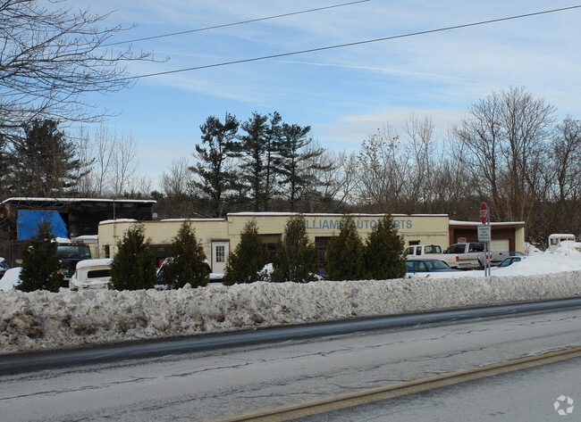
2837 Aqueduct Rd
031-000-0001-024-000-0000
SCHENECTADY
Apartment
New York
R2
24.000
B and X Area of moderate flood hazard, usually the area between the limits of the 100-year and 500-year floods.
20.66 AC
2025
Greater Schenectady
2025
Albany/Schenectady/Troy
032101
Albany-Schenectady-Troy, NY
12,528 SF
NEARBY LISTINGS FOR SALE OR LEASE
DEMOGRAPHICS near 2837 Aqueduct Rd
1 mile
3 mile
5 mile
2025 Total Population
1,749
40,428
125,740
2030 Population
1,783
41,286
127,587
Pop Growth 2025-2030
+ 1.94%
+ 2.12%
+ 1.47%
Average Age
41
41
40
2025 Total Households
665
16,540
49,942
HH Growth 2025-2030
+ 1.95%
+ 2.27%
+ 1.57%
Median Household Inc
$131,071
$89,904
$77,604
Avg Household Size
2.50
2.30
2.30
2025 Avg HH Vehicles
2.00
2.00
2.00
Median Home Value
$408,416
$290,731
$270,981
Median Year Built
1977
1961
1955
Nearby Places
Map Layers
Map Styles
 Street
 Aerial
Layers
 Traffic
 Biking
Places
Listings with unknown addresses are not visible on the map
- Restaurants
- Banks
- Shops
- Fitness
- Groceries
PUBLIC TRANSPORTATION
AIRPORT
Albany International
Drive
Walk
Distance
Albany International
20 min
10.1 mi
Freight Ports
Albany, NY Port
Drive
Walk
Distance
Albany, NY Port
36 min
22.7 mi
Nearby Properties
Address
Land Use
TOTAL SIZE
Lot Size
Zoning
Address
Land Use
TOTAL SIZE
Lot Size
Zoning
174.70 AC
Address
Land Use
TOTAL SIZE
Lot Size
Zoning
338.40 AC
Address
Land Use
TOTAL SIZE
Lot Size
Zoning
583,211 SF
9.95 AC
03 - MULTI
Address
Land Use
TOTAL SIZE
Lot Size
Zoning
155,023 SF
18.81 AC
06 - INDUS
Address
Land Use
TOTAL SIZE
Lot Size
Zoning
6,733 SF
100 AC
03 - MULTI
Address
Land Use
TOTAL SIZE
Lot Size
Zoning
600 SF
28.40 AC
06 - INDUS
Address
Land Use
TOTAL SIZE
Lot Size
Zoning
194,403 SF
315.80 AC
06 - INDUS
Address
Land Use
TOTAL SIZE
Lot Size
Zoning
153,984 SF
139.40 AC
CON
Address
Land Use
TOTAL SIZE
Lot Size
Zoning
246,000 SF
9.85 AC
Address
Land Use
TOTAL SIZE
Lot Size
Zoning
123,030 SF
7.21 AC
03 - MULTI
Address
Land Use
TOTAL SIZE
Lot Size
Zoning
249,801 SF
54.35 AC
R1
Address
Land Use
TOTAL SIZE
Lot Size
Zoning
306,803 SF
3.20 AC
Address
Land Use
TOTAL SIZE
Lot Size
Zoning
234,485 SF
42.50 AC
02 - SINGL
Address
Land Use
TOTAL SIZE
Lot Size
Zoning
32,385 SF
5.02 AC
Address
Land Use
TOTAL SIZE
Lot Size
Zoning
19,080 SF
601.14 AC
CON
Address
Land Use
TOTAL SIZE
Lot Size
Zoning
60,274 SF
12.95 AC
OT
Address
Land Use
TOTAL SIZE
Lot Size
Zoning
23,923 SF
109.83 AC
CON
Address
Land Use
TOTAL SIZE
Lot Size
Zoning
11,424 SF
42.41 AC
CON
Address
Land Use
TOTAL SIZE
Lot Size
Zoning
194.77 AC
Address
Land Use
TOTAL SIZE
Lot Size
Zoning
117,849 SF
5.76 AC
05 - COMME
Address
Land Use
TOTAL SIZE
Lot Size
Zoning
32,626 SF
81.39 AC
IR
Address
Land Use
TOTAL SIZE
Lot Size
Zoning
34,807 SF
15.91 AC
R2
Address
Land Use
TOTAL SIZE
Lot Size
Zoning
93,846 SF
3 AC
R2
Address
Land Use
TOTAL SIZE
Lot Size
Zoning
204,167 SF
33.90 AC
CON
Address
Land Use
TOTAL SIZE
Lot Size
Zoning
70,487 SF
2.51 AC
Address
Land Use
TOTAL SIZE
Lot Size
Zoning
12,572 SF
16.50 AC
CON
Address
Land Use
TOTAL SIZE
Lot Size
Zoning
16,392 SF
14.64 AC
CON
Address
Land Use
TOTAL SIZE
Lot Size
Zoning
8,662 SF
4.97 AC
Address
Land Use
TOTAL SIZE
Lot Size
Zoning
140,900 SF
9.47 AC
The World's #1 Commercial Real Estate Marketplace
Connect with us
© 2026 CoStar Group
The information above has been obtained from sources believed reliable. While we do not doubt its accuracy we have not verified it and make no guarantee, warranty or representation about it. It is your responsibility to independently confirm its accuracy and completeness. Any projections, opinions, assumptions, or estimates used are for example only and do not represent the current or future performance of the property. The value of this transaction to you depends on tax and other factors which should be evaluated by your tax, financial, and legal advisors. You and your advisors should conduct a careful, independent investigation of the property to determine to your satisfaction the suitability of the property for your needs.