Property Record
2837 State Route 207, Campbell Hall, NY 10916
NEARBY LISTINGS FOR SALE OR LEASE
-
-
View all Campbell Hall listings for sale on LoopNet.com
Property Detail
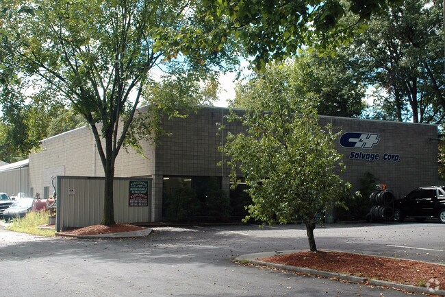
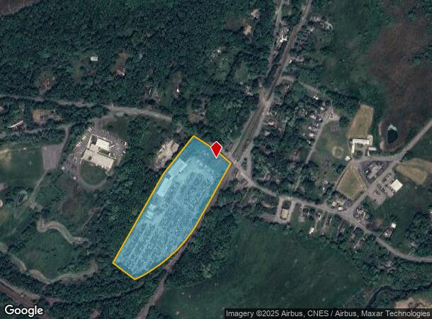
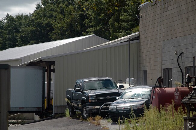
2837 State Route 207
333489-004-000-0001-033.000-0000
Orange
Storageyardjunkautowreckingsalvage
New York
X
33.00
36071C0284E
11.40 AC
2024
Orange County
2024
Northern New Jersey
012300
New York-Jersey City-White Plains, NY-NJ
26,967 SF
DEMOGRAPHICS near 2837 State Route 207
1 Mile
3 Mile
5 Mile
2024 Total Population
806
4,914
25,815
2029 Population
819
4,991
26,248
Pop Growth 2024-2029
+ 1.61%
+ 1.57%
+ 1.68%
Average Age
43
42
41
2024 Total Households
271
1,610
9,126
HH Growth 2024-2029
+ 1.85%
+ 1.68%
+ 1.79%
Median Household Inc
$115,833
$108,716
$101,939
Avg Household Size
2.90
2.90
2.70
2024 Avg HH Vehicles
2.00
2.00
2.00
Median Home Value
$426,229
$428,879
$352,567
Median Year Built
1978
1977
1977
Nearby Places
Map Layers
Map Styles
 Street
 Aerial
- Restaurants
- Banks
- Shops
- Fitness
- Groceries
PUBLIC TRANSPORTATION
COMMUTER RAIL
Campbell Hall (Bergen County/Port Jervis Line - NJ Transit Commuter Rail (NJ Transit), Main/Port Jervis Line - NJ Transit Commuter Rail (NJ Transit))
DRIVE
WALK
Distance
Campbell Hall (Bergen County/Port Jervis Line - NJ Transit Commuter Rail (NJ Transit), Main/Port Jervis Line - NJ Transit Commuter Rail (NJ Transit))
5 min
2.1 mi
Middletown New York (Bergen County/Port Jervis Line - NJ Transit Commuter Rail (NJ Transit), Main/Port Jervis Line - NJ Transit Commuter Rail (NJ Transit))
DRIVE
WALK
Distance
Middletown New York (Bergen County/Port Jervis Line - NJ Transit Commuter Rail (NJ Transit), Main/Port Jervis Line - NJ Transit Commuter Rail (NJ Transit))
17 min
7.7 mi
AIRPORT
New York Stewart International
DRIVE
WALK
Distance
New York Stewart International
17 min
10.7 mi
Freight Ports
Port Newark Container Terminal
DRIVE
WALK
Distance
Port Newark Container Terminal
94 min
71.1 mi
Nearby Properties
Address
Land Use
TOTAL SIZE
Lot Size
Zoning
Address
Land Use
TOTAL SIZE
Lot Size
Zoning
1,040,580 SF
70.80 AC
ID
Address
Land Use
TOTAL SIZE
Lot Size
Zoning
340,782 SF
37 AC
LUI
Address
Land Use
TOTAL SIZE
Lot Size
Zoning
374,356 SF
35.90 AC
LUI
Address
Land Use
TOTAL SIZE
Lot Size
Zoning
25,800 SF
80.20 AC
LUI
Address
Land Use
TOTAL SIZE
Lot Size
Zoning
366,680 SF
32.10 AC
Address
Land Use
TOTAL SIZE
Lot Size
Zoning
109,481 SF
24.90 AC
ID
Address
Land Use
TOTAL SIZE
Lot Size
Zoning
330.10 AC
R4A*
Address
Land Use
TOTAL SIZE
Lot Size
Zoning
4,022 SF
360.50 AC
R4A*
Address
Land Use
TOTAL SIZE
Lot Size
Zoning
41.40 AC
R4A
Address
Land Use
TOTAL SIZE
Lot Size
Zoning
55,200 SF
11.80 AC
R3A*
Address
Land Use
TOTAL SIZE
Lot Size
Zoning
10 AC
HRC4*
Address
Land Use
TOTAL SIZE
Lot Size
Zoning
1,240 SF
188 AC
R4A*
Address
Land Use
TOTAL SIZE
Lot Size
Zoning
16,842 SF
136.30 AC
R4A*
Address
Land Use
TOTAL SIZE
Lot Size
Zoning
250 AC
R4A*
Address
Land Use
TOTAL SIZE
Lot Size
Zoning
6,910 SF
186.70 AC
R4A
Address
Land Use
TOTAL SIZE
Lot Size
Zoning
731,864 SF
43.70 AC
I
Address
Land Use
TOTAL SIZE
Lot Size
Zoning
7,948 SF
115 AC
R4A
Address
Land Use
TOTAL SIZE
Lot Size
Zoning
6,048 SF
145.80 AC
R4A
Address
Land Use
TOTAL SIZE
Lot Size
Zoning
946 SF
227.80 AC
R4A*
Address
Land Use
TOTAL SIZE
Lot Size
Zoning
1,100 SF
203.20 AC
R4A*
Address
Land Use
TOTAL SIZE
Lot Size
Zoning
62,770 SF
10.60 AC
IP
Address
Land Use
TOTAL SIZE
Lot Size
Zoning
11,645 SF
84.20 AC
R4A
Address
Land Use
TOTAL SIZE
Lot Size
Zoning
Address
Land Use
TOTAL SIZE
Lot Size
Zoning
34,151 SF
7.20 AC
ID
Address
Land Use
TOTAL SIZE
Lot Size
Zoning
4,094 SF
142.90 AC
I
Address
Land Use
TOTAL SIZE
Lot Size
Zoning
2,736 SF
108.30 AC
R4A*
Address
Land Use
TOTAL SIZE
Lot Size
Zoning
16,624 SF
1.80 AC
IP
Address
Land Use
TOTAL SIZE
Lot Size
Zoning
4,284 SF
91.40 AC
R2A*
Address
Land Use
TOTAL SIZE
Lot Size
Zoning
7.70 AC
NB*
The World's #1 Commercial Real Estate Marketplace
Connect with us
© 2025 CoStar Group
The information above has been obtained from sources believed reliable. While we do not doubt its accuracy we have not verified it and make no guarantee, warranty or representation about it. It is your responsibility to independently confirm its accuracy and completeness. Any projections, opinions, assumptions, or estimates used are for example only and do not represent the current or future performance of the property. The value of this transaction to you depends on tax and other factors which should be evaluated by your tax, financial, and legal advisors. You and your advisors should conduct a careful, independent investigation of the property to determine to your satisfaction the suitability of the property for your needs.