Property Record
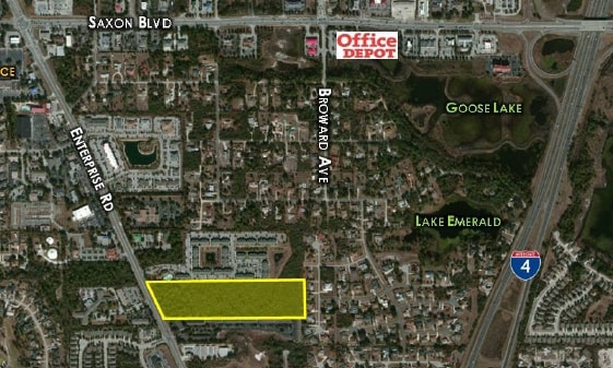
2841 Enterprise Rd, Orange City, FL 32763

Property Detail
2841 Enterprise Rd
8026-00-00-0013
26-18-30 S 395.96 FT OF N 977 FT AS MEASURED ON E/L OF NE 1/4 LYING E OF ENTERPRISE RD EXC NEW R/W FOR ENTERPRISE RD PER OR 2768 PG 1876 PER OR 5646 PG 1088 PER OR 8721 PG 1445
Multifamilydwelling
VOLUSIA
12B4
Florida
B and X Area of moderate flood hazard, usually the area between the limits of the 100-year and 500-year floods.
15.03 AC
2025
Deltona
2026
Deltona/Daytona Beach
090905
Deltona-Daytona Beach-Ormond Beach, FL
232,605 SF
NEARBY LISTINGS FOR SALE OR LEASE
-
-
-
-
-
-
-
East Rhode Island Avenue @ Veterans Memorial Hwy
Orange City, FL 32763
$11,500,000
42.92 AC Lots
Land
-
-
-
View all Orange City listings for sale on LoopNet.com
DEMOGRAPHICS near 2841 Enterprise Rd
1 mile
3 mile
5 mile
2025 Total Population
5,203
57,494
107,529
2030 Population
5,504
60,949
114,280
Pop Growth 2025-2030
+ 5.79%
+ 6.01%
+ 6.28%
Average Age
43
43
42
2025 Total Households
1,995
22,513
41,144
HH Growth 2025-2030
+ 5.86%
+ 5.94%
+ 6.19%
Median Household Inc
$100,719
$68,133
$72,824
Avg Household Size
2.50
2.50
2.50
2025 Avg HH Vehicles
2.00
2.00
2.00
Median Home Value
$389,539
$314,971
$319,330
Median Year Built
1997
1988
1988
Nearby Places
Map Layers
Map Styles
 Street
 Aerial
Layers
 Traffic
 Biking
Places
Listings with unknown addresses are not visible on the map
- Restaurants
- Banks
- Shops
- Fitness
- Groceries
PUBLIC TRANSPORTATION
COMMUTER RAIL
Debary (SunRail - Florida Department of Transportation)
Drive
Walk
Distance
Debary (SunRail - Florida Department of Transportation)
11 min
5.6 mi
AIRPORT
Orlando Sanford International
Drive
Walk
Distance
Orlando Sanford International
31 min
16.5 mi
Daytona Beach International
Drive
Walk
Distance
Daytona Beach International
35 min
26.7 mi
Freight Ports
Port Canaveral
Drive
Walk
Distance
Port Canaveral
96 min
78.8 mi
Nearby Properties
Address
Land Use
TOTAL SIZE
Lot Size
Zoning
Address
Land Use
TOTAL SIZE
Lot Size
Zoning
485,392 SF
69.83 AC
ROW
Address
Land Use
TOTAL SIZE
Lot Size
Zoning
986,415 SF
56.11 AC
Address
Land Use
TOTAL SIZE
Lot Size
Zoning
409,021 SF
38.53 AC
ROW
Address
Land Use
TOTAL SIZE
Lot Size
Zoning
369,949 SF
13.70 AC
Address
Land Use
TOTAL SIZE
Lot Size
Zoning
689,978 SF
39.89 AC
RRC
Address
Land Use
TOTAL SIZE
Lot Size
Zoning
390,347 SF
4.10 AC
Address
Land Use
TOTAL SIZE
Lot Size
Zoning
258,869 SF
38.34 AC
P
Address
Land Use
TOTAL SIZE
Lot Size
Zoning
299,423 SF
88.63 AC
12R1
Address
Land Use
TOTAL SIZE
Lot Size
Zoning
350,763 SF
60 AC
12R1
Address
Land Use
TOTAL SIZE
Lot Size
Zoning
221,429 SF
25.84 AC
Address
Land Use
TOTAL SIZE
Lot Size
Zoning
212,959 SF
65.31 AC
MPUDE
Address
Land Use
TOTAL SIZE
Lot Size
Zoning
136,761 SF
17.77 AC
Address
Land Use
TOTAL SIZE
Lot Size
Zoning
50,005 SF
5.60 AC
Address
Land Use
TOTAL SIZE
Lot Size
Zoning
11,016 SF
13 AC
01MH1
Address
Land Use
TOTAL SIZE
Lot Size
Zoning
170,850 SF
17.82 AC
Address
Land Use
TOTAL SIZE
Lot Size
Zoning
213,506 SF
21 AC
12R2
Address
Land Use
TOTAL SIZE
Lot Size
Zoning
193,964 SF
23.50 AC
Address
Land Use
TOTAL SIZE
Lot Size
Zoning
135,845 SF
18.34 AC
Address
Land Use
TOTAL SIZE
Lot Size
Zoning
11,509 SF
10 AC
01MH1
Address
Land Use
TOTAL SIZE
Lot Size
Zoning
4,684 SF
1.14 AC
12MH1
Address
Land Use
TOTAL SIZE
Lot Size
Zoning
123,193 SF
20 AC
01A3
Address
Land Use
TOTAL SIZE
Lot Size
Zoning
117,406 SF
17.58 AC
Address
Land Use
TOTAL SIZE
Lot Size
Zoning
169,634 SF
12.97 AC
01B
Address
Land Use
TOTAL SIZE
Lot Size
Zoning
121,380 SF
2.33 AC
Address
Land Use
TOTAL SIZE
Lot Size
Zoning
147,759 SF
19.64 AC
Address
Land Use
TOTAL SIZE
Lot Size
Zoning
113,782 SF
18.52 AC
P
Address
Land Use
TOTAL SIZE
Lot Size
Zoning
44,975 SF
7.98 AC
Address
Land Use
TOTAL SIZE
Lot Size
Zoning
214,666 SF
9 AC
Address
Land Use
TOTAL SIZE
Lot Size
Zoning
174,640 SF
13.46 AC
The World's #1 Commercial Real Estate Marketplace
Connect with us
© 2026 CoStar Group
The information above has been obtained from sources believed reliable. While we do not doubt its accuracy we have not verified it and make no guarantee, warranty or representation about it. It is your responsibility to independently confirm its accuracy and completeness. Any projections, opinions, assumptions, or estimates used are for example only and do not represent the current or future performance of the property. The value of this transaction to you depends on tax and other factors which should be evaluated by your tax, financial, and legal advisors. You and your advisors should conduct a careful, independent investigation of the property to determine to your satisfaction the suitability of the property for your needs.