Property Record
2841 Lincoln Hwy E, Ronks, PA 17572


NEARBY LISTINGS FOR SALE OR LEASE
-
-
View all Ronks listings for sale on LoopNet.com
Property Detail
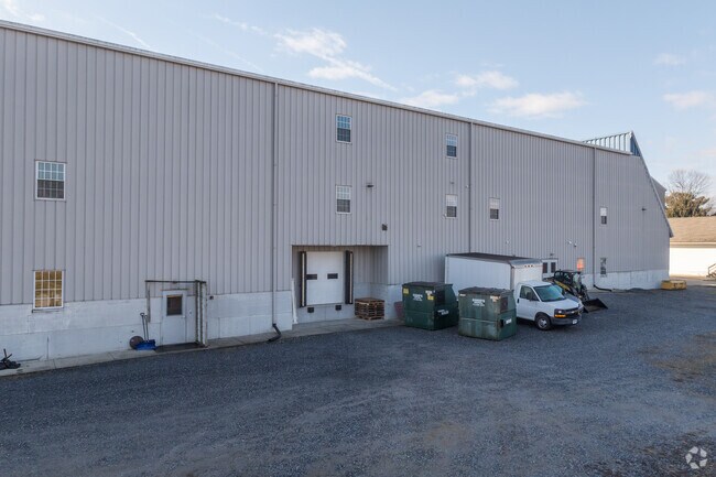
2841 Lincoln Hwy E
310-89683-0-0000
2841 LINCOLN HWY E
Storebuilding
Lancaster
X
Pennsylvania
42071C0393F
0.98 AC
2024
Lancaster County
2025
Philadelphia
013204
Lancaster, PA
24,084 SF
DEMOGRAPHICS near 2841 Lincoln Hwy E
1 Mile
3 Mile
5 Mile
2024 Total Population
822
10,276
32,269
2029 Population
822
10,235
32,181
Pop Growth 2024-2029
0.00%
(0.40%)
(0.27%)
Average Age
38
38
38
2024 Total Households
286
3,531
11,141
HH Growth 2024-2029
0.00%
(0.31%)
(0.22%)
Median Household Inc
$79,942
$79,610
$83,027
Avg Household Size
2.80
2.90
2.80
2024 Avg HH Vehicles
1.00
2.00
2.00
Median Home Value
$356,249
$289,871
$315,356
Median Year Built
1948
1964
1977
Nearby Places
Map Layers
Map Styles
 Street
 Aerial
- Restaurants
- Banks
- Shops
- Fitness
- Groceries
PUBLIC TRANSPORTATION
COMMUTER RAIL
DRIVE
WALK
Distance
19 min
9.2 mi
AIRPORT
Harrisburg International
DRIVE
WALK
Distance
Harrisburg International
54 min
39.8 mi
Freight Ports
Port Newark Container Terminal
DRIVE
WALK
Distance
Port Newark Container Terminal
75 min
41.5 mi
Nearby Properties
Address
Land Use
TOTAL SIZE
Lot Size
Zoning
Address
Land Use
TOTAL SIZE
Lot Size
Zoning
289,398 SF
35.20 AC
C-2
Address
Land Use
TOTAL SIZE
Lot Size
Zoning
221,609 SF
62.37 AC
HC
Address
Land Use
TOTAL SIZE
Lot Size
Zoning
113,272 SF
13.80 AC
RC
Address
Land Use
TOTAL SIZE
Lot Size
Zoning
91,335 SF
11.80 AC
Address
Land Use
TOTAL SIZE
Lot Size
Zoning
103,083 SF
8.73 AC
A
Address
Land Use
TOTAL SIZE
Lot Size
Zoning
36,494 SF
7 AC
R-2
Address
Land Use
TOTAL SIZE
Lot Size
Zoning
51,824 SF
2.33 AC
Address
Land Use
TOTAL SIZE
Lot Size
Zoning
298,472 SF
160.06 AC
R
Address
Land Use
TOTAL SIZE
Lot Size
Zoning
123,614 SF
8.99 AC
C-2
Address
Land Use
TOTAL SIZE
Lot Size
Zoning
53,275 SF
5.01 AC
C-2
Address
Land Use
TOTAL SIZE
Lot Size
Zoning
170,464 SF
8.60 AC
Address
Land Use
TOTAL SIZE
Lot Size
Zoning
46,926 SF
3.12 AC
Address
Land Use
TOTAL SIZE
Lot Size
Zoning
41,534 SF
1.96 AC
Address
Land Use
TOTAL SIZE
Lot Size
Zoning
47,022 SF
3.28 AC
C-2
Address
Land Use
TOTAL SIZE
Lot Size
Zoning
39,670 SF
5.23 AC
C-2
Address
Land Use
TOTAL SIZE
Lot Size
Zoning
21,185 SF
6.88 AC
C-2
Address
Land Use
TOTAL SIZE
Lot Size
Zoning
79,551 SF
8.70 AC
C-1
Address
Land Use
TOTAL SIZE
Lot Size
Zoning
56,614 SF
6.20 AC
C-2
Address
Land Use
TOTAL SIZE
Lot Size
Zoning
55,546 SF
9.70 AC
C-2
Address
Land Use
TOTAL SIZE
Lot Size
Zoning
51,450 SF
7.60 AC
C-2
Address
Land Use
TOTAL SIZE
Lot Size
Zoning
44,862 SF
4.30 AC
Address
Land Use
TOTAL SIZE
Lot Size
Zoning
42,073 SF
4 AC
Address
Land Use
TOTAL SIZE
Lot Size
Zoning
20,436 SF
2.15 AC
Address
Land Use
TOTAL SIZE
Lot Size
Zoning
26,443 SF
84.60 AC
A
Address
Land Use
TOTAL SIZE
Lot Size
Zoning
91,794 SF
7.60 AC
C2
Address
Land Use
TOTAL SIZE
Lot Size
Zoning
24,798 SF
6.90 AC
Address
Land Use
TOTAL SIZE
Lot Size
Zoning
40,001 SF
4.20 AC
C-2
Address
Land Use
TOTAL SIZE
Lot Size
Zoning
27,317 SF
1.90 AC
C-2
Address
Land Use
TOTAL SIZE
Lot Size
Zoning
40,647 SF
4.44 AC
Address
Land Use
TOTAL SIZE
Lot Size
Zoning
106,553 SF
7.41 AC
C-2
The World's #1 Commercial Real Estate Marketplace
Connect with us
© 2026 CoStar Group
The information above has been obtained from sources believed reliable. While we do not doubt its accuracy we have not verified it and make no guarantee, warranty or representation about it. It is your responsibility to independently confirm its accuracy and completeness. Any projections, opinions, assumptions, or estimates used are for example only and do not represent the current or future performance of the property. The value of this transaction to you depends on tax and other factors which should be evaluated by your tax, financial, and legal advisors. You and your advisors should conduct a careful, independent investigation of the property to determine to your satisfaction the suitability of the property for your needs.