Property Record
2842 State Route 209, Kingston, NY 12401


NEARBY LISTINGS FOR SALE OR LEASE
Property Detail
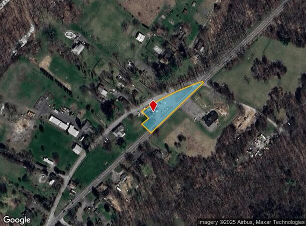
2842 State Route 209
3400-062.001-0003-002.000-0000
Ulster
Restaurantbuilding
New York
X
2.000
36111C0465F
0.95 AC
2025
Newburgh/Kingston
2024
Other Market Areas
952901
Kingston, NY
4,085 SF
DEMOGRAPHICS near 2842 State Route 209
1 Mile
3 Mile
5 Mile
2024 Total Population
277
3,409
15,797
2029 Population
276
3,374
15,682
Pop Growth 2024-2029
(0.36%)
(1.03%)
(0.73%)
Average Age
47
47
46
2024 Total Households
120
1,494
6,782
HH Growth 2024-2029
(0.83%)
(1.14%)
(0.78%)
Median Household Inc
$72,154
$83,333
$88,127
Avg Household Size
2.20
2.20
2.30
2024 Avg HH Vehicles
2.00
2.00
2.00
Median Home Value
$346,428
$375,303
$312,418
Median Year Built
1950
1957
1961
Nearby Places
- Restaurants
- Banks
- Shops
- Fitness
- Groceries
PUBLIC TRANSPORTATION
AIRPORT
New York Stewart International
DRIVE
WALK
Distance
New York Stewart International
57 min
44.4 mi
Freight Ports
Albany, NY Port
DRIVE
WALK
Distance
Albany, NY Port
70 min
57.8 mi
SALE & LEASE HISTORY
LISTING DATE
SALE/LEASE

Mar 12, 2021
For Sale
Jul 07, 2022
For Sale
Nearby Properties
Address
Land Use
TOTAL SIZE
Lot Size
Zoning
Address
Land Use
TOTAL SIZE
Lot Size
Zoning
23,140 SF
87.30 AC
R1
Address
Land Use
TOTAL SIZE
Lot Size
Zoning
201.10 AC
A4
Address
Land Use
TOTAL SIZE
Lot Size
Zoning
1,709 SF
27.40 AC
A2
Address
Land Use
TOTAL SIZE
Lot Size
Zoning
10,007 SF
235.70 AC
I-1
Address
Land Use
TOTAL SIZE
Lot Size
Zoning
42,975 SF
35 AC
R-1
Address
Land Use
TOTAL SIZE
Lot Size
Zoning
11,470 SF
134.90 AC
A
Address
Land Use
TOTAL SIZE
Lot Size
Zoning
6,950 SF
82.86 AC
R1
Address
Land Use
TOTAL SIZE
Lot Size
Zoning
9,080 SF
42.70 AC
R1
Address
Land Use
TOTAL SIZE
Lot Size
Zoning
17,081 SF
6.94 AC
R-1
Address
Land Use
TOTAL SIZE
Lot Size
Zoning
6,290 SF
51.72 AC
A4
Address
Land Use
TOTAL SIZE
Lot Size
Zoning
2,000 SF
144.10 AC
R1
Address
Land Use
TOTAL SIZE
Lot Size
Zoning
3,456 SF
56.24 AC
A3
Address
Land Use
TOTAL SIZE
Lot Size
Zoning
4,280 SF
32.40 AC
A4
Address
Land Use
TOTAL SIZE
Lot Size
Zoning
3,463 SF
72.43 AC
R1
Address
Land Use
TOTAL SIZE
Lot Size
Zoning
21,170 SF
18.67 AC
R-1
Address
Land Use
TOTAL SIZE
Lot Size
Zoning
7,184 SF
27.70 AC
Address
Land Use
TOTAL SIZE
Lot Size
Zoning
2,612 SF
76.50 AC
A
Address
Land Use
TOTAL SIZE
Lot Size
Zoning
561 AC
A
Address
Land Use
TOTAL SIZE
Lot Size
Zoning
3,270 SF
9.20 AC
A2
Address
Land Use
TOTAL SIZE
Lot Size
Zoning
33,270 SF
11 AC
I1
Address
Land Use
TOTAL SIZE
Lot Size
Zoning
1,600 SF
14.90 AC
A4
Address
Land Use
TOTAL SIZE
Lot Size
Zoning
2,897 SF
23.60 AC
R1
Address
Land Use
TOTAL SIZE
Lot Size
Zoning
2,328 SF
52 AC
A3
Address
Land Use
TOTAL SIZE
Lot Size
Zoning
2,200 SF
16 AC
A4
Address
Land Use
TOTAL SIZE
Lot Size
Zoning
6,820 SF
6.25 AC
SR
Address
Land Use
TOTAL SIZE
Lot Size
Zoning
2,160 SF
23 AC
R1
Address
Land Use
TOTAL SIZE
Lot Size
Zoning
4,403 SF
6.30 AC
R1
Address
Land Use
TOTAL SIZE
Lot Size
Zoning
3,356 SF
6 AC
A4
Address
Land Use
TOTAL SIZE
Lot Size
Zoning
3,412 SF
9.40 AC
B1
Address
Land Use
TOTAL SIZE
Lot Size
Zoning
5,812 SF
6 AC
B1
The World's #1 Commercial Real Estate Marketplace
Connect with us
© 2025 CoStar Group
The information above has been obtained from sources believed reliable. While we do not doubt its accuracy we have not verified it and make no guarantee, warranty or representation about it. It is your responsibility to independently confirm its accuracy and completeness. Any projections, opinions, assumptions, or estimates used are for example only and do not represent the current or future performance of the property. The value of this transaction to you depends on tax and other factors which should be evaluated by your tax, financial, and legal advisors. You and your advisors should conduct a careful, independent investigation of the property to determine to your satisfaction the suitability of the property for your needs.