Property Record
2843 Dellwood Rd, Waynesville, NC 28786


This Property Is For Sale
NEARBY LISTINGS FOR SALE OR LEASE
Property Detail
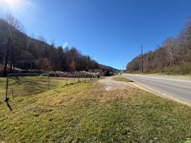
2843 Dellwood Rd
Waynesville, NC
Dellwood Rd
8607-60-2210
2843 DELLWOOD RD #B
Residentialacreage
Haywood
X
North Carolina
3700860700J
0.54 AC
0
Haywood County
2025
Asheville
920602
DEMOGRAPHICS near 2843 Dellwood Rd
1 Mile
3 Mile
5 Mile
2024 Total Population
804
12,169
29,986
2029 Population
812
12,429
30,459
Pop Growth 2024-2029
+ 1.00%
+ 2.14%
+ 1.58%
Average Age
49
49
47
2024 Total Households
378
5,737
13,664
HH Growth 2024-2029
+ 0.79%
+ 2.13%
+ 1.58%
Median Household Inc
$55,000
$60,564
$58,751
Avg Household Size
2.10
2.10
2.10
2024 Avg HH Vehicles
2.00
2.00
2.00
Median Home Value
$351,041
$319,470
$299,032
Median Year Built
1988
1984
1984
Nearby Places
Map Layers
Map Styles
 Street
 Aerial
- Restaurants
- Banks
- Shops
- Fitness
- Groceries
PUBLIC TRANSPORTATION
AIRPORT
Asheville Regional
DRIVE
WALK
Distance
Asheville Regional
46 min
34.8 mi
Freight Ports
North Charleston Terminal
DRIVE
WALK
Distance
North Charleston Terminal
317 min
278.6 mi
Nearby Properties
Address
Land Use
TOTAL SIZE
Lot Size
Zoning
Address
Land Use
TOTAL SIZE
Lot Size
Zoning
3,330 SF
3.73 AC
Address
Land Use
TOTAL SIZE
Lot Size
Zoning
1,500 SF
294.65 AC
Address
Land Use
TOTAL SIZE
Lot Size
Zoning
23,615 SF
7.17 AC
Address
Land Use
TOTAL SIZE
Lot Size
Zoning
37,508 SF
3.44 AC
DJAC
Address
Land Use
TOTAL SIZE
Lot Size
Zoning
16,764 SF
8.28 AC
HND
Address
Land Use
TOTAL SIZE
Lot Size
Zoning
87,969 SF
19.78 AC
RATC
Address
Land Use
TOTAL SIZE
Lot Size
Zoning
19,943 SF
13.52 AC
Address
Land Use
TOTAL SIZE
Lot Size
Zoning
94,031 SF
16.74 AC
RATC
Address
Land Use
TOTAL SIZE
Lot Size
Zoning
25,344 SF
1.16 AC
CBD
Address
Land Use
TOTAL SIZE
Lot Size
Zoning
49,732 SF
6.63 AC
Address
Land Use
TOTAL SIZE
Lot Size
Zoning
52,904 SF
23.08 AC
HMND
Address
Land Use
TOTAL SIZE
Lot Size
Zoning
277,784 SF
35.12 AC
HTD
Address
Land Use
TOTAL SIZE
Lot Size
Zoning
31,787 SF
20.22 AC
Address
Land Use
TOTAL SIZE
Lot Size
Zoning
78,704 SF
19.74 AC
MC1
Address
Land Use
TOTAL SIZE
Lot Size
Zoning
124,013 SF
11.81 AC
RATC
Address
Land Use
TOTAL SIZE
Lot Size
Zoning
7,020 SF
2.22 AC
CBD
Address
Land Use
TOTAL SIZE
Lot Size
Zoning
4,368 SF
1.49 AC
MSND
Address
Land Use
TOTAL SIZE
Lot Size
Zoning
1,239 SF
18.07 AC
Address
Land Use
TOTAL SIZE
Lot Size
Zoning
119,364 SF
8.05 AC
RATC
Address
Land Use
TOTAL SIZE
Lot Size
Zoning
10,754 SF
0.49 AC
CBD
Address
Land Use
TOTAL SIZE
Lot Size
Zoning
48,438 SF
5.25 AC
Address
Land Use
TOTAL SIZE
Lot Size
Zoning
15,735 SF
119.65 AC
MR2
Address
Land Use
TOTAL SIZE
Lot Size
Zoning
7,014 SF
6.23 AC
Address
Land Use
TOTAL SIZE
Lot Size
Zoning
4,215 SF
86.32 AC
ENRD
Address
Land Use
TOTAL SIZE
Lot Size
Zoning
8,295 SF
7.07 AC
Address
Land Use
TOTAL SIZE
Lot Size
Zoning
9,000 SF
2.93 AC
CBD
Address
Land Use
TOTAL SIZE
Lot Size
Zoning
9,923 SF
1.40 AC
CBD
Address
Land Use
TOTAL SIZE
Lot Size
Zoning
25,357 SF
3.38 AC
Address
Land Use
TOTAL SIZE
Lot Size
Zoning
5,950 SF
3.93 AC
MC1
Address
Land Use
TOTAL SIZE
Lot Size
Zoning
11,440 SF
4.97 AC
The World's #1 Commercial Real Estate Marketplace
Connect with us
© 2026 CoStar Group
The information above has been obtained from sources believed reliable. While we do not doubt its accuracy we have not verified it and make no guarantee, warranty or representation about it. It is your responsibility to independently confirm its accuracy and completeness. Any projections, opinions, assumptions, or estimates used are for example only and do not represent the current or future performance of the property. The value of this transaction to you depends on tax and other factors which should be evaluated by your tax, financial, and legal advisors. You and your advisors should conduct a careful, independent investigation of the property to determine to your satisfaction the suitability of the property for your needs.