Property Record
2844 Old Us 231 S, Lafayette, IN 47905


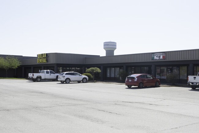
Property Detail
2844 Old Us 231 S
Lafayette-West Lafayette, IN
LAFAYETTE PLAZA SOUTH REPLAT OF LOTS 1 & 2 PT LOT 1
79-11-06-227-006.000-033
TIPPECANOE
Religious
Indiana
B and X Area of moderate flood hazard, usually the area between the limits of the 100-year and 500-year floods.
1,2
2024
44 SF
2024
Lafayette/Kokomo
001800
Other Market Areas
68,405 SF
NEARBY LISTINGS FOR SALE OR LEASE
DEMOGRAPHICS near 2844 Old Us 231 S
1 mile
3 mile
5 mile
2025 Total Population
7,917
79,348
131,291
2030 Population
7,997
82,283
135,738
Pop Growth 2025-2030
+ 1.01%
+ 3.70%
+ 3.39%
Average Age
35
34
34
2025 Total Households
3,459
31,145
51,663
HH Growth 2025-2030
+ 1.19%
+ 4.11%
+ 3.78%
Median Household Inc
$51,177
$53,164
$54,214
Avg Household Size
2.30
2.20
2.20
2025 Avg HH Vehicles
2.00
2.00
2.00
Median Home Value
$216,556
$231,448
$235,248
Median Year Built
1990
1985
1984
Nearby Places
Map Layers
Map Styles
 Street
 Aerial
Layers
 Traffic
 Biking
Places
Listings with unknown addresses are not visible on the map
- Restaurants
- Banks
- Shops
- Fitness
- Groceries
PUBLIC TRANSPORTATION
COMMUTER RAIL
Lafayette Amtrak Station (Cardinal - Amtrak)
Drive
Walk
Distance
Lafayette Amtrak Station (Cardinal - Amtrak)
6 min
2.8 mi
Freight Ports
Port Milwaukee
Drive
Walk
Distance
Port Milwaukee
255 min
210.2 mi
SALE & LEASE HISTORY
LISTING DATE
SALE/LEASE

Apr 29, 2019
For Sale
Nearby Properties
Address
Land Use
TOTAL SIZE
Lot Size
Zoning
Address
Land Use
TOTAL SIZE
Lot Size
Zoning
469,872 SF
0.85 AC
Address
Land Use
TOTAL SIZE
Lot Size
Zoning
377,937 SF
4.80 AC
Address
Land Use
TOTAL SIZE
Lot Size
Zoning
403,394 SF
1.64 AC
PDMX
Address
Land Use
TOTAL SIZE
Lot Size
Zoning
357,185 SF
1 AC
PDMX
Address
Land Use
TOTAL SIZE
Lot Size
Zoning
417,720 SF
3.09 AC
Address
Land Use
TOTAL SIZE
Lot Size
Zoning
Address
Land Use
TOTAL SIZE
Lot Size
Zoning
249,214 SF
1.93 AC
PDMX
Address
Land Use
TOTAL SIZE
Lot Size
Zoning
245,798 SF
1.15 AC
Address
Land Use
TOTAL SIZE
Lot Size
Zoning
159,723 SF
4.87 AC
Address
Land Use
TOTAL SIZE
Lot Size
Zoning
148,860 SF
1.25 AC
Address
Land Use
TOTAL SIZE
Lot Size
Zoning
10,864 SF
51.87 AC
PDMX
Address
Land Use
TOTAL SIZE
Lot Size
Zoning
232,565 SF
1.15 AC
Address
Land Use
TOTAL SIZE
Lot Size
Zoning
270,827 SF
34.90 AC
Address
Land Use
TOTAL SIZE
Lot Size
Zoning
8,675 SF
0.02 AC
Address
Land Use
TOTAL SIZE
Lot Size
Zoning
205,701 SF
1.27 AC
Address
Land Use
TOTAL SIZE
Lot Size
Zoning
221,751 SF
1.16 AC
Address
Land Use
TOTAL SIZE
Lot Size
Zoning
77,226 SF
0.01 AC
Address
Land Use
TOTAL SIZE
Lot Size
Zoning
184,441 SF
5.57 AC
PDNR
Address
Land Use
TOTAL SIZE
Lot Size
Zoning
164,234 SF
0.88 AC
CB
Address
Land Use
TOTAL SIZE
Lot Size
Zoning
27,300 SF
22.52 AC
Address
Land Use
TOTAL SIZE
Lot Size
Zoning
222,276 SF
0.31 AC
Address
Land Use
TOTAL SIZE
Lot Size
Zoning
203,830 SF
18.73 AC
Address
Land Use
TOTAL SIZE
Lot Size
Zoning
267,379 SF
87 SF
Address
Land Use
TOTAL SIZE
Lot Size
Zoning
113,044 SF
44 SF
Address
Land Use
TOTAL SIZE
Lot Size
Zoning
518,808 SF
174 SF
Address
Land Use
TOTAL SIZE
Lot Size
Zoning
118,066 SF
0.80 AC
Address
Land Use
TOTAL SIZE
Lot Size
Zoning
135,090 SF
0.80 AC
Address
Land Use
TOTAL SIZE
Lot Size
Zoning
70,686 SF
25.67 AC
Address
Land Use
TOTAL SIZE
Lot Size
Zoning
1,409,134 SF
170.04 AC
NB
The World's #1 Commercial Real Estate Marketplace
Connect with us
© 2026 CoStar Group
The information above has been obtained from sources believed reliable. While we do not doubt its accuracy we have not verified it and make no guarantee, warranty or representation about it. It is your responsibility to independently confirm its accuracy and completeness. Any projections, opinions, assumptions, or estimates used are for example only and do not represent the current or future performance of the property. The value of this transaction to you depends on tax and other factors which should be evaluated by your tax, financial, and legal advisors. You and your advisors should conduct a careful, independent investigation of the property to determine to your satisfaction the suitability of the property for your needs.