Property Record
2845 S Belt Line Rd, Mesquite, TX 75181
NEARBY LISTINGS FOR SALE OR LEASE
Property Detail
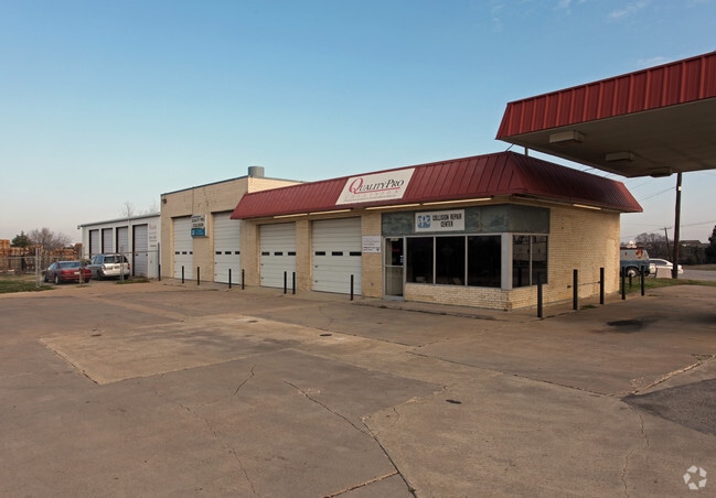
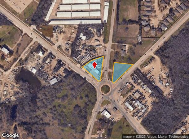
2845 S Belt Line Rd
65016724110100000
Benjamin Beckner
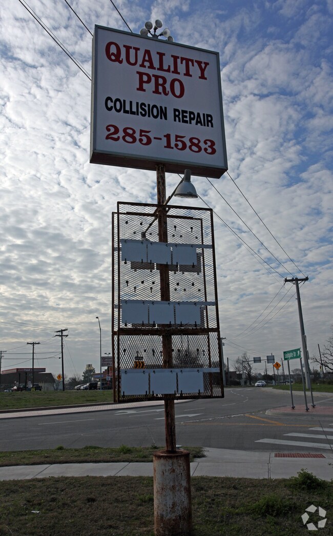
Autorepair
BENJAMIN BECKNER ABST 167 PG 241 TR 10 PROB16-03110-2 DD10151985 CO-DC 0167241101000 3CB01672411
X
Dallas
48257C0150E
Texas
2024
1.35 AC
2025
Mesquite
017314
Dallas/Ft Worth
4,831 SF
Dallas-Fort Worth-Arlington, TX
DEMOGRAPHICS near 2845 S Belt Line Rd
1 Mile
3 Mile
5 Mile
2024 Total Population
11,403
87,535
223,579
2029 Population
11,265
87,097
221,209
Pop Growth 2024-2029
(1.21%)
(0.50%)
(1.06%)
Average Age
33
34
34
2024 Total Households
3,310
25,769
65,492
HH Growth 2024-2029
(1.36%)
(0.73%)
(1.36%)
Median Household Inc
$66,937
$56,963
$54,908
Avg Household Size
3.30
3.30
3.30
2024 Avg HH Vehicles
2.00
2.00
2.00
Median Home Value
$207,305
$180,040
$174,653
Median Year Built
1987
1984
1983
Nearby Places
Map Layers
Map Styles
 Street
 Aerial
- Restaurants
- Banks
- Shops
- Fitness
- Groceries
PUBLIC TRANSPORTATION
AIRPORT
Dallas Love Field
DRIVE
WALK
Distance
Dallas Love Field
32 min
21.3 mi
Dallas-Fort Worth International
DRIVE
WALK
Distance
Dallas-Fort Worth International
46 min
39.3 mi
Freight Ports
Port of Shreveport
DRIVE
WALK
Distance
Port of Shreveport
198 min
184.3 mi
Nearby Properties
Address
Land Use
TOTAL SIZE
Lot Size
Zoning
Address
Land Use
TOTAL SIZE
Lot Size
Zoning
263,360 SF
42.98 AC
Z237
Address
Land Use
TOTAL SIZE
Lot Size
Zoning
441,799 SF
64.72 AC
Z05
Address
Land Use
TOTAL SIZE
Lot Size
Zoning
199,246 SF
15.32 AC
Z250
Address
Land Use
TOTAL SIZE
Lot Size
Zoning
194,385 SF
44.63 AC
Z396
Address
Land Use
TOTAL SIZE
Lot Size
Zoning
200,000 SF
8.11 AC
Address
Land Use
TOTAL SIZE
Lot Size
Zoning
255,008 SF
30.39 AC
Z250
Address
Land Use
TOTAL SIZE
Lot Size
Zoning
290,916 SF
8.24 AC
Address
Land Use
TOTAL SIZE
Lot Size
Zoning
193,000 SF
34.42 AC
Z05
Address
Land Use
TOTAL SIZE
Lot Size
Zoning
257,696 SF
9.62 AC
Address
Land Use
TOTAL SIZE
Lot Size
Zoning
214,853 SF
6.60 AC
Z372
Address
Land Use
TOTAL SIZE
Lot Size
Zoning
364,000 SF
40.25 AC
Z236
Address
Land Use
TOTAL SIZE
Lot Size
Zoning
298,150 SF
20.01 AC
Z14
Address
Land Use
TOTAL SIZE
Lot Size
Zoning
241,512 SF
12.61 AC
Address
Land Use
TOTAL SIZE
Lot Size
Zoning
107,376 SF
38.55 AC
Z372
Address
Land Use
TOTAL SIZE
Lot Size
Zoning
267,011 SF
11.11 AC
Z250
Address
Land Use
TOTAL SIZE
Lot Size
Zoning
174,200 SF
1 AC
Z372
Address
Land Use
TOTAL SIZE
Lot Size
Zoning
56,325 SF
3.84 AC
Z28
Address
Land Use
TOTAL SIZE
Lot Size
Zoning
86,875 SF
6.57 AC
Z376
Address
Land Use
TOTAL SIZE
Lot Size
Zoning
64,404 SF
19.79 AC
Z250
Address
Land Use
TOTAL SIZE
Lot Size
Zoning
238,728 SF
12.31 AC
Z184
Address
Land Use
TOTAL SIZE
Lot Size
Zoning
234,459 SF
9.71 AC
Z138
Address
Land Use
TOTAL SIZE
Lot Size
Zoning
91,871 SF
8.44 AC
Z05
Address
Land Use
TOTAL SIZE
Lot Size
Zoning
190,150 SF
13.39 AC
Z236
Address
Land Use
TOTAL SIZE
Lot Size
Zoning
84,233 SF
20.06 AC
Z148
Address
Land Use
TOTAL SIZE
Lot Size
Zoning
215 SF
29.95 AC
A
Address
Land Use
TOTAL SIZE
Lot Size
Zoning
91,483 SF
8.18 AC
Z372
Address
Land Use
TOTAL SIZE
Lot Size
Zoning
118,237 SF
5.56 AC
Z183
Address
Land Use
TOTAL SIZE
Lot Size
Zoning
92,104 SF
8.13 AC
Z372
Address
Land Use
TOTAL SIZE
Lot Size
Zoning
123,790 SF
6.68 AC
Z183
Address
Land Use
TOTAL SIZE
Lot Size
Zoning
248 SF
32.79 AC
MFA
The World's #1 Commercial Real Estate Marketplace
Connect with us
© 2025 CoStar Group
The information above has been obtained from sources believed reliable. While we do not doubt its accuracy we have not verified it and make no guarantee, warranty or representation about it. It is your responsibility to independently confirm its accuracy and completeness. Any projections, opinions, assumptions, or estimates used are for example only and do not represent the current or future performance of the property. The value of this transaction to you depends on tax and other factors which should be evaluated by your tax, financial, and legal advisors. You and your advisors should conduct a careful, independent investigation of the property to determine to your satisfaction the suitability of the property for your needs.