Property Record
2846 Sw 87Th Way, Gainesville, FL 32608
NEARBY LISTINGS FOR SALE OR LEASE
Property Detail
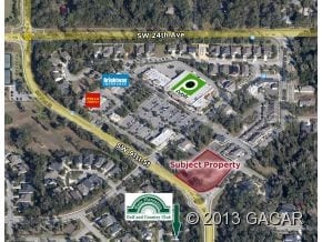
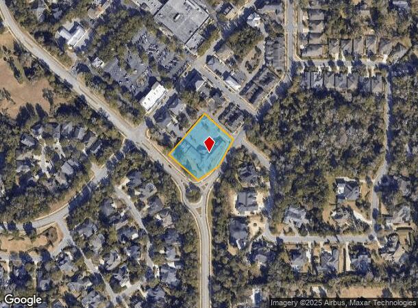
2846 Sw 87Th Way
Gainesville, FL
Haile Plantation Unit 36, Phase 6
06860-366-086
HAILE PLANTATION UNIT 36 PHASE 6 PB 26 PG 10 LOT 86 OR 4321/1497
Officebuilding
Alachua
X
Florida
12001C0293E
86
2025
1.28 AC
2025
West Gainesville
002221
Other Market Areas
11,683 SF
DEMOGRAPHICS near 2846 Sw 87Th Way
1 Mile
3 Mile
5 Mile
2024 Total Population
5,727
52,880
125,017
2029 Population
6,051
56,194
132,022
Pop Growth 2024-2029
+ 5.66%
+ 6.27%
+ 5.60%
Average Age
42
37
36
2024 Total Households
2,172
21,371
51,293
HH Growth 2024-2029
+ 5.80%
+ 6.45%
+ 5.62%
Median Household Inc
$110,241
$73,756
$61,765
Avg Household Size
2.60
2.40
2.30
2024 Avg HH Vehicles
2.00
2.00
2.00
Median Home Value
$393,763
$335,831
$313,204
Median Year Built
1998
1993
1991
Nearby Places
Map Layers
Map Styles
 Street
 Aerial
- Restaurants
- Banks
- Shops
- Fitness
- Groceries
PUBLIC TRANSPORTATION
AIRPORT
Gainesville Regional
DRIVE
WALK
Distance
Gainesville Regional
31 min
14.1 mi
Freight Ports
Jacksonville Port
DRIVE
WALK
Distance
Jacksonville Port
116 min
83.9 mi
Nearby Properties
Address
Land Use
TOTAL SIZE
Lot Size
Zoning
Address
Land Use
TOTAL SIZE
Lot Size
Zoning
1,005,666 SF
11.60 AC
MD
Address
Land Use
TOTAL SIZE
Lot Size
Zoning
571,635 SF
55.49 AC
RMF6
Address
Land Use
TOTAL SIZE
Lot Size
Zoning
790,684 SF
57.09 AC
U8
Address
Land Use
TOTAL SIZE
Lot Size
Zoning
392,717 SF
47.62 AC
R-2
Address
Land Use
TOTAL SIZE
Lot Size
Zoning
318,578 SF
21.24 AC
RMF7
Address
Land Use
TOTAL SIZE
Lot Size
Zoning
335,387 SF
26.55 AC
R-1A
Address
Land Use
TOTAL SIZE
Lot Size
Zoning
299,984 SF
10.33 AC
MU2
Address
Land Use
TOTAL SIZE
Lot Size
Zoning
366,764 SF
26.03 AC
RMF6
Address
Land Use
TOTAL SIZE
Lot Size
Zoning
170,185 SF
5.14 AC
R-1AA
Address
Land Use
TOTAL SIZE
Lot Size
Zoning
371,933 SF
15 AC
PD
Address
Land Use
TOTAL SIZE
Lot Size
Zoning
332,878 SF
34.15 AC
PD
Address
Land Use
TOTAL SIZE
Lot Size
Zoning
344,284 SF
31.74 AC
PD
Address
Land Use
TOTAL SIZE
Lot Size
Zoning
326,376 SF
39.94 AC
R-2
Address
Land Use
TOTAL SIZE
Lot Size
Zoning
214,608 SF
21.23 AC
MU2
Address
Land Use
TOTAL SIZE
Lot Size
Zoning
205,412 SF
23.80 AC
R-1A
Address
Land Use
TOTAL SIZE
Lot Size
Zoning
134,068 SF
3.47 AC
R-2
Address
Land Use
TOTAL SIZE
Lot Size
Zoning
311,673 SF
34.15 AC
R-2
Address
Land Use
TOTAL SIZE
Lot Size
Zoning
272,406 SF
25.39 AC
PD
Address
Land Use
TOTAL SIZE
Lot Size
Zoning
307,316 SF
25.99 AC
R-2
Address
Land Use
TOTAL SIZE
Lot Size
Zoning
296,660 SF
21.78 AC
R-3
Address
Land Use
TOTAL SIZE
Lot Size
Zoning
29,190 SF
4.21 AC
BI
Address
Land Use
TOTAL SIZE
Lot Size
Zoning
172,598 SF
23.13 AC
U9
Address
Land Use
TOTAL SIZE
Lot Size
Zoning
232,380 SF
37.50 AC
PD
Address
Land Use
TOTAL SIZE
Lot Size
Zoning
112,213 SF
18.62 AC
R-1AA
Address
Land Use
TOTAL SIZE
Lot Size
Zoning
87,104 SF
14.59 AC
PD
Address
Land Use
TOTAL SIZE
Lot Size
Zoning
168,261 SF
23.50 AC
BH
Address
Land Use
TOTAL SIZE
Lot Size
Zoning
80,786 SF
15 AC
ED
Address
Land Use
TOTAL SIZE
Lot Size
Zoning
311,290 SF
25.20 AC
R-1A
Address
Land Use
TOTAL SIZE
Lot Size
Zoning
97,648 SF
44.62 AC
A
Address
Land Use
TOTAL SIZE
Lot Size
Zoning
155,747 SF
14.77 AC
RMF7
The World's #1 Commercial Real Estate Marketplace
Connect with us
© 2026 CoStar Group
The information above has been obtained from sources believed reliable. While we do not doubt its accuracy we have not verified it and make no guarantee, warranty or representation about it. It is your responsibility to independently confirm its accuracy and completeness. Any projections, opinions, assumptions, or estimates used are for example only and do not represent the current or future performance of the property. The value of this transaction to you depends on tax and other factors which should be evaluated by your tax, financial, and legal advisors. You and your advisors should conduct a careful, independent investigation of the property to determine to your satisfaction the suitability of the property for your needs.