Property Record
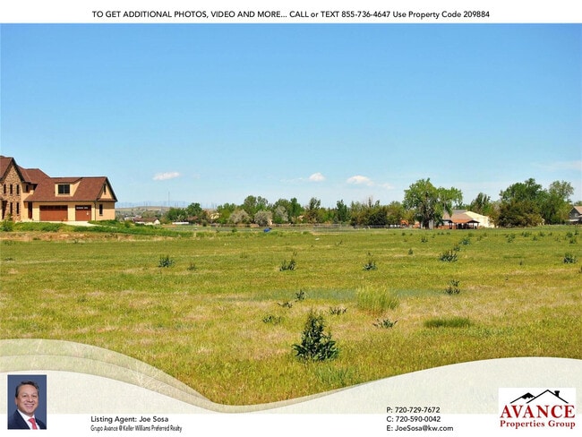
24865 Green Dr, Brighton, CO 80603

Property Detail
24865 Green Dr
Denver-Aurora-Centennial, CO
SUB:GREEN ESTATES FILING NO 3 BLK:1 LOT:1
1567-07-4-03-015
ADAMS
Residentialacreage
Colorado
C3
1
B and X Area of moderate flood hazard, usually the area between the limits of the 100-year and 500-year floods.
5.39 AC
2024
Northeast Denver
2025
Denver
008553
NEARBY LISTINGS FOR SALE OR LEASE
DEMOGRAPHICS near 24865 Green Dr
1 mile
3 mile
5 mile
2024 Total Population
552
13,530
35,671
2029 Population
575
15,075
39,064
Pop Growth 2024-2029
+ 4.17%
+ 11.42%
+ 9.51%
Average Age
43
36
36
2024 Total Households
188
4,293
11,557
HH Growth 2024-2029
+ 4.26%
+ 11.60%
+ 9.63%
Median Household Inc
$138,709
$109,547
$102,526
Avg Household Size
2.90
3.10
3.10
2024 Avg HH Vehicles
3.00
2.00
2.00
Median Home Value
$723,856
$462,606
$458,244
Median Year Built
1999
2006
2006
Nearby Places
Map Layers
Map Styles
 Street
 Aerial
Transit
 Traffic
 Biking
Places
Listings with unknown addresses are not visible on the map
- Restaurants
- Banks
- Shops
- Fitness
- Groceries
PUBLIC TRANSPORTATION
AIRPORT
Denver International
Drive
Walk
Distance
Denver International
28 min
21.7 mi
Freight Ports
Tulsa Port Of Catoosa
Drive
Walk
Distance
Tulsa Port Of Catoosa
734 min
715.8 mi
SALE & LEASE HISTORY
LISTING DATE
SALE/LEASE

Jul 22, 2020
For Sale
Nearby Properties
Address
Land Use
TOTAL SIZE
Lot Size
Zoning
Address
Land Use
TOTAL SIZE
Lot Size
Zoning
614,010 SF
41.81 AC
Address
Land Use
TOTAL SIZE
Lot Size
Zoning
546,000 SF
35.70 AC
Address
Land Use
TOTAL SIZE
Lot Size
Zoning
526,400 SF
29.21 AC
Address
Land Use
TOTAL SIZE
Lot Size
Zoning
243,589 SF
16.71 AC
Address
Land Use
TOTAL SIZE
Lot Size
Zoning
198,433 SF
40.09 AC
Address
Land Use
TOTAL SIZE
Lot Size
Zoning
352,240 SF
19.96 AC
Address
Land Use
TOTAL SIZE
Lot Size
Zoning
300,300 SF
16.38 AC
Address
Land Use
TOTAL SIZE
Lot Size
Zoning
268,226 SF
13.89 AC
Address
Land Use
TOTAL SIZE
Lot Size
Zoning
123,627 SF
11.22 AC
Address
Land Use
TOTAL SIZE
Lot Size
Zoning
101,917 SF
3.72 AC
Address
Land Use
TOTAL SIZE
Lot Size
Zoning
85,968 SF
6.59 AC
Address
Land Use
TOTAL SIZE
Lot Size
Zoning
58,000 SF
2.37 AC
Address
Land Use
TOTAL SIZE
Lot Size
Zoning
52,000 SF
11.18 AC
Address
Land Use
TOTAL SIZE
Lot Size
Zoning
61,250 SF
7.10 AC
Address
Land Use
TOTAL SIZE
Lot Size
Zoning
25.04 AC
Address
Land Use
TOTAL SIZE
Lot Size
Zoning
22,898 SF
3.65 AC
Address
Land Use
TOTAL SIZE
Lot Size
Zoning
6,758 SF
5.22 AC
Address
Land Use
TOTAL SIZE
Lot Size
Zoning
2,123 SF
149.16 AC
A3
Address
Land Use
TOTAL SIZE
Lot Size
Zoning
17,472 SF
2.85 AC
Address
Land Use
TOTAL SIZE
Lot Size
Zoning
704,859 SF
54 AC
Address
Land Use
TOTAL SIZE
Lot Size
Zoning
11,875 SF
1.57 AC
Address
Land Use
TOTAL SIZE
Lot Size
Zoning
4,657 SF
1.22 AC
Address
Land Use
TOTAL SIZE
Lot Size
Zoning
14,740 SF
12.88 AC
Address
Land Use
TOTAL SIZE
Lot Size
Zoning
1,200 SF
151.55 AC
A3
Address
Land Use
TOTAL SIZE
Lot Size
Zoning
10,373 SF
1.38 AC
Address
Land Use
TOTAL SIZE
Lot Size
Zoning
12,701 SF
41.78 AC
A3
Address
Land Use
TOTAL SIZE
Lot Size
Zoning
4,005 SF
298.13 AC
A3
Address
Land Use
TOTAL SIZE
Lot Size
Zoning
15.45 AC
The World's #1 Commercial Real Estate Marketplace
Connect with us
© 2026 CoStar Group
The information above has been obtained from sources believed reliable. While we do not doubt its accuracy we have not verified it and make no guarantee, warranty or representation about it. It is your responsibility to independently confirm its accuracy and completeness. Any projections, opinions, assumptions, or estimates used are for example only and do not represent the current or future performance of the property. The value of this transaction to you depends on tax and other factors which should be evaluated by your tax, financial, and legal advisors. You and your advisors should conduct a careful, independent investigation of the property to determine to your satisfaction the suitability of the property for your needs.