Property Record
285 E Del Amo Blvd, Carson, CA 90745
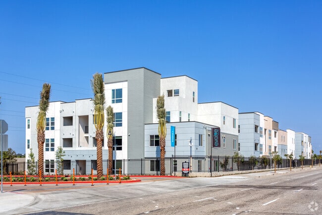


Property Detail
285 E Del Amo Blvd
7336-010-026
TR=42385 EX OF ST LOT 1
Multifamilydwelling
Los Angeles
CASP-10*
California
B and X Area of moderate flood hazard, usually the area between the limits of the 100-year and 500-year floods.
1
2024
11.71 AC
2025
Carson
543801
Los Angeles
64,456 SF
Los Angeles-Long Beach-Glendale, CA
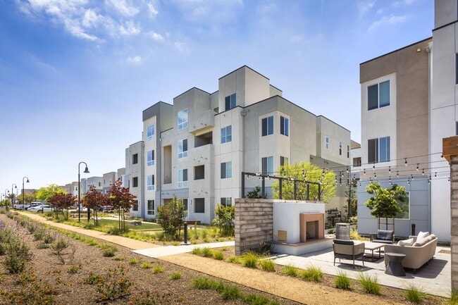
NEARBY LISTINGS FOR SALE OR LEASE
DEMOGRAPHICS near 285 E Del Amo Blvd
1 mile
3 mile
5 mile
2025 Total Population
11,853
166,687
553,437
2030 Population
11,807
165,048
547,686
Pop Growth 2025-2030
(0.39%)
(0.98%)
(1.04%)
Average Age
44
42
41
2025 Total Households
3,504
51,785
173,541
HH Growth 2025-2030
(0.54%)
(1.20%)
(1.20%)
Median Household Inc
$107,651
$97,544
$88,882
Avg Household Size
3.20
3.00
3.00
2025 Avg HH Vehicles
2.00
2.00
2.00
Median Home Value
$697,653
$714,308
$733,742
Median Year Built
1966
1965
1963
Nearby Places
Map Layers
Map Styles
 Street
 Aerial
Layers
 Traffic
 Biking
Places
Listings with unknown addresses are not visible on the map
- Restaurants
- Banks
- Shops
- Fitness
- Groceries
PUBLIC TRANSPORTATION
AIRPORT
Long Beach (Daugherty Field)
Drive
Walk
Distance
Long Beach (Daugherty Field)
13 min
8.9 mi
Los Angeles International
Drive
Walk
Distance
Los Angeles International
20 min
13.3 mi
Bob Hope
Drive
Walk
Distance
Bob Hope
41 min
32.6 mi
Freight Ports
Port of Long Beach
Drive
Walk
Distance
Port of Long Beach
16 min
10.8 mi
Nearby Properties
Address
Land Use
TOTAL SIZE
Lot Size
Zoning
Address
Land Use
TOTAL SIZE
Lot Size
Zoning
997,143 SF
98.35 AC
TOMI-BP
Address
Land Use
TOTAL SIZE
Lot Size
Zoning
236,582 SF
425.41 AC
CAMH*
Address
Land Use
TOTAL SIZE
Lot Size
Zoning
10,152 SF
140.14 AC
TOMI-HVY
Address
Land Use
TOTAL SIZE
Lot Size
Zoning
422,640 SF
LAM3
Address
Land Use
TOTAL SIZE
Lot Size
Zoning
291,731 SF
16.84 AC
CAML*
Address
Land Use
TOTAL SIZE
Lot Size
Zoning
604,106 SF
42.72 AC
TOMI-HVY
Address
Land Use
TOTAL SIZE
Lot Size
Zoning
506,189 SF
20.33 AC
LAM2
Address
Land Use
TOTAL SIZE
Lot Size
Zoning
3,585,714 SF
67.35 AC
LAM3
Address
Land Use
TOTAL SIZE
Lot Size
Zoning
409,522 SF
11.41 AC
LAM3
Address
Land Use
TOTAL SIZE
Lot Size
Zoning
184,300 SF
8.14 AC
LAM3
Address
Land Use
TOTAL SIZE
Lot Size
Zoning
285,314 SF
14.28 AC
CAMH*
Address
Land Use
TOTAL SIZE
Lot Size
Zoning
260,766 SF
10.70 AC
LAM3
Address
Land Use
TOTAL SIZE
Lot Size
Zoning
429,141 SF
3.29 AC
LCM1*
Address
Land Use
TOTAL SIZE
Lot Size
Zoning
282,280 SF
Address
Land Use
TOTAL SIZE
Lot Size
Zoning
670,305 SF
28.08 AC
TOMI-BP
Address
Land Use
TOTAL SIZE
Lot Size
Zoning
383,109 SF
17 AC
LCM2
Address
Land Use
TOTAL SIZE
Lot Size
Zoning
402,197 SF
27.29 AC
COMH*
Address
Land Use
TOTAL SIZE
Lot Size
Zoning
198,502 SF
LCM2 *
Address
Land Use
TOTAL SIZE
Lot Size
Zoning
365,701 SF
2.45 AC
TOMI-BP
Address
Land Use
TOTAL SIZE
Lot Size
Zoning
340,121 SF
13 AC
LCM2
Address
Land Use
TOTAL SIZE
Lot Size
Zoning
430,706 SF
18.95 AC
CASP-4*
Address
Land Use
TOTAL SIZE
Lot Size
Zoning
125,849 SF
6.08 AC
LAM2
Address
Land Use
TOTAL SIZE
Lot Size
Zoning
24,060 SF
LAM2
Address
Land Use
TOTAL SIZE
Lot Size
Zoning
178,323 SF
12.23 AC
CACR&D&MUR
Address
Land Use
TOTAL SIZE
Lot Size
Zoning
546,606 SF
17.58 AC
LAM3
Address
Land Use
TOTAL SIZE
Lot Size
Zoning
1,005,037 SF
23.98 AC
TOMI-LT
Address
Land Use
TOTAL SIZE
Lot Size
Zoning
169,576 SF
8.40 AC
TOMI-BP
Address
Land Use
TOTAL SIZE
Lot Size
Zoning
499,562 SF
6.50 AC
LAM3
Address
Land Use
TOTAL SIZE
Lot Size
Zoning
210,742 SF
11.25 AC
CAML*
The World's #1 Commercial Real Estate Marketplace
Connect with us
© 2026 CoStar Group
The information above has been obtained from sources believed reliable. While we do not doubt its accuracy we have not verified it and make no guarantee, warranty or representation about it. It is your responsibility to independently confirm its accuracy and completeness. Any projections, opinions, assumptions, or estimates used are for example only and do not represent the current or future performance of the property. The value of this transaction to you depends on tax and other factors which should be evaluated by your tax, financial, and legal advisors. You and your advisors should conduct a careful, independent investigation of the property to determine to your satisfaction the suitability of the property for your needs.