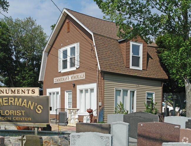
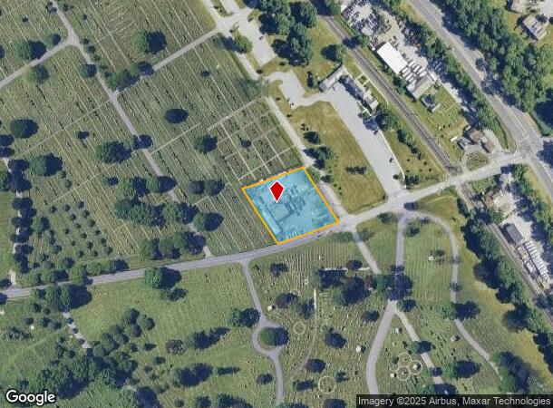
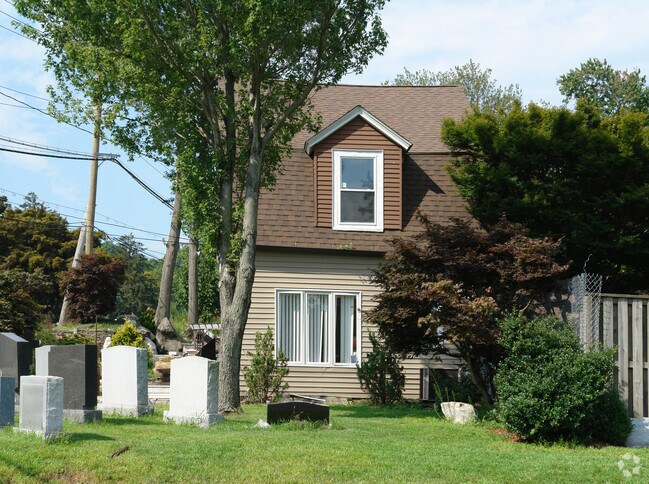
Property Record
285 Lakeview Ave, Valhalla, NY 10595
NEARBY LISTINGS FOR SALE OR LEASE
Property Detail
285 Lakeview Ave
3489-117-010-00001-058-0000
Westchester
Commercialbuilding
New York
X
58.000
36119C0258F
1 AC
2025
West I-287 Corridor
2024
Westchester/So Connecticut
011902
New York-Jersey City-White Plains, NY-NJ
1,485 SF
DEMOGRAPHICS near 285 Lakeview Ave
1 Mile
3 Mile
5 Mile
2024 Total Population
3,701
46,308
171,363
2029 Population
3,567
45,242
168,726
Pop Growth 2024-2029
(3.62%)
(2.30%)
(1.54%)
Average Age
42
42
42
2024 Total Households
1,299
15,761
64,065
HH Growth 2024-2029
(3.85%)
(2.44%)
(1.59%)
Median Household Inc
$145,558
$130,616
$126,385
Avg Household Size
2.80
2.70
2.50
2024 Avg HH Vehicles
2.00
2.00
2.00
Median Home Value
$691,583
$657,710
$663,631
Median Year Built
1956
1961
1960
Nearby Places
Map Layers
Map Styles
 Street
 Aerial
- Restaurants
- Banks
- Shops
- Fitness
- Groceries
PUBLIC TRANSPORTATION
COMMUTER RAIL
Valhalla Station (Harlem Line - Metro-North Commuter Railroad Company (Metro-North))
DRIVE
WALK
Distance
Valhalla Station (Harlem Line - Metro-North Commuter Railroad Company (Metro-North))
1 min
0.9 mi
Mount Pleasant Station (Harlem Line - Metro-North Commuter Railroad Company (Metro-North))
DRIVE
WALK
Distance
Mount Pleasant Station (Harlem Line - Metro-North Commuter Railroad Company (Metro-North))
2 min
1.2 mi
AIRPORT
Westchester County
DRIVE
WALK
Distance
Westchester County
15 min
8.6 mi
LaGuardia
DRIVE
WALK
Distance
LaGuardia
44 min
28.8 mi
Freight Ports
NY - Red Hook Container Terminal
DRIVE
WALK
Distance
NY - Red Hook Container Terminal
57 min
36.9 mi
Nearby Properties
Address
Land Use
TOTAL SIZE
Lot Size
Zoning
Address
Land Use
TOTAL SIZE
Lot Size
Zoning
358.83 AC
Address
Land Use
TOTAL SIZE
Lot Size
Zoning
85.40 AC
Address
Land Use
TOTAL SIZE
Lot Size
Zoning
4.45 AC
B
Address
Land Use
TOTAL SIZE
Lot Size
Zoning
2,760 SF
60.76 AC
Address
Land Use
TOTAL SIZE
Lot Size
Zoning
22.92 AC
Address
Land Use
TOTAL SIZE
Lot Size
Zoning
75.87 AC
R-20
Address
Land Use
TOTAL SIZE
Lot Size
Zoning
36.59 AC
Address
Land Use
TOTAL SIZE
Lot Size
Zoning
17.17 AC
Address
Land Use
TOTAL SIZE
Lot Size
Zoning
14.86 AC
OB
Address
Land Use
TOTAL SIZE
Lot Size
Zoning
24.66 AC
Address
Land Use
TOTAL SIZE
Lot Size
Zoning
16.22 AC
UR
Address
Land Use
TOTAL SIZE
Lot Size
Zoning
19.25 AC
Address
Land Use
TOTAL SIZE
Lot Size
Zoning
28.51 AC
Address
Land Use
TOTAL SIZE
Lot Size
Zoning
253,167 SF
9.11 AC
OB
Address
Land Use
TOTAL SIZE
Lot Size
Zoning
60.01 AC
Address
Land Use
TOTAL SIZE
Lot Size
Zoning
11.61 AC
Address
Land Use
TOTAL SIZE
Lot Size
Zoning
Address
Land Use
TOTAL SIZE
Lot Size
Zoning
68,000 SF
1.53 AC
B
Address
Land Use
TOTAL SIZE
Lot Size
Zoning
Address
Land Use
TOTAL SIZE
Lot Size
Zoning
1.69 AC
Address
Land Use
TOTAL SIZE
Lot Size
Zoning
29.42 AC
PUD
Address
Land Use
TOTAL SIZE
Lot Size
Zoning
10.90 AC
UR
Address
Land Use
TOTAL SIZE
Lot Size
Zoning
Address
Land Use
TOTAL SIZE
Lot Size
Zoning
180,750 SF
22.03 AC
PD
Address
Land Use
TOTAL SIZE
Lot Size
Zoning
3.16 AC
Address
Land Use
TOTAL SIZE
Lot Size
Zoning
7.98 AC
M-14
Address
Land Use
TOTAL SIZE
Lot Size
Zoning
0.58 AC
B
Address
Land Use
TOTAL SIZE
Lot Size
Zoning
1.78 AC
Address
Land Use
TOTAL SIZE
Lot Size
Zoning
15.69 AC
Address
Land Use
TOTAL SIZE
Lot Size
Zoning
39.83 AC
The World's #1 Commercial Real Estate Marketplace
Connect with us
© 2026 CoStar Group
The information above has been obtained from sources believed reliable. While we do not doubt its accuracy we have not verified it and make no guarantee, warranty or representation about it. It is your responsibility to independently confirm its accuracy and completeness. Any projections, opinions, assumptions, or estimates used are for example only and do not represent the current or future performance of the property. The value of this transaction to you depends on tax and other factors which should be evaluated by your tax, financial, and legal advisors. You and your advisors should conduct a careful, independent investigation of the property to determine to your satisfaction the suitability of the property for your needs.