Property Record
285 Nw 35Th St, Corvallis, OR 97330
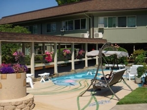


Property Detail
285 Nw 35Th St
Taxexempt
Benton
RS-20
Oregon
B and X Area of moderate flood hazard, usually the area between the limits of the 100-year and 500-year floods.
3.20 AC
0
Oregon West Area
2025
Other Market Areas
010702
Corvallis, OR
55,431 SF
105803
NEARBY LISTINGS FOR SALE OR LEASE
DEMOGRAPHICS near 285 Nw 35Th St
1 mile
3 mile
5 mile
2025 Total Population
21,776
65,352
78,454
2030 Population
23,180
68,130
81,429
Pop Growth 2025-2030
+ 6.45%
+ 4.25%
+ 3.79%
Average Age
31
37
38
2025 Total Households
7,811
26,152
31,408
HH Growth 2025-2030
+ 7.62%
+ 4.58%
+ 4.06%
Median Household Inc
$42,216
$62,975
$66,863
Avg Household Size
2.20
2.20
2.20
2025 Avg HH Vehicles
2.00
2.00
2.00
Median Home Value
$521,727
$528,277
$512,469
Median Year Built
1979
1979
1980
Nearby Places
Map Layers
Map Styles
 Street
 Aerial
Transit
 Traffic
 Biking
Places
Listings with unknown addresses are not visible on the map
- Restaurants
- Banks
- Shops
- Fitness
- Groceries
PUBLIC TRANSPORTATION
AIRPORT
Mahlon Sweet Field
Drive
Walk
Distance
Mahlon Sweet Field
61 min
37.4 mi
Nearby Properties
Address
Land Use
TOTAL SIZE
Lot Size
Zoning
Address
Land Use
TOTAL SIZE
Lot Size
Zoning
1,687,456 SF
178.96 AC
OSU
Address
Land Use
TOTAL SIZE
Lot Size
Zoning
Address
Land Use
TOTAL SIZE
Lot Size
Zoning
Address
Land Use
TOTAL SIZE
Lot Size
Zoning
84,026 SF
29.97 AC
OSU
Address
Land Use
TOTAL SIZE
Lot Size
Zoning
878,646 SF
26.45 AC
OSU
Address
Land Use
TOTAL SIZE
Lot Size
Zoning
552,129 SF
25.99 AC
RS-12
Address
Land Use
TOTAL SIZE
Lot Size
Zoning
298,527 SF
32.61 AC
PD(RS-3.5)
Address
Land Use
TOTAL SIZE
Lot Size
Zoning
247,098 SF
16.39 AC
OSU
Address
Land Use
TOTAL SIZE
Lot Size
Zoning
321,584 SF
21.48 AC
RS-9
Address
Land Use
TOTAL SIZE
Lot Size
Zoning
45.23 AC
OSU
Address
Land Use
TOTAL SIZE
Lot Size
Zoning
195,325 SF
26.28 AC
RS-3.5
Address
Land Use
TOTAL SIZE
Lot Size
Zoning
Address
Land Use
TOTAL SIZE
Lot Size
Zoning
292,032 SF
40.52 AC
RS-3.5
Address
Land Use
TOTAL SIZE
Lot Size
Zoning
120,379 SF
11.85 AC
OSU
Address
Land Use
TOTAL SIZE
Lot Size
Zoning
339,006 SF
0.69 AC
RF
Address
Land Use
TOTAL SIZE
Lot Size
Zoning
91,272 SF
1.27 AC
OSU
Address
Land Use
TOTAL SIZE
Lot Size
Zoning
330,693 SF
1.25 AC
MUE
Address
Land Use
TOTAL SIZE
Lot Size
Zoning
122,130 SF
5.64 AC
OSU
Address
Land Use
TOTAL SIZE
Lot Size
Zoning
20.84 AC
GI
Address
Land Use
TOTAL SIZE
Lot Size
Zoning
106,538 SF
4.38 AC
RS-12
Address
Land Use
TOTAL SIZE
Lot Size
Zoning
82,704 SF
7.66 AC
RS-5
Address
Land Use
TOTAL SIZE
Lot Size
Zoning
215,337 SF
16.20 AC
RS-20
Address
Land Use
TOTAL SIZE
Lot Size
Zoning
297,220 SF
2.67 AC
OSU
Address
Land Use
TOTAL SIZE
Lot Size
Zoning
166,415 SF
3.04 AC
OSU
Address
Land Use
TOTAL SIZE
Lot Size
Zoning
137,135 SF
14.80 AC
RTC
Address
Land Use
TOTAL SIZE
Lot Size
Zoning
47,966 SF
2.44 AC
RS-9
Address
Land Use
TOTAL SIZE
Lot Size
Zoning
68,500 SF
10 AC
OSU
Address
Land Use
TOTAL SIZE
Lot Size
Zoning
176,703 SF
3.43 AC
OSU
Address
Land Use
TOTAL SIZE
Lot Size
Zoning
116,863 SF
2.10 AC
OSU
Address
Land Use
TOTAL SIZE
Lot Size
Zoning
81,113 SF
1.81 AC
PD(RS-20)
The World's #1 Commercial Real Estate Marketplace
Connect with us
© 2026 CoStar Group
The information above has been obtained from sources believed reliable. While we do not doubt its accuracy we have not verified it and make no guarantee, warranty or representation about it. It is your responsibility to independently confirm its accuracy and completeness. Any projections, opinions, assumptions, or estimates used are for example only and do not represent the current or future performance of the property. The value of this transaction to you depends on tax and other factors which should be evaluated by your tax, financial, and legal advisors. You and your advisors should conduct a careful, independent investigation of the property to determine to your satisfaction the suitability of the property for your needs.