Property Record
285 Webber Rd, Brimfield, MA 01010
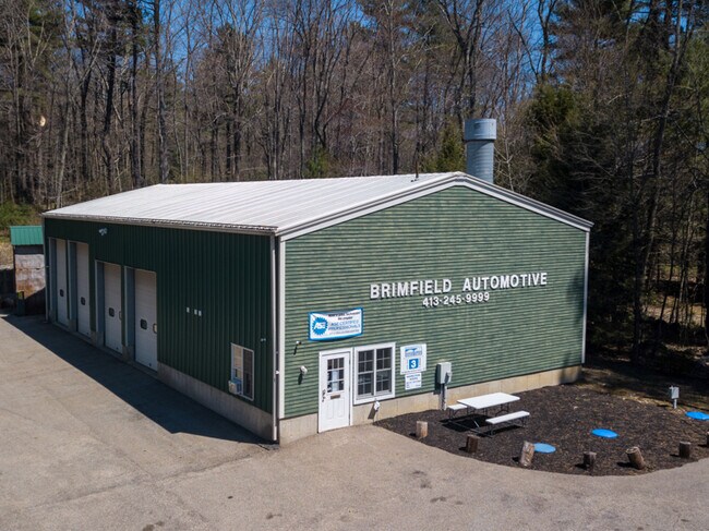

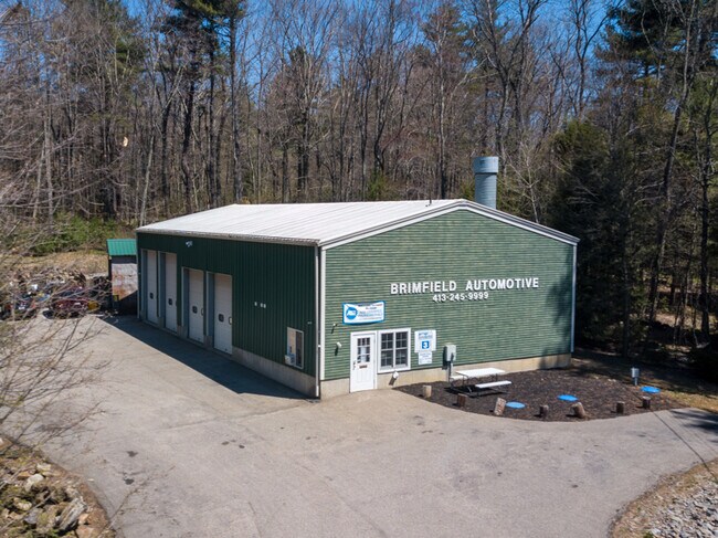
Property Detail
285 Webber Rd
BRIM-000015-A000000-000004
Hampden
Autorepair
Massachusetts
B
4
B and X Area of moderate flood hazard, usually the area between the limits of the 100-year and 500-year floods.
2 AC
2025
Hampden County
2025
Hartford
813802
Springfield, MA
320 SF
NEARBY LISTINGS FOR SALE OR LEASE
-
-
View all Brimfield listings for sale on LoopNet.com
DEMOGRAPHICS near 285 Webber Rd
1 mile
3 mile
5 mile
2025 Total Population
299
5,838
15,564
2030 Population
303
5,969
16,046
Pop Growth 2025-2030
+ 1.34%
+ 2.24%
+ 3.10%
Average Age
45
43
44
2025 Total Households
120
2,323
6,248
HH Growth 2025-2030
+ 0.83%
+ 2.28%
+ 3.19%
Median Household Inc
$118,749
$107,544
$110,289
Avg Household Size
2.50
2.50
2.50
2025 Avg HH Vehicles
2.00
2.00
2.00
Median Home Value
$450,000
$413,536
$405,467
Median Year Built
1986
1983
1983
Nearby Places
Map Layers
Map Styles
 Street
 Aerial
Transit
 Traffic
 Biking
Places
Listings with unknown addresses are not visible on the map
- Restaurants
- Banks
- Shops
- Fitness
- Groceries
PUBLIC TRANSPORTATION
AIRPORT
Worcester Regional
Drive
Walk
Distance
Worcester Regional
43 min
25.5 mi
Bradley International
Drive
Walk
Distance
Bradley International
70 min
43.1 mi
Freight Ports
Port of Davisville, RI
Drive
Walk
Distance
Port of Davisville, RI
102 min
76.8 mi
SALE & LEASE HISTORY
LISTING DATE
SALE/LEASE

May 10, 2020
For Sale
Nearby Properties
Address
Land Use
TOTAL SIZE
Lot Size
Zoning
Address
Land Use
TOTAL SIZE
Lot Size
Zoning
Address
Land Use
TOTAL SIZE
Lot Size
Zoning
40,910 SF
25.36 AC
Address
Land Use
TOTAL SIZE
Lot Size
Zoning
1,846.93 AC
AR
Address
Land Use
TOTAL SIZE
Lot Size
Zoning
10.65 AC
B
Address
Land Use
TOTAL SIZE
Lot Size
Zoning
189.22 AC
B
Address
Land Use
TOTAL SIZE
Lot Size
Zoning
68,898 SF
49.02 AC
Address
Land Use
TOTAL SIZE
Lot Size
Zoning
5.60 AC
AR
Address
Land Use
TOTAL SIZE
Lot Size
Zoning
36,220 SF
1.42 AC
Address
Land Use
TOTAL SIZE
Lot Size
Zoning
51,006 SF
10.54 AC
Address
Land Use
TOTAL SIZE
Lot Size
Zoning
73,136 SF
7.70 AC
Address
Land Use
TOTAL SIZE
Lot Size
Zoning
28,371 SF
1.85 AC
Address
Land Use
TOTAL SIZE
Lot Size
Zoning
2,752 SF
0.22 AC
Address
Land Use
TOTAL SIZE
Lot Size
Zoning
14,671 SF
1 AC
Address
Land Use
TOTAL SIZE
Lot Size
Zoning
54,599 SF
5.37 AC
Address
Land Use
TOTAL SIZE
Lot Size
Zoning
65.96 AC
AR
Address
Land Use
TOTAL SIZE
Lot Size
Zoning
5.90 AC
1B
Address
Land Use
TOTAL SIZE
Lot Size
Zoning
3,812 SF
3.26 AC
Address
Land Use
TOTAL SIZE
Lot Size
Zoning
9,812 SF
2 AC
B
Address
Land Use
TOTAL SIZE
Lot Size
Zoning
4,168 SF
1.01 AC
Address
Land Use
TOTAL SIZE
Lot Size
Zoning
46,729 SF
1.39 AC
Address
Land Use
TOTAL SIZE
Lot Size
Zoning
29,430 SF
2.50 AC
Address
Land Use
TOTAL SIZE
Lot Size
Zoning
10,740 SF
15.50 AC
Address
Land Use
TOTAL SIZE
Lot Size
Zoning
29,400 SF
4.63 AC
AR
Address
Land Use
TOTAL SIZE
Lot Size
Zoning
0.33 AC
Address
Land Use
TOTAL SIZE
Lot Size
Zoning
2,944 SF
15 AC
AR
Address
Land Use
TOTAL SIZE
Lot Size
Zoning
4,732 SF
15 AC
B
Address
Land Use
TOTAL SIZE
Lot Size
Zoning
7,965 SF
2.14 AC
Address
Land Use
TOTAL SIZE
Lot Size
Zoning
3,686 SF
2.12 AC
Address
Land Use
TOTAL SIZE
Lot Size
Zoning
465.80 AC
AR
Address
Land Use
TOTAL SIZE
Lot Size
Zoning
4,920 SF
0.47 AC
B
The World's #1 Commercial Real Estate Marketplace
Connect with us
© 2026 CoStar Group
The information above has been obtained from sources believed reliable. While we do not doubt its accuracy we have not verified it and make no guarantee, warranty or representation about it. It is your responsibility to independently confirm its accuracy and completeness. Any projections, opinions, assumptions, or estimates used are for example only and do not represent the current or future performance of the property. The value of this transaction to you depends on tax and other factors which should be evaluated by your tax, financial, and legal advisors. You and your advisors should conduct a careful, independent investigation of the property to determine to your satisfaction the suitability of the property for your needs.