Property Record
2850 Joe Dimaggio Blvd, Round Rock, TX 78665

Property Detail
2850 Joe Dimaggio Blvd
Austin-Round Rock-San Marcos, TX
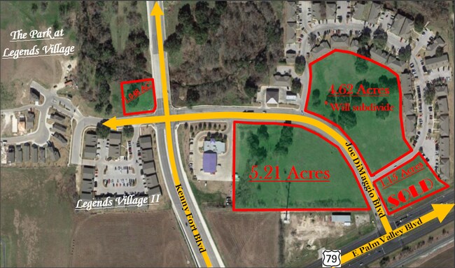
Legends Village Sec 4
R503525
S9912 - LEGENDS VILLAGE SEC 4, BLOCK A, LOT 2, ACRES 1.104
Commercialacreage
Williamson
AE
Texas
48491C0494F
2
2024
1.10 AC
2025
Round Rock
021512
Austin
NEARBY LISTINGS FOR SALE OR LEASE
-
-
-
-
-
-
-
-
-
-
-
-
-
No Photo
-
-
View all Round Rock listings for sale on LoopNet.com
DEMOGRAPHICS near 2850 Joe Dimaggio Blvd
1 mile
3 mile
5 mile
2024 Total Population
8,401
100,554
236,071
2029 Population
10,712
126,897
291,350
Pop Growth 2024-2029
+ 27.51%
+ 26.20%
+ 23.42%
Average Age
36
36
36
2024 Total Households
2,989
35,726
85,482
HH Growth 2024-2029
+ 28.00%
+ 26.73%
+ 24.04%
Median Household Inc
$90,851
$88,863
$96,308
Avg Household Size
2.80
2.80
2.70
2024 Avg HH Vehicles
2.00
2.00
2.00
Median Home Value
$298,708
$329,175
$348,920
Median Year Built
2004
2002
2006
Nearby Places
Map Layers
Map Styles
 Street
 Aerial
Transit
 Traffic
 Biking
Places
Listings with unknown addresses are not visible on the map
- Restaurants
- Banks
- Shops
- Fitness
- Groceries
PUBLIC TRANSPORTATION
AIRPORT
Austin-Bergstrom International
Drive
Walk
Distance
Austin-Bergstrom International
43 min
31.9 mi
SALE & LEASE HISTORY
LISTING DATE
SALE/LEASE

Sep 24, 2016
For Sale
Nearby Properties
Address
Land Use
TOTAL SIZE
Lot Size
Zoning
Address
Land Use
TOTAL SIZE
Lot Size
Zoning
1,240,638 SF
171.60 AC
Address
Land Use
TOTAL SIZE
Lot Size
Zoning
2,089,779 SF
167.49 AC
Address
Land Use
TOTAL SIZE
Lot Size
Zoning
374,545 SF
38.86 AC
Address
Land Use
TOTAL SIZE
Lot Size
Zoning
422,682 SF
95.18 AC
Address
Land Use
TOTAL SIZE
Lot Size
Zoning
485,021 SF
50.17 AC
C1
Address
Land Use
TOTAL SIZE
Lot Size
Zoning
345,000 SF
48.61 AC
Address
Land Use
TOTAL SIZE
Lot Size
Zoning
533,151 SF
26.90 AC
PUD
Address
Land Use
TOTAL SIZE
Lot Size
Zoning
445,321 SF
12.52 AC
Address
Land Use
TOTAL SIZE
Lot Size
Zoning
273,462 SF
47.12 AC
Address
Land Use
TOTAL SIZE
Lot Size
Zoning
456,943 SF
66.31 AC
SF2
Address
Land Use
TOTAL SIZE
Lot Size
Zoning
618,605 SF
14.11 AC
PUD
Address
Land Use
TOTAL SIZE
Lot Size
Zoning
326,015 SF
11.11 AC
Address
Land Use
TOTAL SIZE
Lot Size
Zoning
201,200 SF
9.48 AC
Address
Land Use
TOTAL SIZE
Lot Size
Zoning
411,020 SF
29.91 AC
PUD
Address
Land Use
TOTAL SIZE
Lot Size
Zoning
140,409 SF
17.15 AC
Address
Land Use
TOTAL SIZE
Lot Size
Zoning
330,541 SF
20.90 AC
PUD
Address
Land Use
TOTAL SIZE
Lot Size
Zoning
364,432 SF
20.56 AC
MF
Address
Land Use
TOTAL SIZE
Lot Size
Zoning
285,835 SF
25.69 AC
C1
Address
Land Use
TOTAL SIZE
Lot Size
Zoning
409,875 SF
25.28 AC
MF
Address
Land Use
TOTAL SIZE
Lot Size
Zoning
330,300 SF
18.58 AC
C1
Address
Land Use
TOTAL SIZE
Lot Size
Zoning
375,523 SF
15.43 AC
PUD
Address
Land Use
TOTAL SIZE
Lot Size
Zoning
217,013 SF
20.44 AC
Address
Land Use
TOTAL SIZE
Lot Size
Zoning
326,218 SF
44.54 AC
Address
Land Use
TOTAL SIZE
Lot Size
Zoning
364,797 SF
13.50 AC
Address
Land Use
TOTAL SIZE
Lot Size
Zoning
236,046 SF
9.77 AC
Address
Land Use
TOTAL SIZE
Lot Size
Zoning
234,510 SF
19.18 AC
Address
Land Use
TOTAL SIZE
Lot Size
Zoning
220,792 SF
11.31 AC
Address
Land Use
TOTAL SIZE
Lot Size
Zoning
112.40 AC
PF3
Address
Land Use
TOTAL SIZE
Lot Size
Zoning
276,364 SF
12.33 AC
PUD
Address
Land Use
TOTAL SIZE
Lot Size
Zoning
315,884 SF
15.05 AC
The World's #1 Commercial Real Estate Marketplace
Connect with us
© 2026 CoStar Group
The information above has been obtained from sources believed reliable. While we do not doubt its accuracy we have not verified it and make no guarantee, warranty or representation about it. It is your responsibility to independently confirm its accuracy and completeness. Any projections, opinions, assumptions, or estimates used are for example only and do not represent the current or future performance of the property. The value of this transaction to you depends on tax and other factors which should be evaluated by your tax, financial, and legal advisors. You and your advisors should conduct a careful, independent investigation of the property to determine to your satisfaction the suitability of the property for your needs.