Property Record
2850 Ne 32Nd St, Fort Lauderdale, FL 33306
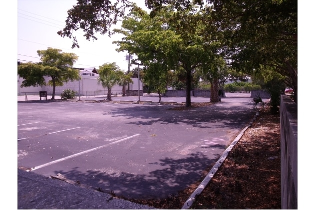
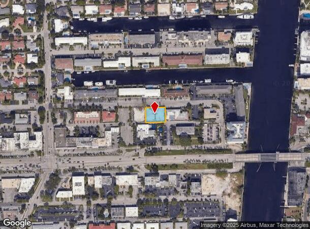
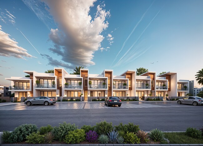
This Property Is For Sale
NEARBY LISTINGS FOR SALE OR LEASE
Property Detail
2850 Ne 32Nd St
Fort Lauderdale-Pompano Beach-Deerfield Beach, FL
Coral Ridge Galt Add No 3
49-42-24-03-0600
CORAL RIDGE GALT ADD NO 3 35-47 B LOT 15 W 38,16 BLK 17
Commercialacreage
Broward
AE
Florida
12011C0386J
15
2024
0.32 AC
2025
Fort Lauderdale
040401
South Florida
DEMOGRAPHICS near 2850 Ne 32Nd St
1 Mile
3 Mile
5 Mile
2024 Total Population
19,886
116,319
265,899
2029 Population
21,005
118,922
270,942
Pop Growth 2024-2029
+ 5.63%
+ 2.24%
+ 1.90%
Average Age
56
49
45
2024 Total Households
11,225
59,731
128,225
HH Growth 2024-2029
+ 5.57%
+ 2.16%
+ 1.97%
Median Household Inc
$91,929
$76,284
$71,941
Avg Household Size
1.80
1.90
2.00
2024 Avg HH Vehicles
1.00
1.00
1.00
Median Home Value
$663,864
$544,848
$482,012
Median Year Built
1972
1971
1973
Nearby Places
Map Layers
Map Styles
 Street
 Aerial
- Restaurants
- Banks
- Shops
- Fitness
- Groceries
PUBLIC TRANSPORTATION
COMMUTER RAIL
Cypress Creek (Tri-County Commuter - South Florida Regional Transportation Authority (Tri-Rail))
DRIVE
WALK
Distance
Cypress Creek (Tri-County Commuter - South Florida Regional Transportation Authority (Tri-Rail))
12 min
5.0 mi
DRIVE
WALK
Distance
13 min
5.4 mi
AIRPORT
Fort Lauderdale/Hollywood International
DRIVE
WALK
Distance
Fort Lauderdale/Hollywood International
23 min
12.6 mi
Miami International
DRIVE
WALK
Distance
Miami International
60 min
37.8 mi
Freight Ports
Port Everglades
DRIVE
WALK
Distance
Port Everglades
17 min
7.3 mi
Nearby Properties
Address
Land Use
TOTAL SIZE
Lot Size
Zoning
Address
Land Use
TOTAL SIZE
Lot Size
Zoning
1,030,211 SF
7.57 AC
RMH-60
Address
Land Use
TOTAL SIZE
Lot Size
Zoning
730,297 SF
4.02 AC
B-1
Address
Land Use
TOTAL SIZE
Lot Size
Zoning
567,524 SF
3.81 AC
ABA
Address
Land Use
TOTAL SIZE
Lot Size
Zoning
1,080,487 SF
27.58 AC
CF
Address
Land Use
TOTAL SIZE
Lot Size
Zoning
129,561 SF
ABA
Address
Land Use
TOTAL SIZE
Lot Size
Zoning
206,691 SF
1.61 AC
ABA
Address
Land Use
TOTAL SIZE
Lot Size
Zoning
259,144 SF
2.55 AC
ABA
Address
Land Use
TOTAL SIZE
Lot Size
Zoning
287,591 SF
9.23 AC
MR
Address
Land Use
TOTAL SIZE
Lot Size
Zoning
531,570 SF
4.18 AC
B-1
Address
Land Use
TOTAL SIZE
Lot Size
Zoning
470,786 SF
1.58 AC
B-1
Address
Land Use
TOTAL SIZE
Lot Size
Zoning
188,965 SF
1.46 AC
Address
Land Use
TOTAL SIZE
Lot Size
Zoning
436,752 SF
2.09 AC
B-1
Address
Land Use
TOTAL SIZE
Lot Size
Zoning
256,158 SF
13.06 AC
RMH-60
Address
Land Use
TOTAL SIZE
Lot Size
Zoning
1,726,840 SF
24.57 AC
B-1
Address
Land Use
TOTAL SIZE
Lot Size
Zoning
245,081 SF
0.79 AC
ABA
Address
Land Use
TOTAL SIZE
Lot Size
Zoning
411,173 SF
4.21 AC
B-3
Address
Land Use
TOTAL SIZE
Lot Size
Zoning
19,177 SF
92.14 AC
P
Address
Land Use
TOTAL SIZE
Lot Size
Zoning
141,832 SF
0.73 AC
SLA
Address
Land Use
TOTAL SIZE
Lot Size
Zoning
213,768 SF
10.23 AC
RM-25
Address
Land Use
TOTAL SIZE
Lot Size
Zoning
383,848 SF
2.54 AC
PUD
Address
Land Use
TOTAL SIZE
Lot Size
Zoning
216,569 SF
6.82 AC
TOC EAST
Address
Land Use
TOTAL SIZE
Lot Size
Zoning
296,703 SF
1.62 AC
RAC-CC
Address
Land Use
TOTAL SIZE
Lot Size
Zoning
418,713 SF
3.61 AC
B-1
Address
Land Use
TOTAL SIZE
Lot Size
Zoning
345,035 SF
49.57 AC
CF
Address
Land Use
TOTAL SIZE
Lot Size
Zoning
134,706 SF
86.54 AC
P
Address
Land Use
TOTAL SIZE
Lot Size
Zoning
294,917 SF
25.52 AC
CF
Address
Land Use
TOTAL SIZE
Lot Size
Zoning
155,760 SF
5.69 AC
RAC-UV
Address
Land Use
TOTAL SIZE
Lot Size
Zoning
170,569 SF
0.72 AC
ABA
Address
Land Use
TOTAL SIZE
Lot Size
Zoning
223,809 SF
18.56 AC
B-2
Address
Land Use
TOTAL SIZE
Lot Size
Zoning
571,332 SF
3.29 AC
B-1
The World's #1 Commercial Real Estate Marketplace
Connect with us
© 2025 CoStar Group
The information above has been obtained from sources believed reliable. While we do not doubt its accuracy we have not verified it and make no guarantee, warranty or representation about it. It is your responsibility to independently confirm its accuracy and completeness. Any projections, opinions, assumptions, or estimates used are for example only and do not represent the current or future performance of the property. The value of this transaction to you depends on tax and other factors which should be evaluated by your tax, financial, and legal advisors. You and your advisors should conduct a careful, independent investigation of the property to determine to your satisfaction the suitability of the property for your needs.