Property Record
2850 Owens Rd, Circleville, OH 43113
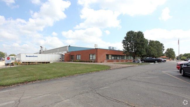

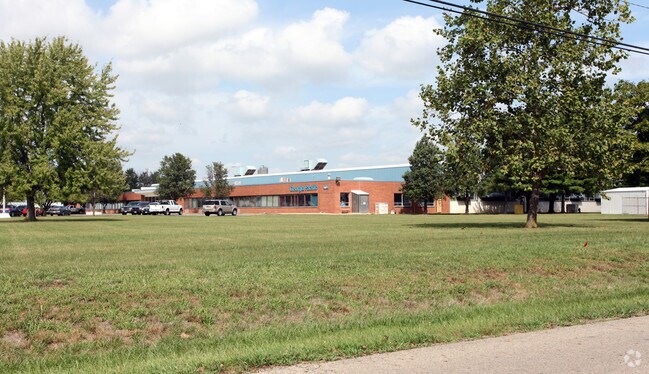
Property Detail
2850 Owens Rd
Columbus, OH
N PT E SIDE & N MID PT NW1/4 SEC 6
J24-0-001-00-109-00
Pickaway
Manufacturinglight
Ohio
B and X Area of moderate flood hazard, usually the area between the limits of the 100-year and 500-year floods.
33.64 AC
2025
Pickaway County
2025
Columbus
021700
NEARBY LISTINGS FOR SALE OR LEASE
DEMOGRAPHICS near 2850 Owens Rd
1 mile
3 mile
5 mile
2025 Total Population
1,167
8,669
19,781
2030 Population
1,230
9,236
20,980
Pop Growth 2025-2030
+ 5.40%
+ 6.54%
+ 6.06%
Average Age
44
41
42
2025 Total Households
474
3,522
8,073
HH Growth 2025-2030
+ 5.70%
+ 6.59%
+ 6.17%
Median Household Inc
$60,984
$52,323
$59,460
Avg Household Size
2.30
2.30
2.30
2025 Avg HH Vehicles
2.00
2.00
2.00
Median Home Value
$210,000
$184,887
$211,613
Median Year Built
1977
1964
1969
Nearby Places
Map Layers
Map Styles
 Street
 Aerial
Transit
 Traffic
 Biking
Places
Listings with unknown addresses are not visible on the map
- Restaurants
- Banks
- Shops
- Fitness
- Groceries
PUBLIC TRANSPORTATION
AIRPORT
Rickenbacker International
Drive
Walk
Distance
Rickenbacker International
38 min
23.6 mi
John Glenn Columbus International
Drive
Walk
Distance
John Glenn Columbus International
57 min
38.8 mi
Nearby Properties
Address
Land Use
TOTAL SIZE
Lot Size
Zoning
Address
Land Use
TOTAL SIZE
Lot Size
Zoning
Address
Land Use
TOTAL SIZE
Lot Size
Zoning
7,732 SF
67.11 AC
Address
Land Use
TOTAL SIZE
Lot Size
Zoning
211,546 SF
22.68 AC
Address
Land Use
TOTAL SIZE
Lot Size
Zoning
56,220 SF
23.19 AC
Address
Land Use
TOTAL SIZE
Lot Size
Zoning
Address
Land Use
TOTAL SIZE
Lot Size
Zoning
27,378 SF
3.19 AC
Address
Land Use
TOTAL SIZE
Lot Size
Zoning
62,550 SF
31.82 AC
Address
Land Use
TOTAL SIZE
Lot Size
Zoning
61.51 AC
Address
Land Use
TOTAL SIZE
Lot Size
Zoning
2.36 AC
Address
Land Use
TOTAL SIZE
Lot Size
Zoning
22,010 SF
9.28 AC
Address
Land Use
TOTAL SIZE
Lot Size
Zoning
26,868 SF
8 AC
Address
Land Use
TOTAL SIZE
Lot Size
Zoning
Address
Land Use
TOTAL SIZE
Lot Size
Zoning
346.65 AC
Address
Land Use
TOTAL SIZE
Lot Size
Zoning
56,704 SF
11.99 AC
Address
Land Use
TOTAL SIZE
Lot Size
Zoning
63,072 SF
7.68 AC
Address
Land Use
TOTAL SIZE
Lot Size
Zoning
63.89 AC
Address
Land Use
TOTAL SIZE
Lot Size
Zoning
Address
Land Use
TOTAL SIZE
Lot Size
Zoning
Address
Land Use
TOTAL SIZE
Lot Size
Zoning
38,402 SF
0.75 AC
Address
Land Use
TOTAL SIZE
Lot Size
Zoning
Address
Land Use
TOTAL SIZE
Lot Size
Zoning
195,200 SF
11.66 AC
Address
Land Use
TOTAL SIZE
Lot Size
Zoning
Address
Land Use
TOTAL SIZE
Lot Size
Zoning
30,474 SF
0.40 AC
Address
Land Use
TOTAL SIZE
Lot Size
Zoning
68,110 SF
2.04 AC
Address
Land Use
TOTAL SIZE
Lot Size
Zoning
Address
Land Use
TOTAL SIZE
Lot Size
Zoning
Address
Land Use
TOTAL SIZE
Lot Size
Zoning
35,926 SF
0.45 AC
Address
Land Use
TOTAL SIZE
Lot Size
Zoning
26,240 SF
1.29 AC
Address
Land Use
TOTAL SIZE
Lot Size
Zoning
2,466 SF
5.01 AC
The World's #1 Commercial Real Estate Marketplace
Connect with us
© 2026 CoStar Group
The information above has been obtained from sources believed reliable. While we do not doubt its accuracy we have not verified it and make no guarantee, warranty or representation about it. It is your responsibility to independently confirm its accuracy and completeness. Any projections, opinions, assumptions, or estimates used are for example only and do not represent the current or future performance of the property. The value of this transaction to you depends on tax and other factors which should be evaluated by your tax, financial, and legal advisors. You and your advisors should conduct a careful, independent investigation of the property to determine to your satisfaction the suitability of the property for your needs.