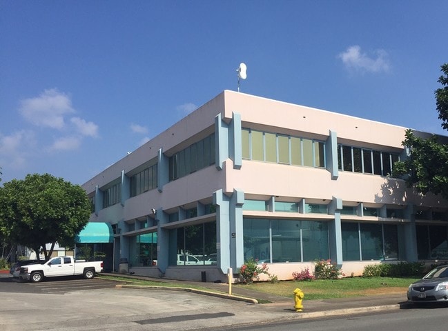
Property Record
2850 Paa St, Honolulu, HI 96819


NEARBY LISTINGS FOR SALE OR LEASE
Property Detail
2850 Paa St
Urban Honolulu, HI
Village On The Green At Waikele Phase 1A
1-1-1-007-038-0000
LOT 3264-B-2-A-1 6.851 AC MAP 467 LCAPP 1074 SUBJ/UTILITY ESMT
Commercialnec
Honolulu
X
Hawaii
15003C0351G
3264-
2024
6.85 AC
2025
Leeward
981300
Hawaii
165,493 SF
DEMOGRAPHICS near 2850 Paa St
1 Mile
3 Mile
5 Mile
2024 Total Population
20,212
134,782
266,172
2029 Population
19,804
129,880
259,511
Pop Growth 2024-2029
(2.02%)
(3.64%)
(2.50%)
Average Age
41
39
42
2024 Total Households
7,522
37,932
94,780
HH Growth 2024-2029
(2.67%)
(4.19%)
(2.64%)
Median Household Inc
$93,704
$85,127
$79,710
Avg Household Size
2.60
3.10
2.60
2024 Avg HH Vehicles
2.00
2.00
2.00
Median Home Value
$664,416
$775,926
$732,172
Median Year Built
1977
1972
1975
Nearby Places
Map Layers
Map Styles
 Street
 Aerial
- Restaurants
- Banks
- Shops
- Fitness
- Groceries
PUBLIC TRANSPORTATION
AIRPORT
Daniel K Inouye International
DRIVE
WALK
Distance
Daniel K Inouye International
10 min
2.9 mi
Freight Ports
Honolulu Harbor, Oahu
DRIVE
WALK
Distance
Honolulu Harbor, Oahu
1 min
3.3 mi
SALE & LEASE HISTORY
LISTING DATE
SALE/LEASE

Sep 25, 2016
For Lease
Sep 25, 2016
For Lease
Sep 12, 2018
For Lease
Nov 07, 2016
For Lease
Nearby Properties
Address
Land Use
TOTAL SIZE
Lot Size
Zoning
Address
Land Use
TOTAL SIZE
Lot Size
Zoning
1,675.63 AC
C/61/60
Address
Land Use
TOTAL SIZE
Lot Size
Zoning
355.21 AC
U/63/80 -
Address
Land Use
TOTAL SIZE
Lot Size
Zoning
1,153,381 SF
425.42 AC
R-5
Address
Land Use
TOTAL SIZE
Lot Size
Zoning
1,725,655 SF
11 AC
I-2
Address
Land Use
TOTAL SIZE
Lot Size
Zoning
1,725,655 SF
11 AC
I-2
Address
Land Use
TOTAL SIZE
Lot Size
Zoning
12,430 SF
86.69 AC
P-1
Address
Land Use
TOTAL SIZE
Lot Size
Zoning
163,285 SF
15.08 AC
R-7.5
Address
Land Use
TOTAL SIZE
Lot Size
Zoning
26,537 SF
2,470.86 AC
I-2
Address
Land Use
TOTAL SIZE
Lot Size
Zoning
1,447,909 SF
12.54 AC
IMX-1
Address
Land Use
TOTAL SIZE
Lot Size
Zoning
919,972 SF
14.45 AC
I-2
Address
Land Use
TOTAL SIZE
Lot Size
Zoning
6.20 AC
I-2
Address
Land Use
TOTAL SIZE
Lot Size
Zoning
960 SF
71.97 AC
P-2
Address
Land Use
TOTAL SIZE
Lot Size
Zoning
16.46 AC
I-2
Address
Land Use
TOTAL SIZE
Lot Size
Zoning
37.94 AC
I-3
Address
Land Use
TOTAL SIZE
Lot Size
Zoning
267,131 SF
6.06 AC
I-2
Address
Land Use
TOTAL SIZE
Lot Size
Zoning
347,039 SF
12.61 AC
IMX-1
Address
Land Use
TOTAL SIZE
Lot Size
Zoning
619,404 SF
10.83 AC
IMX-1
Address
Land Use
TOTAL SIZE
Lot Size
Zoning
86,335 SF
6.41 AC
R-5
Address
Land Use
TOTAL SIZE
Lot Size
Zoning
262,068 SF
27.25 AC
I-3
Address
Land Use
TOTAL SIZE
Lot Size
Zoning
12.54 AC
IMX-1
Address
Land Use
TOTAL SIZE
Lot Size
Zoning
350,452 SF
9 AC
IMX-1
Address
Land Use
TOTAL SIZE
Lot Size
Zoning
9.58 AC
IMX-1
Address
Land Use
TOTAL SIZE
Lot Size
Zoning
154,018 SF
15.24 AC
F-1
Address
Land Use
TOTAL SIZE
Lot Size
Zoning
9.46 AC
IMX-1
Address
Land Use
TOTAL SIZE
Lot Size
Zoning
12.47 AC
F-1
Address
Land Use
TOTAL SIZE
Lot Size
Zoning
57,554 SF
10.05 AC
I-2
Address
Land Use
TOTAL SIZE
Lot Size
Zoning
390,709 SF
6.78 AC
IMX-1
Address
Land Use
TOTAL SIZE
Lot Size
Zoning
14,553 SF
14.57 AC
B-2
Address
Land Use
TOTAL SIZE
Lot Size
Zoning
117,641 SF
9.61 AC
B-2
Address
Land Use
TOTAL SIZE
Lot Size
Zoning
140,483 SF
5.65 AC
IMX-1
The World's #1 Commercial Real Estate Marketplace
Connect with us
© 2025 CoStar Group
The information above has been obtained from sources believed reliable. While we do not doubt its accuracy we have not verified it and make no guarantee, warranty or representation about it. It is your responsibility to independently confirm its accuracy and completeness. Any projections, opinions, assumptions, or estimates used are for example only and do not represent the current or future performance of the property. The value of this transaction to you depends on tax and other factors which should be evaluated by your tax, financial, and legal advisors. You and your advisors should conduct a careful, independent investigation of the property to determine to your satisfaction the suitability of the property for your needs.