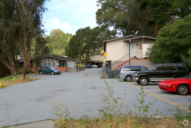
Property Record
2850 Sneath Ln, San Bruno, CA 94066


Save to a Folder
{{folder.Name}}
{{folder.ListingIds.length}} Properties
{{folder.ListingIds.length}} Property
Create a New Folder
Property Detail
2850 Sneath Ln
017-133-230
1.61 AC MOL ON NWLY LN OF SNEATH LANE BEING LOT D CRESTMOOR PARK NO 7 RSM 49/19-20 & ADJ ACREAGE CITY OF SAN BRUNO
Multifamilydwelling
San Mateo
R30000
California
D Areas with possible but undetermined flood hazards.
d
2025
1.97 AC
2026
San Bruno
603700
San Francisco
29,858 SF
San Francisco-San Mateo-Redwood City, CA
NEARBY LISTINGS FOR SALE OR LEASE
DEMOGRAPHICS near 2850 Sneath Ln
1 mile
3 mile
5 mile
2025 Total Population
13,528
140,486
245,612
2030 Population
13,609
140,871
246,301
Pop Growth 2025-2030
+ 0.60%
+ 0.27%
+ 0.28%
Average Age
44
43
43
2025 Total Households
4,394
48,480
82,887
HH Growth 2025-2030
+ 0.46%
+ 0.22%
+ 0.24%
Median Household Inc
$159,091
$139,911
$137,688
Avg Household Size
2.90
2.80
2.90
2025 Avg HH Vehicles
2.00
2.00
2.00
Median Home Value
$1,114,696
$1,070,367
$1,080,219
Median Year Built
1961
1965
1964
Nearby Places
Map Layers
Map Styles
 Street
 Aerial
Layers
 Traffic
 Biking
Places
Listings with unknown addresses are not visible on the map
- Restaurants
- Banks
- Shops
- Fitness
- Groceries
PUBLIC TRANSPORTATION
COMMUTER RAIL
San Bruno Caltrain Station Southbound (Local Weekday - Caltrain (Caltrain), Local Weekend - Caltrain (Caltrain))
Drive
Walk
Distance
San Bruno Caltrain Station Southbound (Local Weekday - Caltrain (Caltrain), Local Weekend - Caltrain (Caltrain))
4 min
2.6 mi
South San Francisco Caltrain Station Northbound (Express - Caltrain (Caltrain), Limited - Caltrain (Caltrain), Local Weekday - Caltrain (Caltrain), Local Weekend - Caltrain (Caltrain))
Drive
Walk
Distance
South San Francisco Caltrain Station Northbound (Express - Caltrain (Caltrain), Limited - Caltrain (Caltrain), Local Weekday - Caltrain (Caltrain), Local Weekend - Caltrain (Caltrain))
8 min
4.7 mi
AIRPORT
San Francisco International
Drive
Walk
Distance
San Francisco International
10 min
5.1 mi
Metro Oakland International
Drive
Walk
Distance
Metro Oakland International
46 min
35.5 mi
Freight Ports
Port of San Francisco
Drive
Walk
Distance
Port of San Francisco
22 min
16.5 mi
Nearby Properties
Address
Land Use
TOTAL SIZE
Lot Size
Zoning
Address
Land Use
TOTAL SIZE
Lot Size
Zoning
6.67 AC
PD0000
Address
Land Use
TOTAL SIZE
Lot Size
Zoning
198,375 SF
5.52 AC
PD0000
Address
Land Use
TOTAL SIZE
Lot Size
Zoning
Address
Land Use
TOTAL SIZE
Lot Size
Zoning
167,105 SF
2.07 AC
C10000
Address
Land Use
TOTAL SIZE
Lot Size
Zoning
403,363 SF
11.26 AC
PD0000
Address
Land Use
TOTAL SIZE
Lot Size
Zoning
270,980 SF
3.33 AC
Address
Land Use
TOTAL SIZE
Lot Size
Zoning
453,076 SF
25.10 AC
Address
Land Use
TOTAL SIZE
Lot Size
Zoning
86,000 SF
4.90 AC
PD0000
Address
Land Use
TOTAL SIZE
Lot Size
Zoning
11.46 AC
Address
Land Use
TOTAL SIZE
Lot Size
Zoning
Address
Land Use
TOTAL SIZE
Lot Size
Zoning
144,591 SF
6.06 AC
CO0000
Address
Land Use
TOTAL SIZE
Lot Size
Zoning
105,710 SF
3.49 AC
Address
Land Use
TOTAL SIZE
Lot Size
Zoning
165,936 SF
1.58 AC
CL00C1
Address
Land Use
TOTAL SIZE
Lot Size
Zoning
178,110 SF
1.67 AC
Address
Land Use
TOTAL SIZE
Lot Size
Zoning
15.33 AC
Address
Land Use
TOTAL SIZE
Lot Size
Zoning
2,025 SF
2.28 AC
Address
Land Use
TOTAL SIZE
Lot Size
Zoning
338,057 SF
5.06 AC
Address
Land Use
TOTAL SIZE
Lot Size
Zoning
231,306 SF
3.68 AC
Address
Land Use
TOTAL SIZE
Lot Size
Zoning
220,000 SF
9.80 AC
PD0000
Address
Land Use
TOTAL SIZE
Lot Size
Zoning
40.92 AC
Address
Land Use
TOTAL SIZE
Lot Size
Zoning
11.98 AC
PD0000
Address
Land Use
TOTAL SIZE
Lot Size
Zoning
178,444 SF
3.29 AC
Address
Land Use
TOTAL SIZE
Lot Size
Zoning
Address
Land Use
TOTAL SIZE
Lot Size
Zoning
24,933 SF
4.23 AC
M00014
Address
Land Use
TOTAL SIZE
Lot Size
Zoning
141,000 SF
8.21 AC
MH00M2
Address
Land Use
TOTAL SIZE
Lot Size
Zoning
215,640 SF
7.76 AC
M10000
Address
Land Use
TOTAL SIZE
Lot Size
Zoning
Address
Land Use
TOTAL SIZE
Lot Size
Zoning
559,605 SF
19.80 AC
M1000H
Address
Land Use
TOTAL SIZE
Lot Size
Zoning
101,123 SF
6.23 AC
The World's #1 Commercial Real Estate Marketplace
Connect with us
© 2026 CoStar Group
The information above has been obtained from sources believed reliable. While we do not doubt its accuracy we have not verified it and make no guarantee, warranty or representation about it. It is your responsibility to independently confirm its accuracy and completeness. Any projections, opinions, assumptions, or estimates used are for example only and do not represent the current or future performance of the property. The value of this transaction to you depends on tax and other factors which should be evaluated by your tax, financial, and legal advisors. You and your advisors should conduct a careful, independent investigation of the property to determine to your satisfaction the suitability of the property for your needs.