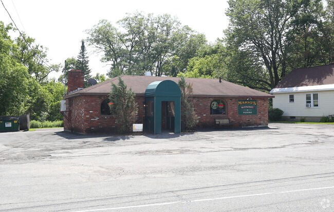
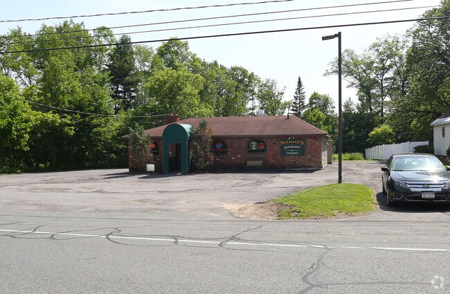
Property Record
2850/2854 River Rd, Schenectady, NY 12309

Property Detail
2850/2854 River Rd
051-000-0001-006-000-0000
SCHENECTADY
Restaurantbuilding
New York
CN
6.000
B and X Area of moderate flood hazard, usually the area between the limits of the 100-year and 500-year floods.
1 AC
2025
Outer Schenectady County
2024
Albany/Schenectady/Troy
032101
Albany-Schenectady-Troy, NY
2,118 SF
NEARBY LISTINGS FOR SALE OR LEASE
-
-
View all Schenectady listings for sale on LoopNet.com
DEMOGRAPHICS near 2850/2854 River Rd
1 mile
3 mile
5 mile
2025 Total Population
3,104
45,842
137,751
2030 Population
3,178
46,604
139,735
Pop Growth 2025-2030
+ 2.38%
+ 1.66%
+ 1.44%
Average Age
42
41
40
2025 Total Households
1,079
18,181
54,801
HH Growth 2025-2030
+ 2.41%
+ 1.76%
+ 1.53%
Median Household Inc
$176,520
$104,521
$79,210
Avg Household Size
2.80
2.40
2.30
2025 Avg HH Vehicles
2.00
2.00
2.00
Median Home Value
$461,636
$290,904
$282,367
Median Year Built
1978
1958
1959
Nearby Places
Map Layers
Map Styles
 Street
 Aerial
Transit
 Traffic
 Biking
Places
Listings with unknown addresses are not visible on the map
- Restaurants
- Banks
- Shops
- Fitness
- Groceries
PUBLIC TRANSPORTATION
AIRPORT
Albany International
Drive
Walk
Distance
Albany International
13 min
5.9 mi
Nearby Properties
Address
Land Use
TOTAL SIZE
Lot Size
Zoning
Address
Land Use
TOTAL SIZE
Lot Size
Zoning
174.70 AC
Address
Land Use
TOTAL SIZE
Lot Size
Zoning
338.40 AC
Address
Land Use
TOTAL SIZE
Lot Size
Zoning
583,211 SF
9.95 AC
03 - MULTI
Address
Land Use
TOTAL SIZE
Lot Size
Zoning
11,700 SF
43.80 AC
R2
Address
Land Use
TOTAL SIZE
Lot Size
Zoning
194,403 SF
315.80 AC
06 - INDUS
Address
Land Use
TOTAL SIZE
Lot Size
Zoning
184,878 SF
15.58 AC
03 - MULTI
Address
Land Use
TOTAL SIZE
Lot Size
Zoning
102,862 SF
32.45 AC
CS
Address
Land Use
TOTAL SIZE
Lot Size
Zoning
120,755 SF
33.88 AC
R1
Address
Land Use
TOTAL SIZE
Lot Size
Zoning
123,030 SF
7.21 AC
03 - MULTI
Address
Land Use
TOTAL SIZE
Lot Size
Zoning
249,801 SF
54.35 AC
R1
Address
Land Use
TOTAL SIZE
Lot Size
Zoning
234,485 SF
42.50 AC
02 - SINGL
Address
Land Use
TOTAL SIZE
Lot Size
Zoning
21,912 SF
26.44 AC
07 - MIXED
Address
Land Use
TOTAL SIZE
Lot Size
Zoning
194.77 AC
Address
Land Use
TOTAL SIZE
Lot Size
Zoning
67,526 SF
9.40 AC
R1
Address
Land Use
TOTAL SIZE
Lot Size
Zoning
4,680 SF
11.39 AC
CH
Address
Land Use
TOTAL SIZE
Lot Size
Zoning
34,807 SF
15.91 AC
R2
Address
Land Use
TOTAL SIZE
Lot Size
Zoning
117,074 SF
25.30 AC
CN
Address
Land Use
TOTAL SIZE
Lot Size
Zoning
93,846 SF
3 AC
R2
Address
Land Use
TOTAL SIZE
Lot Size
Zoning
45,896 SF
10.20 AC
03 - MULTI
Address
Land Use
TOTAL SIZE
Lot Size
Zoning
303 SF
29.20 AC
CN
Address
Land Use
TOTAL SIZE
Lot Size
Zoning
79,041 SF
13.20 AC
CN
Address
Land Use
TOTAL SIZE
Lot Size
Zoning
58,918 SF
4.35 AC
CN
Address
Land Use
TOTAL SIZE
Lot Size
Zoning
120,373 SF
9.68 AC
CS
Address
Land Use
TOTAL SIZE
Lot Size
Zoning
68,080 SF
6.22 AC
CS
Address
Land Use
TOTAL SIZE
Lot Size
Zoning
63,762 SF
4 AC
R1
Address
Land Use
TOTAL SIZE
Lot Size
Zoning
37,572 SF
1.70 AC
RP
Address
Land Use
TOTAL SIZE
Lot Size
Zoning
3,630 SF
174.59 AC
08 - GOVER
Address
Land Use
TOTAL SIZE
Lot Size
Zoning
115,593 SF
2.70 AC
03 - MULTI
Address
Land Use
TOTAL SIZE
Lot Size
Zoning
13,568 SF
11.54 AC
R2
Address
Land Use
TOTAL SIZE
Lot Size
Zoning
6,944 SF
13.02 AC
R3
The World's #1 Commercial Real Estate Marketplace
Connect with us
© 2026 CoStar Group
The information above has been obtained from sources believed reliable. While we do not doubt its accuracy we have not verified it and make no guarantee, warranty or representation about it. It is your responsibility to independently confirm its accuracy and completeness. Any projections, opinions, assumptions, or estimates used are for example only and do not represent the current or future performance of the property. The value of this transaction to you depends on tax and other factors which should be evaluated by your tax, financial, and legal advisors. You and your advisors should conduct a careful, independent investigation of the property to determine to your satisfaction the suitability of the property for your needs.