Property Record
2853 El Pomar Dr, Templeton, CA 93465


Property Detail
2853 El Pomar Dr
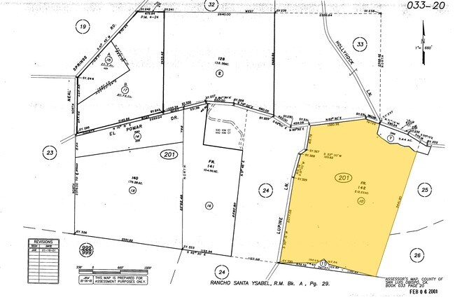
033-201-010
RHO STA YSBL PTN LT 142
Winery
SAN LUIS OBISPO
AG
California
B and X Area of moderate flood hazard, usually the area between the limits of the 100-year and 500-year floods.
142
2024
198 AC
2025
North 101 Corridor
013100
San Luis Obispo/Paso Robles
1,295 SF
San Luis Obispo-Paso Robles, CA
NEARBY LISTINGS FOR SALE OR LEASE
DEMOGRAPHICS near 2853 El Pomar Dr
1 mile
3 mile
5 mile
2025 Total Population
244
2,620
38,796
2030 Population
239
2,578
38,191
Pop Growth 2025-2030
(2.05%)
(1.60%)
(1.56%)
Average Age
45
44
41
2025 Total Households
91
975
14,339
HH Growth 2025-2030
(2.20%)
(1.85%)
(1.83%)
Median Household Inc
$134,375
$124,837
$100,871
Avg Household Size
2.60
2.60
2.60
2025 Avg HH Vehicles
3.00
3.00
2.00
Median Home Value
$1,062,195
$976,488
$739,600
Median Year Built
1989
1993
1986
Nearby Places
Map Layers
Map Styles
 Street
 Aerial
Transit
 Traffic
 Biking
Places
Listings with unknown addresses are not visible on the map
- Restaurants
- Banks
- Shops
- Fitness
- Groceries
PUBLIC TRANSPORTATION
COMMUTER RAIL
Paso Robles Amtrak Station (Coast Starlight - Amtrak)
Drive
Walk
Distance
Paso Robles Amtrak Station (Coast Starlight - Amtrak)
18 min
6.7 mi
AIRPORT
San Luis County Regional
Drive
Walk
Distance
San Luis County Regional
48 min
28.8 mi
Freight Ports
The Port of Hueneme
Drive
Walk
Distance
The Port of Hueneme
205 min
155.8 mi
Nearby Properties
Address
Land Use
TOTAL SIZE
Lot Size
Zoning
Address
Land Use
TOTAL SIZE
Lot Size
Zoning
46,942 SF
2.82 AC
IND
Address
Land Use
TOTAL SIZE
Lot Size
Zoning
7,114 SF
32.04 AC
AG
Address
Land Use
TOTAL SIZE
Lot Size
Zoning
228.80 AC
AG
Address
Land Use
TOTAL SIZE
Lot Size
Zoning
41,800 SF
3 AC
IND
Address
Land Use
TOTAL SIZE
Lot Size
Zoning
11,317 SF
1.62 AC
CR
Address
Land Use
TOTAL SIZE
Lot Size
Zoning
151.15 AC
AG
Address
Land Use
TOTAL SIZE
Lot Size
Zoning
888 SF
217 AC
AG
Address
Land Use
TOTAL SIZE
Lot Size
Zoning
5.10 AC
IND
Address
Land Use
TOTAL SIZE
Lot Size
Zoning
260 AC
AG
Address
Land Use
TOTAL SIZE
Lot Size
Zoning
5.27 AC
SFR
Address
Land Use
TOTAL SIZE
Lot Size
Zoning
89,620 SF
3.68 AC
CS
Address
Land Use
TOTAL SIZE
Lot Size
Zoning
1.89 AC
IND
Address
Land Use
TOTAL SIZE
Lot Size
Zoning
84.21 AC
AG
Address
Land Use
TOTAL SIZE
Lot Size
Zoning
140 AC
AG
Address
Land Use
TOTAL SIZE
Lot Size
Zoning
206.65 AC
AG
Address
Land Use
TOTAL SIZE
Lot Size
Zoning
12,072 SF
1.03 AC
CR
Address
Land Use
TOTAL SIZE
Lot Size
Zoning
1.91 AC
IND
Address
Land Use
TOTAL SIZE
Lot Size
Zoning
1,360 SF
41.60 AC
CS
Address
Land Use
TOTAL SIZE
Lot Size
Zoning
193.45 AC
AG
Address
Land Use
TOTAL SIZE
Lot Size
Zoning
7.86 AC
IND
Address
Land Use
TOTAL SIZE
Lot Size
Zoning
2.41 AC
SFR
Address
Land Use
TOTAL SIZE
Lot Size
Zoning
1.01 AC
IND
Address
Land Use
TOTAL SIZE
Lot Size
Zoning
12,554 SF
1.17 AC
IND
Address
Land Use
TOTAL SIZE
Lot Size
Zoning
80.56 AC
Address
Land Use
TOTAL SIZE
Lot Size
Zoning
217.35 AC
AG
Address
Land Use
TOTAL SIZE
Lot Size
Zoning
15,375 SF
1.25 AC
IND
Address
Land Use
TOTAL SIZE
Lot Size
Zoning
11,100 SF
1 AC
IND
Address
Land Use
TOTAL SIZE
Lot Size
Zoning
2,372 SF
5.46 AC
CR
Address
Land Use
TOTAL SIZE
Lot Size
Zoning
23.70 AC
AG
The World's #1 Commercial Real Estate Marketplace
Connect with us
© 2026 CoStar Group
The information above has been obtained from sources believed reliable. While we do not doubt its accuracy we have not verified it and make no guarantee, warranty or representation about it. It is your responsibility to independently confirm its accuracy and completeness. Any projections, opinions, assumptions, or estimates used are for example only and do not represent the current or future performance of the property. The value of this transaction to you depends on tax and other factors which should be evaluated by your tax, financial, and legal advisors. You and your advisors should conduct a careful, independent investigation of the property to determine to your satisfaction the suitability of the property for your needs.