Property Record
2853 Route 9N E, Greenfield Center, NY 12833


NEARBY LISTINGS FOR SALE OR LEASE
Property Detail
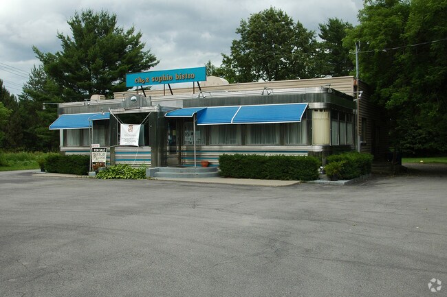
2853 Route 9N E
Albany-Schenectady-Troy, NY
CHEZ SOPHIE SIDE: E DINER
414089-204-004-0001-024-000-0000
Saratoga
Restaurantbuilding
New York
2024
24.000
2024
0.41 AC
060601
Saratoga County
2,260 SF
Albany/Schenectady/Troy
DEMOGRAPHICS near 2853 Route 9N E
1 Mile
3 Mile
5 Mile
2024 Total Population
453
11,624
54,802
2029 Population
478
12,180
57,482
Pop Growth 2024-2029
+ 5.52%
+ 4.78%
+ 4.89%
Average Age
44
43
43
2024 Total Households
184
5,120
24,873
HH Growth 2024-2029
+ 5.43%
+ 4.86%
+ 4.96%
Median Household Inc
$104,167
$98,520
$91,637
Avg Household Size
2.40
2.20
2.20
2024 Avg HH Vehicles
2.00
2.00
2.00
Median Home Value
$393,749
$281,305
$327,931
Median Year Built
1991
1987
1986
Nearby Places
- Restaurants
- Banks
- Shops
- Fitness
- Groceries
PUBLIC TRANSPORTATION
COMMUTER RAIL
DRIVE
WALK
Distance
11 min
5.7 mi
AIRPORT
Albany International
DRIVE
WALK
Distance
Albany International
29 min
22.1 mi
Freight Ports
Albany, NY Port
DRIVE
WALK
Distance
Albany, NY Port
44 min
32.6 mi
SALE & LEASE HISTORY
LISTING DATE
SALE/LEASE

Sep 20, 2018
For Sale
Sep 11, 2018
For Sale
Jan 25, 2018
For Sale
Nearby Properties
Address
Land Use
TOTAL SIZE
Lot Size
Zoning
Address
Land Use
TOTAL SIZE
Lot Size
Zoning
131,572 SF
9.96 AC
C1
Address
Land Use
TOTAL SIZE
Lot Size
Zoning
10,322 SF
29.43 AC
PDD
Address
Land Use
TOTAL SIZE
Lot Size
Zoning
128,767 SF
16.51 AC
PDD
Address
Land Use
TOTAL SIZE
Lot Size
Zoning
1,377 SF
75.07 AC
Address
Land Use
TOTAL SIZE
Lot Size
Zoning
86,475 SF
0.14 AC
PDD
Address
Land Use
TOTAL SIZE
Lot Size
Zoning
105,772 SF
5.17 AC
C6
Address
Land Use
TOTAL SIZE
Lot Size
Zoning
600 SF
50.28 AC
R3
Address
Land Use
TOTAL SIZE
Lot Size
Zoning
58,334 SF
7.96 AC
PDD
Address
Land Use
TOTAL SIZE
Lot Size
Zoning
23,280 SF
25.19 AC
PDD
Address
Land Use
TOTAL SIZE
Lot Size
Zoning
32,344 SF
6.22 AC
PDD
Address
Land Use
TOTAL SIZE
Lot Size
Zoning
25,292 SF
291.60 AC
C6
Address
Land Use
TOTAL SIZE
Lot Size
Zoning
17,800 SF
2.82 AC
DA-2
Address
Land Use
TOTAL SIZE
Lot Size
Zoning
13,468 SF
1.87 AC
Address
Land Use
TOTAL SIZE
Lot Size
Zoning
18,258 SF
1.66 AC
Address
Land Use
TOTAL SIZE
Lot Size
Zoning
28,279 SF
5.91 AC
GC-3
Address
Land Use
TOTAL SIZE
Lot Size
Zoning
19,972 SF
4.18 AC
GC-3
Address
Land Use
TOTAL SIZE
Lot Size
Zoning
33,675 SF
6.61 AC
Address
Land Use
TOTAL SIZE
Lot Size
Zoning
283.08 AC
INSPR
Address
Land Use
TOTAL SIZE
Lot Size
Zoning
16,000 SF
165.20 AC
C6
Address
Land Use
TOTAL SIZE
Lot Size
Zoning
5,576 SF
14.51 AC
C8
Address
Land Use
TOTAL SIZE
Lot Size
Zoning
7,560 SF
4.25 AC
C6
Address
Land Use
TOTAL SIZE
Lot Size
Zoning
1,477 SF
7.30 AC
PDD
Address
Land Use
TOTAL SIZE
Lot Size
Zoning
19,298 SF
6.07 AC
PDD
Address
Land Use
TOTAL SIZE
Lot Size
Zoning
19,137 SF
12.56 AC
PDD
Address
Land Use
TOTAL SIZE
Lot Size
Zoning
20,310 SF
5.44 AC
C9
Address
Land Use
TOTAL SIZE
Lot Size
Zoning
12,880 SF
1.48 AC
C1
Address
Land Use
TOTAL SIZE
Lot Size
Zoning
2,900 SF
142.21 AC
INSPR
Address
Land Use
TOTAL SIZE
Lot Size
Zoning
4,752 SF
128.57 AC
INSPR
Address
Land Use
TOTAL SIZE
Lot Size
Zoning
8,377 SF
5.59 AC
C7
Address
Land Use
TOTAL SIZE
Lot Size
Zoning
16,704 SF
2.37 AC
PDD
The World's #1 Commercial Real Estate Marketplace
Connect with us
© 2025 CoStar Group
The information above has been obtained from sources believed reliable. While we do not doubt its accuracy we have not verified it and make no guarantee, warranty or representation about it. It is your responsibility to independently confirm its accuracy and completeness. Any projections, opinions, assumptions, or estimates used are for example only and do not represent the current or future performance of the property. The value of this transaction to you depends on tax and other factors which should be evaluated by your tax, financial, and legal advisors. You and your advisors should conduct a careful, independent investigation of the property to determine to your satisfaction the suitability of the property for your needs.