Property Record
28534 State Road 52, San Antonio, FL 33576


NEARBY LISTINGS FOR SALE OR LEASE
Property Detail
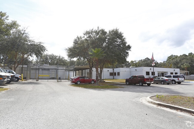
28534 State Road 52
07-25-20-0000-00300-0000
S.R. 52
Stateproperty
BEG SE COR SEC 7 TH NLY 2521.49 FT TH WLY 1964.38 FT W FOR POB TH SWLY ALG S R/W LN OF SR # 52 284.04 FT TH S 618.04 FT TO N R/W LN ACL RR TH NELY ALG N ROW LN SCL RR 301.60 FT TH N 529.60 FT TO POB AKA PCL A & BEG SE COR SEC 7 TH NLY 2521.49 FT TH W
A
Pasco
12101C0254F
Florida
0
8.06 AC
2025
Pasco County
031902
Tampa/St Petersburg
34,372 SF
Tampa-St. Petersburg-Clearwater, FL
DEMOGRAPHICS near 28534 State Road 52
1 Mile
3 Mile
5 Mile
2024 Total Population
901
4,817
24,050
2029 Population
1,075
5,844
29,230
Pop Growth 2024-2029
+ 19.31%
+ 21.32%
+ 21.54%
Average Age
68
59
42
2024 Total Households
509
2,352
8,479
HH Growth 2024-2029
+ 19.06%
+ 21.22%
+ 21.94%
Median Household Inc
$64,021
$71,167
$87,621
Avg Household Size
1.70
2.00
2.60
2024 Avg HH Vehicles
1.00
2.00
2.00
Median Home Value
$252,923
$272,110
$292,197
Median Year Built
1997
2004
2004
Nearby Places
Map Layers
Map Styles
 Street
 Aerial
- Restaurants
- Banks
- Shops
- Fitness
- Groceries
PUBLIC TRANSPORTATION
AIRPORT
Tampa International
DRIVE
WALK
Distance
Tampa International
48 min
37.2 mi
Freight Ports
Port of Tampa Bay
DRIVE
WALK
Distance
Port of Tampa Bay
44 min
32.8 mi
Nearby Properties
Address
Land Use
TOTAL SIZE
Lot Size
Zoning
Address
Land Use
TOTAL SIZE
Lot Size
Zoning
1,825,014 SF
157.17 AC
MPUD
Address
Land Use
TOTAL SIZE
Lot Size
Zoning
373,572 SF
23.16 AC
MPUD
Address
Land Use
TOTAL SIZE
Lot Size
Zoning
104,994 SF
5.04 AC
I1
Address
Land Use
TOTAL SIZE
Lot Size
Zoning
58.54 AC
MPUD
Address
Land Use
TOTAL SIZE
Lot Size
Zoning
60,265 SF
13.36 AC
MPUD
Address
Land Use
TOTAL SIZE
Lot Size
Zoning
46,656 SF
2.99 AC
MPUD
Address
Land Use
TOTAL SIZE
Lot Size
Zoning
68.79 AC
MPUD
Address
Land Use
TOTAL SIZE
Lot Size
Zoning
1,838 SF
29.25 AC
MPUD
Address
Land Use
TOTAL SIZE
Lot Size
Zoning
2,688 SF
10.21 AC
MPUD
Address
Land Use
TOTAL SIZE
Lot Size
Zoning
32.62 AC
MPUD
Address
Land Use
TOTAL SIZE
Lot Size
Zoning
18.02 AC
MPUD
Address
Land Use
TOTAL SIZE
Lot Size
Zoning
30,939 SF
25.65 AC
AC
Address
Land Use
TOTAL SIZE
Lot Size
Zoning
33,600 SF
5.85 AC
AR
Address
Land Use
TOTAL SIZE
Lot Size
Zoning
5,600 SF
7.06 AC
C2
Address
Land Use
TOTAL SIZE
Lot Size
Zoning
12.50 AC
MPUD
Address
Land Use
TOTAL SIZE
Lot Size
Zoning
43,176 SF
8.99 AC
I1
Address
Land Use
TOTAL SIZE
Lot Size
Zoning
15,067 SF
19.12 AC
I2
Address
Land Use
TOTAL SIZE
Lot Size
Zoning
39,984 SF
2.69 AC
I1
Address
Land Use
TOTAL SIZE
Lot Size
Zoning
7,020 SF
12.47 AC
AR
Address
Land Use
TOTAL SIZE
Lot Size
Zoning
14.76 AC
MPUD
Address
Land Use
TOTAL SIZE
Lot Size
Zoning
21,745 SF
2.98 AC
I1
Address
Land Use
TOTAL SIZE
Lot Size
Zoning
56.58 AC
MPUD
Address
Land Use
TOTAL SIZE
Lot Size
Zoning
34,895 SF
2.02 AC
I1
Address
Land Use
TOTAL SIZE
Lot Size
Zoning
121.69 AC
MPUD
Address
Land Use
TOTAL SIZE
Lot Size
Zoning
29,598 SF
2.09 AC
I1
Address
Land Use
TOTAL SIZE
Lot Size
Zoning
15.09 AC
MPUD
Address
Land Use
TOTAL SIZE
Lot Size
Zoning
12,516 SF
10.03 AC
I1
Address
Land Use
TOTAL SIZE
Lot Size
Zoning
32,400 SF
2.55 AC
I1
Address
Land Use
TOTAL SIZE
Lot Size
Zoning
11.18 AC
MPUD
The World's #1 Commercial Real Estate Marketplace
Connect with us
© 2025 CoStar Group
The information above has been obtained from sources believed reliable. While we do not doubt its accuracy we have not verified it and make no guarantee, warranty or representation about it. It is your responsibility to independently confirm its accuracy and completeness. Any projections, opinions, assumptions, or estimates used are for example only and do not represent the current or future performance of the property. The value of this transaction to you depends on tax and other factors which should be evaluated by your tax, financial, and legal advisors. You and your advisors should conduct a careful, independent investigation of the property to determine to your satisfaction the suitability of the property for your needs.