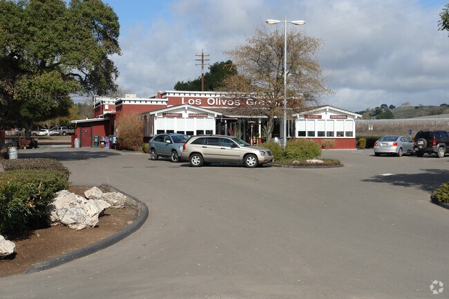
Property Record
2857 Santa Ynez St, Santa Ynez, CA 93460


NEARBY LISTINGS FOR SALE OR LEASE
Property Detail
2857 Santa Ynez St
Santa Maria-Santa Barbara, CA
Canada De Los Pinos Rho Sub/Co
135-040-020
Santa Barbara
Miscresidentialimprovement
California
X
7
06083C0811G
3 AC
2024
Central SB County
2025
Santa Barbara/Sta Maria/Goleta
001905
DEMOGRAPHICS near 2857 Santa Ynez St
1 Mile
3 Mile
5 Mile
2024 Total Population
715
3,526
10,750
2029 Population
662
3,305
10,273
Pop Growth 2024-2029
(7.41%)
(6.27%)
(4.44%)
Average Age
45
46
47
2024 Total Households
265
1,328
4,131
HH Growth 2024-2029
(7.55%)
(6.63%)
(4.67%)
Median Household Inc
$126,190
$135,393
$122,698
Avg Household Size
2.40
2.50
2.50
2024 Avg HH Vehicles
2.00
3.00
2.00
Median Home Value
$933,035
$1,056,465
$1,029,172
Median Year Built
1977
1977
1979
Nearby Places
Map Layers
Map Styles
 Street
 Aerial
- Restaurants
- Banks
- Shops
- Fitness
- Groceries
PUBLIC TRANSPORTATION
AIRPORT
Santa Barbara Municipal
DRIVE
WALK
Distance
Santa Barbara Municipal
48 min
34.0 mi
Nearby Properties
Address
Land Use
TOTAL SIZE
Lot Size
Zoning
Address
Land Use
TOTAL SIZE
Lot Size
Zoning
5.43 AC
Address
Land Use
TOTAL SIZE
Lot Size
Zoning
46.18 AC
AGI10
Address
Land Use
TOTAL SIZE
Lot Size
Zoning
18.16 AC
AGI40
Address
Land Use
TOTAL SIZE
Lot Size
Zoning
6,332 SF
24.44 AC
AGI20
Address
Land Use
TOTAL SIZE
Lot Size
Zoning
4,912 SF
65.81 AC
AGI40
Address
Land Use
TOTAL SIZE
Lot Size
Zoning
148.18 AC
AGII100
Address
Land Use
TOTAL SIZE
Lot Size
Zoning
15.19 AC
AGI10
Address
Land Use
TOTAL SIZE
Lot Size
Zoning
37.06 AC
AGI40
Address
Land Use
TOTAL SIZE
Lot Size
Zoning
445.97 AC
AGII100
Address
Land Use
TOTAL SIZE
Lot Size
Zoning
4,149 SF
19.52 AC
AGI20
Address
Land Use
TOTAL SIZE
Lot Size
Zoning
5,093 SF
40 AC
AGII40
Address
Land Use
TOTAL SIZE
Lot Size
Zoning
1,190 SF
52.62 AC
AGII40
Address
Land Use
TOTAL SIZE
Lot Size
Zoning
9,864 SF
250.68 AC
AGII100
Address
Land Use
TOTAL SIZE
Lot Size
Zoning
214.81 AC
AGII100
Address
Land Use
TOTAL SIZE
Lot Size
Zoning
9,062 SF
0.52 AC
C2
Address
Land Use
TOTAL SIZE
Lot Size
Zoning
219.26 AC
AGII100
Address
Land Use
TOTAL SIZE
Lot Size
Zoning
5,900 SF
21.69 AC
AGI20
Address
Land Use
TOTAL SIZE
Lot Size
Zoning
20.67 AC
AGII40
Address
Land Use
TOTAL SIZE
Lot Size
Zoning
4,178 SF
10.45 AC
AGI10
Address
Land Use
TOTAL SIZE
Lot Size
Zoning
9,854 SF
0.39 AC
C2
Address
Land Use
TOTAL SIZE
Lot Size
Zoning
1,994 SF
107.07 AC
AGII100
Address
Land Use
TOTAL SIZE
Lot Size
Zoning
4,811 SF
5.33 AC
Address
Land Use
TOTAL SIZE
Lot Size
Zoning
3,635 SF
17.11 AC
AGI20
Address
Land Use
TOTAL SIZE
Lot Size
Zoning
1,448 SF
39.19 AC
AGI40
Address
Land Use
TOTAL SIZE
Lot Size
Zoning
5,380 SF
20 AC
AGI20
Address
Land Use
TOTAL SIZE
Lot Size
Zoning
52.62 AC
AGII40
Address
Land Use
TOTAL SIZE
Lot Size
Zoning
115.80 AC
AGII100
Address
Land Use
TOTAL SIZE
Lot Size
Zoning
230.09 AC
AGII100
Address
Land Use
TOTAL SIZE
Lot Size
Zoning
29.32 AC
AGI20
Address
Land Use
TOTAL SIZE
Lot Size
Zoning
5,872 SF
24.72 AC
AGI40
The World's #1 Commercial Real Estate Marketplace
Connect with us
© 2026 CoStar Group
The information above has been obtained from sources believed reliable. While we do not doubt its accuracy we have not verified it and make no guarantee, warranty or representation about it. It is your responsibility to independently confirm its accuracy and completeness. Any projections, opinions, assumptions, or estimates used are for example only and do not represent the current or future performance of the property. The value of this transaction to you depends on tax and other factors which should be evaluated by your tax, financial, and legal advisors. You and your advisors should conduct a careful, independent investigation of the property to determine to your satisfaction the suitability of the property for your needs.