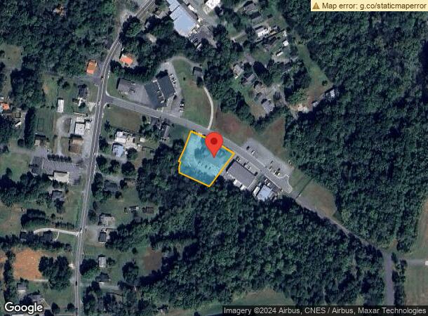
Property Record
2858 Rob Shepard Dr, Burlington, NC 27215

NEARBY LISTINGS FOR SALE OR LEASE
Property Detail
2858 Rob Shepard Dr
112149
BA 2858 ROB SHEPARD DR LT 3C 2/10/1999
Officebuilding
Alamance
X
North Carolina
3710885300K
3c
2025
0.87 AC
2025
West Burlington/Airport
021801
Greensboro/Winston-Salem
11,412 SF
Burlington, NC
DEMOGRAPHICS near 2858 Rob Shepard Dr
1 Mile
3 Mile
5 Mile
2024 Total Population
1,293
14,653
62,228
2029 Population
1,394
15,993
66,904
Pop Growth 2024-2029
+ 7.81%
+ 9.14%
+ 7.51%
Average Age
42
40
41
2024 Total Households
530
6,269
25,746
HH Growth 2024-2029
+ 7.74%
+ 9.17%
+ 7.73%
Median Household Inc
$72,125
$63,395
$63,399
Avg Household Size
2.40
2.30
2.30
2024 Avg HH Vehicles
2.00
2.00
2.00
Median Home Value
$311,111
$248,181
$233,465
Median Year Built
1997
1997
1989
Nearby Places
Map Layers
Map Styles
 Street
 Aerial
- Restaurants
- Banks
- Shops
- Fitness
- Groceries
PUBLIC TRANSPORTATION
AIRPORT
Piedmont Triad International
DRIVE
WALK
Distance
Piedmont Triad International
36 min
30.7 mi
Freight Ports
Virginia Port Authority - Richmond
DRIVE
WALK
Distance
Virginia Port Authority - Richmond
1 min
150.8 mi
SALE & LEASE HISTORY
LISTING DATE
SALE/LEASE

Sep 25, 2016
For Lease
Mar 15, 2017
For Sale
Feb 04, 2019
For Sale
Nearby Properties
Address
Land Use
TOTAL SIZE
Lot Size
Zoning
Address
Land Use
TOTAL SIZE
Lot Size
Zoning
350,000 SF
64.18 AC
O I
Address
Land Use
TOTAL SIZE
Lot Size
Zoning
26,280 SF
14.34 AC
R 15
Address
Land Use
TOTAL SIZE
Lot Size
Zoning
41,892 SF
21.63 AC
CR
Address
Land Use
TOTAL SIZE
Lot Size
Zoning
51,381 SF
34.69 AC
CB
Address
Land Use
TOTAL SIZE
Lot Size
Zoning
10,368 SF
13.60 AC
MFA
Address
Land Use
TOTAL SIZE
Lot Size
Zoning
10,744 SF
24.60 AC
MF A
Address
Land Use
TOTAL SIZE
Lot Size
Zoning
27,803 SF
8.80 AC
CR
Address
Land Use
TOTAL SIZE
Lot Size
Zoning
23,265 SF
20.45 AC
MF A
Address
Land Use
TOTAL SIZE
Lot Size
Zoning
12,600 SF
44.61 AC
Address
Land Use
TOTAL SIZE
Lot Size
Zoning
203,832 SF
36.10 AC
B 2
Address
Land Use
TOTAL SIZE
Lot Size
Zoning
10,384 SF
16.51 AC
B2
Address
Land Use
TOTAL SIZE
Lot Size
Zoning
14,760 SF
13.07 AC
MFA
Address
Land Use
TOTAL SIZE
Lot Size
Zoning
53,012 SF
18.58 AC
B 2
Address
Land Use
TOTAL SIZE
Lot Size
Zoning
90,767 SF
36.47 AC
I 1
Address
Land Use
TOTAL SIZE
Lot Size
Zoning
81,726 SF
18.01 AC
R 15
Address
Land Use
TOTAL SIZE
Lot Size
Zoning
80,865 SF
76.02 AC
I 1A
Address
Land Use
TOTAL SIZE
Lot Size
Zoning
26,280 SF
9.64 AC
R15
Address
Land Use
TOTAL SIZE
Lot Size
Zoning
43,680 SF
5.77 AC
Address
Land Use
TOTAL SIZE
Lot Size
Zoning
55,500 SF
Address
Land Use
TOTAL SIZE
Lot Size
Zoning
101,469 SF
4.28 AC
CR
Address
Land Use
TOTAL SIZE
Lot Size
Zoning
30,000 SF
3.48 AC
R 15
Address
Land Use
TOTAL SIZE
Lot Size
Zoning
73,948 SF
Address
Land Use
TOTAL SIZE
Lot Size
Zoning
7,456 SF
346.75 AC
Address
Land Use
TOTAL SIZE
Lot Size
Zoning
47,520 SF
1.44 AC
B 2
Address
Land Use
TOTAL SIZE
Lot Size
Zoning
64,830 SF
2.87 AC
B 2
Address
Land Use
TOTAL SIZE
Lot Size
Zoning
64,926 SF
4.62 AC
O I
Address
Land Use
TOTAL SIZE
Lot Size
Zoning
65,480 SF
11.09 AC
B 2
Address
Land Use
TOTAL SIZE
Lot Size
Zoning
62,812 SF
1.88 AC
B 2
Address
Land Use
TOTAL SIZE
Lot Size
Zoning
97,190 SF
23.95 AC
Address
Land Use
TOTAL SIZE
Lot Size
Zoning
57,794 SF
2.84 AC
B 2
The World's #1 Commercial Real Estate Marketplace
Connect with us
© 2026 CoStar Group
The information above has been obtained from sources believed reliable. While we do not doubt its accuracy we have not verified it and make no guarantee, warranty or representation about it. It is your responsibility to independently confirm its accuracy and completeness. Any projections, opinions, assumptions, or estimates used are for example only and do not represent the current or future performance of the property. The value of this transaction to you depends on tax and other factors which should be evaluated by your tax, financial, and legal advisors. You and your advisors should conduct a careful, independent investigation of the property to determine to your satisfaction the suitability of the property for your needs.