Property Record
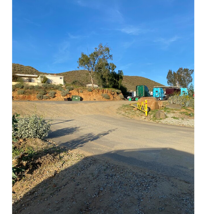
28585 State Highway 74, Perris, CA 92570


Property Detail
28585 State Highway 74
347-100-001
13.34 ACRES M/L IN PAR 1 RS 015/092
Agriculturalland
RIVERSIDE
RA10
California
B and X Area of moderate flood hazard, usually the area between the limits of the 100-year and 500-year floods.
1
2024
13.34 AC
2025
South Riverside
042903
Inland Empire (California)
1,548 SF
Riverside-San Bernardino-Ontario, CA
NEARBY LISTINGS FOR SALE OR LEASE
DEMOGRAPHICS near 28585 State Highway 74
1 mile
3 mile
5 mile
2025 Total Population
4,720
19,464
88,723
2030 Population
4,834
19,941
91,597
Pop Growth 2025-2030
+ 2.42%
+ 2.45%
+ 3.24%
Average Age
34
36
36
2025 Total Households
1,347
5,448
26,036
HH Growth 2025-2030
+ 1.19%
+ 1.74%
+ 2.83%
Median Household Inc
$117,121
$84,091
$92,495
Avg Household Size
3.40
3.40
3.30
2025 Avg HH Vehicles
2.00
2.00
2.00
Median Home Value
$631,579
$557,252
$616,009
Median Year Built
2005
1997
1993
Nearby Places
Map Layers
Map Styles
 Street
 Aerial
Layers
 Traffic
 Biking
Places
Listings with unknown addresses are not visible on the map
- Restaurants
- Banks
- Shops
- Fitness
- Groceries
PUBLIC TRANSPORTATION
COMMUTER RAIL
Perris Downtown (Metrolink 91-Perris Valley Line - Metrolink Trains)
Drive
Walk
Distance
Perris Downtown (Metrolink 91-Perris Valley Line - Metrolink Trains)
13 min
8.3 mi
AIRPORT
Ontario International
Drive
Walk
Distance
Ontario International
46 min
36.6 mi
Freight Ports
Port of Long Beach
Drive
Walk
Distance
Port of Long Beach
82 min
64.2 mi
SALE & LEASE HISTORY
LISTING DATE
SALE/LEASE

Mar 04, 2020
For Sale
Jul 22, 2020
For Sale
Feb 22, 2021
For Sale
Nearby Properties
Address
Land Use
TOTAL SIZE
Lot Size
Zoning
Address
Land Use
TOTAL SIZE
Lot Size
Zoning
297,071 SF
26.18 AC
C1
Address
Land Use
TOTAL SIZE
Lot Size
Zoning
276,268 SF
11.60 AC
Address
Land Use
TOTAL SIZE
Lot Size
Zoning
299,526 SF
13.75 AC
Address
Land Use
TOTAL SIZE
Lot Size
Zoning
125,300 SF
9.96 AC
Address
Land Use
TOTAL SIZE
Lot Size
Zoning
74,712 SF
5.73 AC
MSC
Address
Land Use
TOTAL SIZE
Lot Size
Zoning
56,006 SF
5.33 AC
R1
Address
Land Use
TOTAL SIZE
Lot Size
Zoning
45,460 SF
4.24 AC
CPS
Address
Land Use
TOTAL SIZE
Lot Size
Zoning
207,052 SF
10.61 AC
Address
Land Use
TOTAL SIZE
Lot Size
Zoning
31,864 SF
2.57 AC
Address
Land Use
TOTAL SIZE
Lot Size
Zoning
83,874 SF
5.99 AC
M-1
Address
Land Use
TOTAL SIZE
Lot Size
Zoning
52,293 SF
5 AC
Address
Land Use
TOTAL SIZE
Lot Size
Zoning
42,581 SF
2.66 AC
Address
Land Use
TOTAL SIZE
Lot Size
Zoning
18,800 SF
3.03 AC
M1
Address
Land Use
TOTAL SIZE
Lot Size
Zoning
18,800 SF
1.67 AC
C1
Address
Land Use
TOTAL SIZE
Lot Size
Zoning
3,217 SF
0.85 AC
Address
Land Use
TOTAL SIZE
Lot Size
Zoning
34,351 SF
3.31 AC
Address
Land Use
TOTAL SIZE
Lot Size
Zoning
117,328 SF
4.14 AC
Address
Land Use
TOTAL SIZE
Lot Size
Zoning
11,251 SF
1.02 AC
Address
Land Use
TOTAL SIZE
Lot Size
Zoning
27,223 SF
1.54 AC
M1
Address
Land Use
TOTAL SIZE
Lot Size
Zoning
63,668 SF
3.58 AC
R1
Address
Land Use
TOTAL SIZE
Lot Size
Zoning
29,883 SF
1.52 AC
M1
Address
Land Use
TOTAL SIZE
Lot Size
Zoning
10,825 SF
0.93 AC
RR
Address
Land Use
TOTAL SIZE
Lot Size
Zoning
50,520 SF
5.35 AC
RA20000
Address
Land Use
TOTAL SIZE
Lot Size
Zoning
30,000 SF
2.96 AC
Address
Land Use
TOTAL SIZE
Lot Size
Zoning
4,434 SF
1.07 AC
Address
Land Use
TOTAL SIZE
Lot Size
Zoning
86,463 SF
2.96 AC
M1
Address
Land Use
TOTAL SIZE
Lot Size
Zoning
4,420 SF
0.79 AC
The World's #1 Commercial Real Estate Marketplace
Connect with us
© 2026 CoStar Group
The information above has been obtained from sources believed reliable. While we do not doubt its accuracy we have not verified it and make no guarantee, warranty or representation about it. It is your responsibility to independently confirm its accuracy and completeness. Any projections, opinions, assumptions, or estimates used are for example only and do not represent the current or future performance of the property. The value of this transaction to you depends on tax and other factors which should be evaluated by your tax, financial, and legal advisors. You and your advisors should conduct a careful, independent investigation of the property to determine to your satisfaction the suitability of the property for your needs.