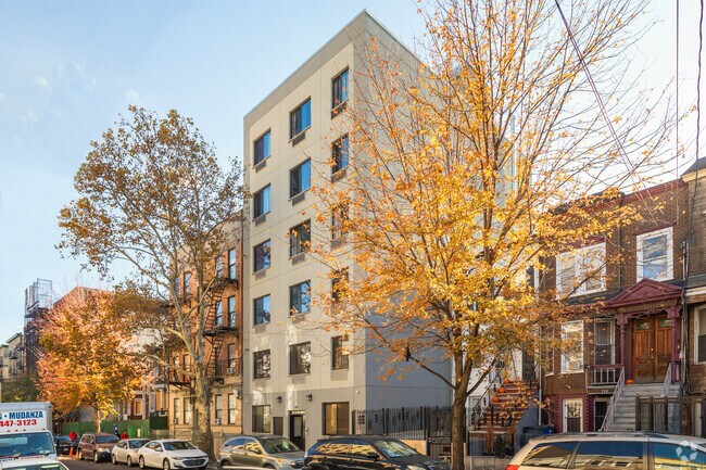
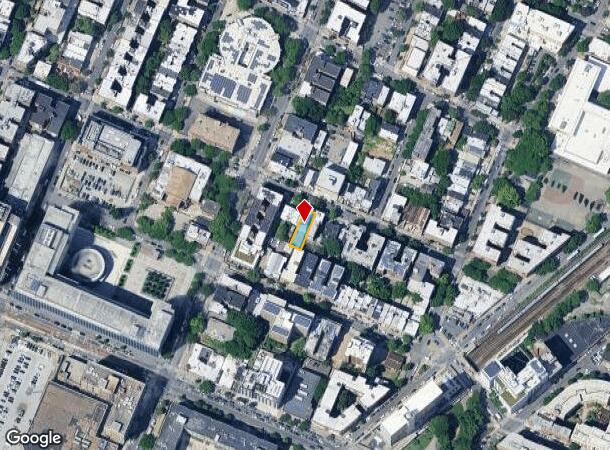
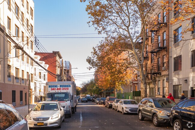
Property Record
286 E 163Rd St, Bronx, NY 10451
Property Detail
286 E 163Rd St
02422-0015
Map Of Lands Of James Morris
Apartment
Bronx
X
New York
3604970083F
15
2024
0.04 AC
2025
Fleetwood-Concourse Village
017300
Westchester/So Connecticut
12,000 SF
New York-Jersey City-White Plains, NY-NJ
NEARBY LISTINGS FOR SALE OR LEASE
DEMOGRAPHICS near 286 E 163Rd St
1 mile
3 mile
5 mile
2024 Total Population
222,911
1,243,718
2,429,605
2029 Population
209,060
1,158,064
2,258,971
Pop Growth 2024-2029
(6.21%)
(6.89%)
(7.02%)
Average Age
37
38
40
2024 Total Households
77,194
454,778
959,710
HH Growth 2024-2029
(6.99%)
(7.42%)
(7.43%)
Median Household Inc
$32,715
$39,959
$57,058
Avg Household Size
2.70
2.60
2.40
2024 Avg HH Vehicles
.00
.00
.00
Median Home Value
$317,861
$571,029
$733,829
Median Year Built
1961
1951
1951
Nearby Places
Map Layers
Map Styles
 Street
 Aerial
Transit
 Traffic
 Biking
Places
Listings with unknown addresses are not visible on the map
- Restaurants
- Banks
- Shops
- Fitness
- Groceries
PUBLIC TRANSPORTATION
TRANSIT/SUBWAY
161 Street-Yankee Stadium (4 - New York MTA Subway (The Subway), B - New York MTA Subway (The Subway), D - New York MTA Subway (The Subway))
Drive
Walk
Distance
161 Street-Yankee Stadium (4 - New York MTA Subway (The Subway), B - New York MTA Subway (The Subway), D - New York MTA Subway (The Subway))
2 min
10 min
0.6 mi
167 Street (B,D Line) (B - New York MTA Subway (The Subway), D - New York MTA Subway (The Subway))
Drive
Walk
Distance
167 Street (B,D Line) (B - New York MTA Subway (The Subway), D - New York MTA Subway (The Subway))
2 min
12 min
0.6 mi
167 Street (4 Line) (4 - New York MTA Subway (The Subway))
Drive
Walk
Distance
167 Street (4 Line) (4 - New York MTA Subway (The Subway))
3 min
16 min
0.9 mi
3 Avenue-149 Street (2 - New York MTA Subway (The Subway), 5 - New York MTA Subway (The Subway))
Drive
Walk
Distance
3 Avenue-149 Street (2 - New York MTA Subway (The Subway), 5 - New York MTA Subway (The Subway))
5 min
17 min
0.9 mi
149 Street-Grand Concourse (2 - New York MTA Subway (The Subway), 4 - New York MTA Subway (The Subway), 5 - New York MTA Subway (The Subway))
Drive
Walk
Distance
149 Street-Grand Concourse (2 - New York MTA Subway (The Subway), 4 - New York MTA Subway (The Subway), 5 - New York MTA Subway (The Subway))
4 min
17 min
0.9 mi
COMMUTER RAIL
Melrose Station (Harlem Line - Metro-North Commuter Railroad Company (Metro-North))
Drive
Walk
Distance
Melrose Station (Harlem Line - Metro-North Commuter Railroad Company (Metro-North))
2 min
3 min
0.2 mi
Yankees-E 153Rd Street Station (Hudson Line - Metro-North Commuter Railroad Company (Metro-North))
Drive
Walk
Distance
Yankees-E 153Rd Street Station (Hudson Line - Metro-North Commuter Railroad Company (Metro-North))
6 min
17 min
0.9 mi
AIRPORT
LaGuardia
Drive
Walk
Distance
LaGuardia
18 min
8.5 mi
John F Kennedy International
Drive
Walk
Distance
John F Kennedy International
32 min
19.7 mi
Newark Liberty International
Drive
Walk
Distance
Newark Liberty International
29 min
22.9 mi
Freight Ports
NY - Red Hook Container Terminal
Drive
Walk
Distance
NY - Red Hook Container Terminal
31 min
16.6 mi
SALE & LEASE HISTORY
LISTING DATE
SALE/LEASE

Mar 09, 2020
For Sale
Jun 17, 2020
For Sale
Dec 06, 2023
For Sale
Nearby Properties
Address
Land Use
TOTAL SIZE
Lot Size
Zoning
Address
Land Use
TOTAL SIZE
Lot Size
Zoning
5,519,372 SF
409.21 AC
C8-2
Address
Land Use
TOTAL SIZE
Lot Size
Zoning
3,693,539 SF
8.37 AC
R8
Address
Land Use
TOTAL SIZE
Lot Size
Zoning
400,160 SF
10.96 AC
R7-2
Address
Land Use
TOTAL SIZE
Lot Size
Zoning
1,299,700 SF
29.82 AC
R6
Address
Land Use
TOTAL SIZE
Lot Size
Zoning
1,743,584 SF
77.87 AC
R6
Address
Land Use
TOTAL SIZE
Lot Size
Zoning
1,368,870 SF
16.86 AC
R8
Address
Land Use
TOTAL SIZE
Lot Size
Zoning
2,278,432 SF
5.99 AC
R7-2
Address
Land Use
TOTAL SIZE
Lot Size
Zoning
11.92 AC
R7-2
Address
Land Use
TOTAL SIZE
Lot Size
Zoning
11.92 AC
R7-2
Address
Land Use
TOTAL SIZE
Lot Size
Zoning
11.92 AC
R7-2
Address
Land Use
TOTAL SIZE
Lot Size
Zoning
11.92 AC
R7-2
Address
Land Use
TOTAL SIZE
Lot Size
Zoning
11.92 AC
R7-2
Address
Land Use
TOTAL SIZE
Lot Size
Zoning
11.92 AC
R7-2
Address
Land Use
TOTAL SIZE
Lot Size
Zoning
11.92 AC
R7-2
Address
Land Use
TOTAL SIZE
Lot Size
Zoning
11.92 AC
R7-2
Address
Land Use
TOTAL SIZE
Lot Size
Zoning
11.92 AC
R7-2
Address
Land Use
TOTAL SIZE
Lot Size
Zoning
11.92 AC
R7-2
Address
Land Use
TOTAL SIZE
Lot Size
Zoning
11.92 AC
R7-2
Address
Land Use
TOTAL SIZE
Lot Size
Zoning
11.92 AC
R7-2
Address
Land Use
TOTAL SIZE
Lot Size
Zoning
11.92 AC
R7-2
Address
Land Use
TOTAL SIZE
Lot Size
Zoning
11.92 AC
R7-2
Address
Land Use
TOTAL SIZE
Lot Size
Zoning
11.92 AC
R7-2
Address
Land Use
TOTAL SIZE
Lot Size
Zoning
11.92 AC
R7-2
Address
Land Use
TOTAL SIZE
Lot Size
Zoning
11.92 AC
R7-2
Address
Land Use
TOTAL SIZE
Lot Size
Zoning
11.92 AC
R7-2
Address
Land Use
TOTAL SIZE
Lot Size
Zoning
11.92 AC
R7-2
Address
Land Use
TOTAL SIZE
Lot Size
Zoning
11.92 AC
R7-2
Address
Land Use
TOTAL SIZE
Lot Size
Zoning
11.92 AC
R7-2
Address
Land Use
TOTAL SIZE
Lot Size
Zoning
11.92 AC
R7-2
Address
Land Use
TOTAL SIZE
Lot Size
Zoning
11.92 AC
R7-2
The World's #1 Commercial Real Estate Marketplace
Connect with us
© 2026 CoStar Group
The information above has been obtained from sources believed reliable. While we do not doubt its accuracy we have not verified it and make no guarantee, warranty or representation about it. It is your responsibility to independently confirm its accuracy and completeness. Any projections, opinions, assumptions, or estimates used are for example only and do not represent the current or future performance of the property. The value of this transaction to you depends on tax and other factors which should be evaluated by your tax, financial, and legal advisors. You and your advisors should conduct a careful, independent investigation of the property to determine to your satisfaction the suitability of the property for your needs.