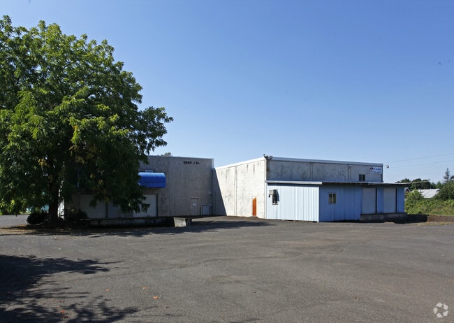
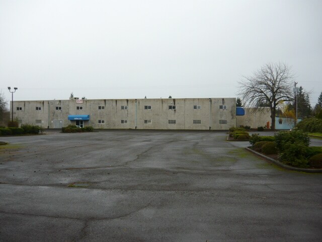
Property Record
2860 J St, Hubbard, OR 97032

Property Detail
2860 J St
511598
ACRES 4.50
Officebuilding
Marion
I
Oregon
C and X Area of minimal flood hazard, usually depicted on FIRMs as above the 500-year flood level.
4.50 AC
2024
Marion County
2025
Portland
010202
Salem, OR
41,328 SF
NEARBY LISTINGS FOR SALE OR LEASE
DEMOGRAPHICS near 2860 J St
1 mile
3 mile
5 mile
2024 Total Population
3,922
16,916
42,889
2029 Population
3,996
17,235
43,797
Pop Growth 2024-2029
+ 1.89%
+ 1.89%
+ 2.12%
Average Age
38
38
39
2024 Total Households
1,244
5,274
13,647
HH Growth 2024-2029
+ 2.01%
+ 2.01%
+ 2.19%
Median Household Inc
$102,956
$80,098
$73,478
Avg Household Size
3.20
3.10
3.10
2024 Avg HH Vehicles
2.00
2.00
2.00
Median Home Value
$472,678
$443,333
$397,984
Median Year Built
1978
1977
1978
Nearby Places
Map Layers
Map Styles
 Street
 Aerial
Transit
 Traffic
 Biking
Places
Listings with unknown addresses are not visible on the map
- Restaurants
- Banks
- Shops
- Fitness
- Groceries
PUBLIC TRANSPORTATION
AIRPORT
Portland International
Drive
Walk
Distance
Portland International
56 min
38.2 mi
Freight Ports
Port of Portland
Drive
Walk
Distance
Port of Portland
42 min
29.4 mi
SALE & LEASE HISTORY
LISTING DATE
SALE/LEASE

Sep 23, 2016
For Sale
May 09, 2017
For Sale
Mar 01, 2018
For Lease
Jun 12, 2017
For Sale
Jan 07, 2019
For Lease
Nearby Properties
Address
Land Use
TOTAL SIZE
Lot Size
Zoning
Address
Land Use
TOTAL SIZE
Lot Size
Zoning
26,283 SF
56.26 AC
P/SP
Address
Land Use
TOTAL SIZE
Lot Size
Zoning
234,131 SF
9.47 AC
CG
Address
Land Use
TOTAL SIZE
Lot Size
Zoning
198,139 SF
8.60 AC
CG
Address
Land Use
TOTAL SIZE
Lot Size
Zoning
82,150 SF
7.05 AC
CG
Address
Land Use
TOTAL SIZE
Lot Size
Zoning
20 SF
100.66 AC
P
Address
Land Use
TOTAL SIZE
Lot Size
Zoning
Address
Land Use
TOTAL SIZE
Lot Size
Zoning
72,935 SF
9.73 AC
CG
Address
Land Use
TOTAL SIZE
Lot Size
Zoning
100,645 SF
3.24 AC
CG
Address
Land Use
TOTAL SIZE
Lot Size
Zoning
161,280 SF
11.39 AC
RM
Address
Land Use
TOTAL SIZE
Lot Size
Zoning
90,582 SF
3.39 AC
CG
Address
Land Use
TOTAL SIZE
Lot Size
Zoning
152,390 SF
20.40 AC
IP
Address
Land Use
TOTAL SIZE
Lot Size
Zoning
27,204 SF
9.16 AC
P/SP
Address
Land Use
TOTAL SIZE
Lot Size
Zoning
99,924 SF
8.50 AC
CG
Address
Land Use
TOTAL SIZE
Lot Size
Zoning
57,356 SF
3.52 AC
RM
Address
Land Use
TOTAL SIZE
Lot Size
Zoning
6.22 AC
IL
Address
Land Use
TOTAL SIZE
Lot Size
Zoning
52,328 SF
9.68 AC
CG
Address
Land Use
TOTAL SIZE
Lot Size
Zoning
56,744 SF
3.40 AC
RM
Address
Land Use
TOTAL SIZE
Lot Size
Zoning
29,547 SF
3.92 AC
CO
Address
Land Use
TOTAL SIZE
Lot Size
Zoning
51,936 SF
5.98 AC
RM
Address
Land Use
TOTAL SIZE
Lot Size
Zoning
151,472 SF
11.98 AC
IP
Address
Land Use
TOTAL SIZE
Lot Size
Zoning
Address
Land Use
TOTAL SIZE
Lot Size
Zoning
47,709 SF
29.13 AC
IP
Address
Land Use
TOTAL SIZE
Lot Size
Zoning
27,250 SF
2.66 AC
RM
Address
Land Use
TOTAL SIZE
Lot Size
Zoning
39,666 SF
8.39 AC
I
Address
Land Use
TOTAL SIZE
Lot Size
Zoning
81,772 SF
3.92 AC
IC
Address
Land Use
TOTAL SIZE
Lot Size
Zoning
Address
Land Use
TOTAL SIZE
Lot Size
Zoning
74,888 SF
4.02 AC
IL
Address
Land Use
TOTAL SIZE
Lot Size
Zoning
420 SF
1.39 AC
P/SP
Address
Land Use
TOTAL SIZE
Lot Size
Zoning
39,323 SF
15.38 AC
IL
Address
Land Use
TOTAL SIZE
Lot Size
Zoning
11.13 AC
IP
The World's #1 Commercial Real Estate Marketplace
Connect with us
© 2026 CoStar Group
The information above has been obtained from sources believed reliable. While we do not doubt its accuracy we have not verified it and make no guarantee, warranty or representation about it. It is your responsibility to independently confirm its accuracy and completeness. Any projections, opinions, assumptions, or estimates used are for example only and do not represent the current or future performance of the property. The value of this transaction to you depends on tax and other factors which should be evaluated by your tax, financial, and legal advisors. You and your advisors should conduct a careful, independent investigation of the property to determine to your satisfaction the suitability of the property for your needs.