Property Record
2860 S Us Highway 83, Zapata, TX 78076


NEARBY LISTINGS FOR SALE OR LEASE
-
-
View all Zapata listings for sale on LoopNet.com
Property Detail
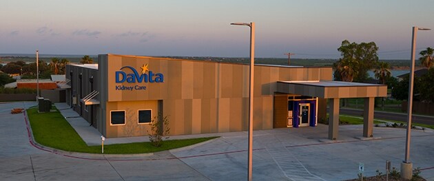
2860 S Us Highway 83
Zapata, TX
Falcon Lake Estates West
5066
FALCON LAKE ESTATES WEST, LOT C-2018, (GENESIS KC SUBDIVISION)
Commercialnec
Zapata
X
Texas
48505C0510B
c-2018
2024
1.19 AC
2025
Other Market Areas
950401
DEMOGRAPHICS near 2860 S Us Highway 83
1 Mile
3 Mile
5 Mile
2024 Total Population
1,913
6,693
12,957
2029 Population
1,844
6,713
12,967
Pop Growth 2024-2029
(3.61%)
+ 0.30%
+ 0.08%
Average Age
35
37
36
2024 Total Households
646
2,282
4,216
HH Growth 2024-2029
(3.25%)
+ 0.39%
+ 0.17%
Median Household Inc
$56,435
$36,385
$34,721
Avg Household Size
3.00
2.90
3.00
2024 Avg HH Vehicles
2.00
2.00
2.00
Median Home Value
$108,250
$112,519
$94,400
Median Year Built
1985
1989
1990
Nearby Places
Map Layers
Map Styles
 Street
 Aerial
- Restaurants
- Banks
- Shops
- Fitness
- Groceries
SALE & LEASE HISTORY
LISTING DATE
SALE/LEASE

Jun 30, 2017
For Sale
Aug 04, 2017
For Sale
Nearby Properties
Address
Land Use
TOTAL SIZE
Lot Size
Zoning
Address
Land Use
TOTAL SIZE
Lot Size
Zoning
3.38 AC
Address
Land Use
TOTAL SIZE
Lot Size
Zoning
5.42 AC
Address
Land Use
TOTAL SIZE
Lot Size
Zoning
9.39 AC
Address
Land Use
TOTAL SIZE
Lot Size
Zoning
27.95 AC
Address
Land Use
TOTAL SIZE
Lot Size
Zoning
1,350 SF
1.91 AC
Address
Land Use
TOTAL SIZE
Lot Size
Zoning
1,284.22 AC
Address
Land Use
TOTAL SIZE
Lot Size
Zoning
2.90 AC
Address
Land Use
TOTAL SIZE
Lot Size
Zoning
4.87 AC
Address
Land Use
TOTAL SIZE
Lot Size
Zoning
4.31 AC
Address
Land Use
TOTAL SIZE
Lot Size
Zoning
3,000 SF
1,010.80 AC
Address
Land Use
TOTAL SIZE
Lot Size
Zoning
12,987 SF
1.59 AC
Address
Land Use
TOTAL SIZE
Lot Size
Zoning
2,592 SF
8.36 AC
Address
Land Use
TOTAL SIZE
Lot Size
Zoning
1.13 AC
Address
Land Use
TOTAL SIZE
Lot Size
Zoning
1.10 AC
Address
Land Use
TOTAL SIZE
Lot Size
Zoning
Address
Land Use
TOTAL SIZE
Lot Size
Zoning
676.63 AC
Address
Land Use
TOTAL SIZE
Lot Size
Zoning
1.24 AC
Address
Land Use
TOTAL SIZE
Lot Size
Zoning
1.13 AC
Address
Land Use
TOTAL SIZE
Lot Size
Zoning
360 SF
1.30 AC
Address
Land Use
TOTAL SIZE
Lot Size
Zoning
2.09 AC
Address
Land Use
TOTAL SIZE
Lot Size
Zoning
3.99 AC
Address
Land Use
TOTAL SIZE
Lot Size
Zoning
1.22 AC
Address
Land Use
TOTAL SIZE
Lot Size
Zoning
Address
Land Use
TOTAL SIZE
Lot Size
Zoning
14,646 SF
1.96 AC
Address
Land Use
TOTAL SIZE
Lot Size
Zoning
1.85 AC
Address
Land Use
TOTAL SIZE
Lot Size
Zoning
0.90 AC
Address
Land Use
TOTAL SIZE
Lot Size
Zoning
4.93 AC
Address
Land Use
TOTAL SIZE
Lot Size
Zoning
1.35 AC
Address
Land Use
TOTAL SIZE
Lot Size
Zoning
2.63 AC
Address
Land Use
TOTAL SIZE
Lot Size
Zoning
840 SF
2.04 AC
The World's #1 Commercial Real Estate Marketplace
Connect with us
© 2025 CoStar Group
The information above has been obtained from sources believed reliable. While we do not doubt its accuracy we have not verified it and make no guarantee, warranty or representation about it. It is your responsibility to independently confirm its accuracy and completeness. Any projections, opinions, assumptions, or estimates used are for example only and do not represent the current or future performance of the property. The value of this transaction to you depends on tax and other factors which should be evaluated by your tax, financial, and legal advisors. You and your advisors should conduct a careful, independent investigation of the property to determine to your satisfaction the suitability of the property for your needs.