Property Record
2860 State Route 208, Walden, NY 12586

NEARBY LISTINGS FOR SALE OR LEASE
Property Detail
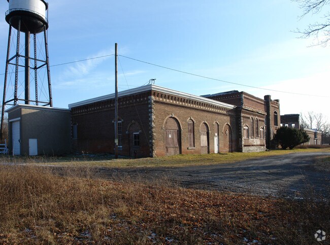
2860 State Route 208
334289-002-000-0001-004.000-0000
ST HWY 208 FIRE DAMAGE PARTIAL A/V
Industrialgeneral
Orange
AE
New York
36111C0860E
4.000
2024
19.80 AC
2024
Orange County
010602
Northern New Jersey
60,592 SF
Kiryas Joel-Poughkeepsie-Newburgh, NY
DEMOGRAPHICS near 2860 State Route 208
1 Mile
3 Mile
5 Mile
2024 Total Population
657
14,481
26,347
2029 Population
656
14,609
26,524
Pop Growth 2024-2029
(0.15%)
+ 0.88%
+ 0.67%
Average Age
42
40
41
2024 Total Households
240
5,012
8,898
HH Growth 2024-2029
0.00%
+ 0.90%
+ 0.66%
Median Household Inc
$120,672
$85,829
$97,845
Avg Household Size
2.70
2.70
2.70
2024 Avg HH Vehicles
2.00
2.00
2.00
Median Home Value
$331,372
$296,198
$317,206
Median Year Built
1979
1970
1972
Nearby Places
Map Layers
Map Styles
 Street
 Aerial
- Restaurants
- Banks
- Shops
- Fitness
- Groceries
PUBLIC TRANSPORTATION
AIRPORT
New York Stewart International
DRIVE
WALK
Distance
New York Stewart International
21 min
12.7 mi
Freight Ports
Port Newark Container Terminal
DRIVE
WALK
Distance
Port Newark Container Terminal
105 min
78.8 mi
SALE & LEASE HISTORY
LISTING DATE
SALE/LEASE

Sep 25, 2016
For Lease
Nearby Properties
Address
Land Use
TOTAL SIZE
Lot Size
Zoning
Address
Land Use
TOTAL SIZE
Lot Size
Zoning
109,108 SF
15.60 AC
B2
Address
Land Use
TOTAL SIZE
Lot Size
Zoning
32,505 SF
15.10 AC
I1
Address
Land Use
TOTAL SIZE
Lot Size
Zoning
14,376 SF
63.90 AC
01
Address
Land Use
TOTAL SIZE
Lot Size
Zoning
72,852 SF
2.20 AC
Address
Land Use
TOTAL SIZE
Lot Size
Zoning
85,275 SF
70.20 AC
RA-.5
Address
Land Use
TOTAL SIZE
Lot Size
Zoning
18,386 SF
54.70 AC
RA-.5
Address
Land Use
TOTAL SIZE
Lot Size
Zoning
38.80 AC
H-1
Address
Land Use
TOTAL SIZE
Lot Size
Zoning
195,821 SF
27.50 AC
I1
Address
Land Use
TOTAL SIZE
Lot Size
Zoning
111,517 SF
0.32 AC
R3
Address
Land Use
TOTAL SIZE
Lot Size
Zoning
Address
Land Use
TOTAL SIZE
Lot Size
Zoning
82,465 SF
14.40 AC
I1
Address
Land Use
TOTAL SIZE
Lot Size
Zoning
2.10 AC
R5
Address
Land Use
TOTAL SIZE
Lot Size
Zoning
78,179 SF
30.50 AC
I1
Address
Land Use
TOTAL SIZE
Lot Size
Zoning
52,267 SF
4.60 AC
RM2
Address
Land Use
TOTAL SIZE
Lot Size
Zoning
35.80 AC
I1
Address
Land Use
TOTAL SIZE
Lot Size
Zoning
34.20 AC
Address
Land Use
TOTAL SIZE
Lot Size
Zoning
19,208 SF
4.10 AC
R4
Address
Land Use
TOTAL SIZE
Lot Size
Zoning
51,257 SF
8.50 AC
RM1
Address
Land Use
TOTAL SIZE
Lot Size
Zoning
100.90 AC
RAG-2
Address
Land Use
TOTAL SIZE
Lot Size
Zoning
36,648 SF
3.10 AC
R4
Address
Land Use
TOTAL SIZE
Lot Size
Zoning
23,040 SF
12.10 AC
RA2
Address
Land Use
TOTAL SIZE
Lot Size
Zoning
84.40 AC
RA-.5
Address
Land Use
TOTAL SIZE
Lot Size
Zoning
9,976 SF
1 AC
MX
Address
Land Use
TOTAL SIZE
Lot Size
Zoning
92,537 SF
3.80 AC
H-1
Address
Land Use
TOTAL SIZE
Lot Size
Zoning
121,584 SF
9.20 AC
I1
Address
Land Use
TOTAL SIZE
Lot Size
Zoning
32,219 SF
9.40 AC
R3
Address
Land Use
TOTAL SIZE
Lot Size
Zoning
3,664 SF
133.20 AC
RA5
Address
Land Use
TOTAL SIZE
Lot Size
Zoning
15,368 SF
11.80 AC
Address
Land Use
TOTAL SIZE
Lot Size
Zoning
93.10 AC
RA-.5
Address
Land Use
TOTAL SIZE
Lot Size
Zoning
63,710 SF
26.30 AC
H-1
The World's #1 Commercial Real Estate Marketplace
Connect with us
© 2026 CoStar Group
The information above has been obtained from sources believed reliable. While we do not doubt its accuracy we have not verified it and make no guarantee, warranty or representation about it. It is your responsibility to independently confirm its accuracy and completeness. Any projections, opinions, assumptions, or estimates used are for example only and do not represent the current or future performance of the property. The value of this transaction to you depends on tax and other factors which should be evaluated by your tax, financial, and legal advisors. You and your advisors should conduct a careful, independent investigation of the property to determine to your satisfaction the suitability of the property for your needs.