Property Record
2863 N High St, Columbus, OH 43202

Save to a Folder
{{folder.Name}}
{{folder.ListingIds.length}} Properties
{{folder.ListingIds.length}} Property
Create a New Folder
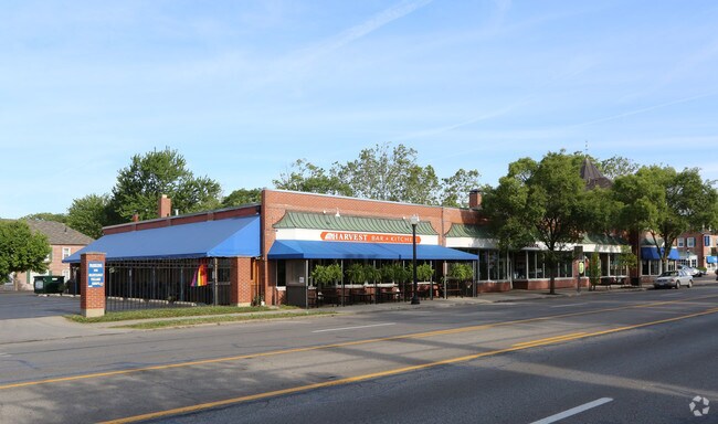
Property Detail
2863 N High St
010-234239
2885-2941 N HIGH ST WILSON FARM 20.739 ACRES
Apartment
FRANKLIN
B and X Area of moderate flood hazard, usually the area between the limits of the 100-year and 500-year floods.
Ohio
2024
20.74 AC
2025
North Central
000500
Columbus
397,193 SF
Columbus, OH
NEARBY LISTINGS FOR SALE OR LEASE
DEMOGRAPHICS near 2863 N High St
1 mile
3 mile
5 mile
2025 Total Population
24,055
182,396
383,665
2030 Population
24,858
188,689
397,234
Pop Growth 2025-2030
+ 3.34%
+ 3.45%
+ 3.54%
Average Age
33
35
36
2025 Total Households
11,545
77,593
166,143
HH Growth 2025-2030
+ 3.58%
+ 3.60%
+ 3.79%
Median Household Inc
$57,763
$59,953
$63,036
Avg Household Size
2.00
2.10
2.10
2025 Avg HH Vehicles
2.00
2.00
2.00
Median Home Value
$352,457
$359,583
$344,207
Median Year Built
1953
1960
1966
Nearby Places
Map Layers
Map Styles
 Street
 Aerial
Layers
 Traffic
 Biking
Places
Listings with unknown addresses are not visible on the map
- Restaurants
- Banks
- Shops
- Fitness
- Groceries
PUBLIC TRANSPORTATION
AIRPORT
John Glenn Columbus International
Drive
Walk
Distance
John Glenn Columbus International
18 min
10.3 mi
Rickenbacker International
Drive
Walk
Distance
Rickenbacker International
32 min
19.5 mi
Freight Ports
Port of Toledo
Drive
Walk
Distance
Port of Toledo
181 min
140.7 mi
SALE & LEASE HISTORY
LISTING DATE
SALE/LEASE

May 10, 2019
For Lease
Jan 30, 2020
For Lease
Nearby Properties
Address
Land Use
TOTAL SIZE
Lot Size
Zoning
Address
Land Use
TOTAL SIZE
Lot Size
Zoning
1,160,461 SF
328.10 AC
Address
Land Use
TOTAL SIZE
Lot Size
Zoning
3,462,019 SF
54.42 AC
Address
Land Use
TOTAL SIZE
Lot Size
Zoning
344,620 SF
291.96 AC
Address
Land Use
TOTAL SIZE
Lot Size
Zoning
382,270 SF
319.59 AC
Address
Land Use
TOTAL SIZE
Lot Size
Zoning
Address
Land Use
TOTAL SIZE
Lot Size
Zoning
1,099,074 SF
39.47 AC
Address
Land Use
TOTAL SIZE
Lot Size
Zoning
388,082 SF
12.41 AC
Address
Land Use
TOTAL SIZE
Lot Size
Zoning
1.64 AC
Address
Land Use
TOTAL SIZE
Lot Size
Zoning
611,253 SF
32.89 AC
Address
Land Use
TOTAL SIZE
Lot Size
Zoning
378,522 SF
41.13 AC
Address
Land Use
TOTAL SIZE
Lot Size
Zoning
747,391 SF
3.15 AC
Address
Land Use
TOTAL SIZE
Lot Size
Zoning
4.90 AC
Address
Land Use
TOTAL SIZE
Lot Size
Zoning
2.25 AC
Address
Land Use
TOTAL SIZE
Lot Size
Zoning
240,144 SF
45.78 AC
Address
Land Use
TOTAL SIZE
Lot Size
Zoning
691,902 SF
12.34 AC
Address
Land Use
TOTAL SIZE
Lot Size
Zoning
767,328 SF
5.10 AC
Address
Land Use
TOTAL SIZE
Lot Size
Zoning
4.46 AC
Address
Land Use
TOTAL SIZE
Lot Size
Zoning
36.42 AC
Address
Land Use
TOTAL SIZE
Lot Size
Zoning
15,968 SF
10 AC
Address
Land Use
TOTAL SIZE
Lot Size
Zoning
34,200 SF
8.10 AC
Address
Land Use
TOTAL SIZE
Lot Size
Zoning
365,440 SF
4.03 AC
Address
Land Use
TOTAL SIZE
Lot Size
Zoning
325,684 SF
2 AC
Address
Land Use
TOTAL SIZE
Lot Size
Zoning
431,360 SF
7.95 AC
Address
Land Use
TOTAL SIZE
Lot Size
Zoning
24.14 AC
Address
Land Use
TOTAL SIZE
Lot Size
Zoning
10,368 SF
293.98 AC
Address
Land Use
TOTAL SIZE
Lot Size
Zoning
339,332 SF
1.42 AC
Address
Land Use
TOTAL SIZE
Lot Size
Zoning
634,615 SF
10.10 AC
Address
Land Use
TOTAL SIZE
Lot Size
Zoning
0.99 AC
Address
Land Use
TOTAL SIZE
Lot Size
Zoning
1.39 AC
Address
Land Use
TOTAL SIZE
Lot Size
Zoning
349,372 SF
3.09 AC
The World's #1 Commercial Real Estate Marketplace
Connect with us
© 2026 CoStar Group
The information above has been obtained from sources believed reliable. While we do not doubt its accuracy we have not verified it and make no guarantee, warranty or representation about it. It is your responsibility to independently confirm its accuracy and completeness. Any projections, opinions, assumptions, or estimates used are for example only and do not represent the current or future performance of the property. The value of this transaction to you depends on tax and other factors which should be evaluated by your tax, financial, and legal advisors. You and your advisors should conduct a careful, independent investigation of the property to determine to your satisfaction the suitability of the property for your needs.