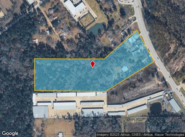
Property Record
28631 Fm 2978 Rd, Magnolia, TX 77354
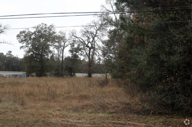
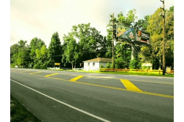

This Property Is For Sale
NEARBY LISTINGS FOR SALE OR LEASE
Property Detail
28631 Fm 2978 Rd
0078-01-02105
Brown James
Commercialnec
A0078 BROWN JAMES, TRACT 19,21, ACRES 0.500
X
Montgomery
48339C0515G
Texas
2024
0.50 AC
2025
Northwest Outlier
690408
Houston
1,012 SF
Houston-Pasadena-The Woodlands, TX
DEMOGRAPHICS near 28631 Fm 2978 Rd
1 Mile
3 Mile
5 Mile
2024 Total Population
3,910
34,954
110,731
2029 Population
4,829
42,563
128,857
Pop Growth 2024-2029
+ 23.50%
+ 21.77%
+ 16.37%
Average Age
37
37
38
2024 Total Households
1,399
11,528
37,093
HH Growth 2024-2029
+ 23.59%
+ 21.90%
+ 16.47%
Median Household Inc
$119,478
$126,274
$129,696
Avg Household Size
2.70
3.00
2.90
2024 Avg HH Vehicles
2.00
2.00
2.00
Median Home Value
$337,719
$442,087
$411,933
Median Year Built
2010
2008
2007
Nearby Places
Map Layers
Map Styles
 Street
 Aerial
- Restaurants
- Banks
- Shops
- Fitness
- Groceries
PUBLIC TRANSPORTATION
AIRPORT
George Bush Intcntl/Houston
DRIVE
WALK
Distance
George Bush Intcntl/Houston
42 min
32.8 mi
Freight Ports
Port of Houston
DRIVE
WALK
Distance
Port of Houston
65 min
48.5 mi
Nearby Properties
Address
Land Use
TOTAL SIZE
Lot Size
Zoning
Address
Land Use
TOTAL SIZE
Lot Size
Zoning
461,345 SF
28.36 AC
Address
Land Use
TOTAL SIZE
Lot Size
Zoning
370,029 SF
16.12 AC
Address
Land Use
TOTAL SIZE
Lot Size
Zoning
361,747 SF
16.71 AC
Address
Land Use
TOTAL SIZE
Lot Size
Zoning
194,272 SF
11.06 AC
Address
Land Use
TOTAL SIZE
Lot Size
Zoning
211,965 SF
25.17 AC
Address
Land Use
TOTAL SIZE
Lot Size
Zoning
172,784 SF
20.60 AC
2
Address
Land Use
TOTAL SIZE
Lot Size
Zoning
190,000 SF
24.21 AC
Address
Land Use
TOTAL SIZE
Lot Size
Zoning
165,218 SF
17.40 AC
2
Address
Land Use
TOTAL SIZE
Lot Size
Zoning
1,440 SF
126.83 AC
2
Address
Land Use
TOTAL SIZE
Lot Size
Zoning
105,005 SF
2.84 AC
Address
Land Use
TOTAL SIZE
Lot Size
Zoning
116,619 SF
14 AC
Address
Land Use
TOTAL SIZE
Lot Size
Zoning
47.19 AC
Address
Land Use
TOTAL SIZE
Lot Size
Zoning
118,359 SF
14.15 AC
Address
Land Use
TOTAL SIZE
Lot Size
Zoning
43,510 SF
5.63 AC
Address
Land Use
TOTAL SIZE
Lot Size
Zoning
37,764 SF
15.71 AC
Address
Land Use
TOTAL SIZE
Lot Size
Zoning
31,689 SF
5.24 AC
Address
Land Use
TOTAL SIZE
Lot Size
Zoning
112,014 SF
9.56 AC
Address
Land Use
TOTAL SIZE
Lot Size
Zoning
43,105 SF
51.54 AC
2
Address
Land Use
TOTAL SIZE
Lot Size
Zoning
1,360 SF
15.02 AC
Address
Land Use
TOTAL SIZE
Lot Size
Zoning
27,300 SF
3.23 AC
Address
Land Use
TOTAL SIZE
Lot Size
Zoning
96,968 SF
10.05 AC
2
Address
Land Use
TOTAL SIZE
Lot Size
Zoning
90,222 SF
15 AC
Address
Land Use
TOTAL SIZE
Lot Size
Zoning
460.32 AC
Address
Land Use
TOTAL SIZE
Lot Size
Zoning
66,252 SF
12.28 AC
2
Address
Land Use
TOTAL SIZE
Lot Size
Zoning
16,260 SF
3.24 AC
2
Address
Land Use
TOTAL SIZE
Lot Size
Zoning
40,900 SF
5.25 AC
2
Address
Land Use
TOTAL SIZE
Lot Size
Zoning
18,800 SF
2.28 AC
Address
Land Use
TOTAL SIZE
Lot Size
Zoning
24,080 SF
5.09 AC
2
Address
Land Use
TOTAL SIZE
Lot Size
Zoning
28,284 SF
4 AC
Address
Land Use
TOTAL SIZE
Lot Size
Zoning
14,605 SF
2.35 AC
The World's #1 Commercial Real Estate Marketplace
Connect with us
© 2026 CoStar Group
The information above has been obtained from sources believed reliable. While we do not doubt its accuracy we have not verified it and make no guarantee, warranty or representation about it. It is your responsibility to independently confirm its accuracy and completeness. Any projections, opinions, assumptions, or estimates used are for example only and do not represent the current or future performance of the property. The value of this transaction to you depends on tax and other factors which should be evaluated by your tax, financial, and legal advisors. You and your advisors should conduct a careful, independent investigation of the property to determine to your satisfaction the suitability of the property for your needs.