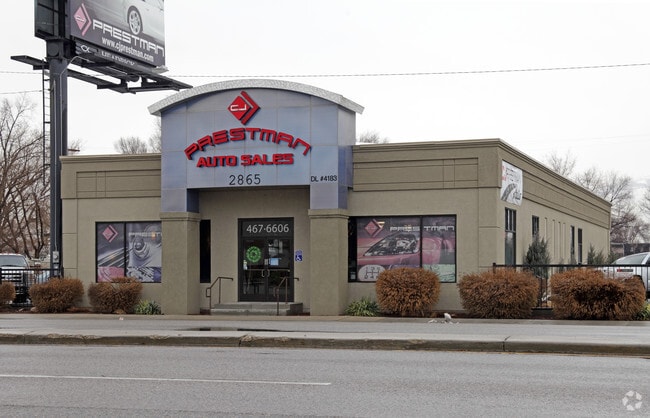
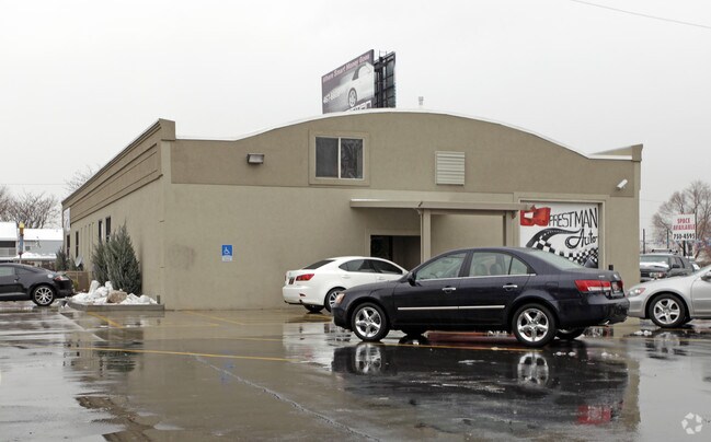
Property Record
2865 S State St, South Salt Lake, UT 84115

NEARBY LISTINGS FOR SALE OR LEASE
Property Detail
2865 S State St
Salt Lake City, UT
Centralia Sub
16-30-107-006-0000
BEG AT SW COR LOT 13, BLK 2, CENTRALIA SUB; N 0^1718 E 590.48 FT; S 89^4408 E 297.22 FT; S 0^0240 W 236.25 FT; N 89^1257 W 149.18 FT; S 0^3245 W 94.66 FT; S 89^3631 E 1.45 FT; S 0^2329 W 101.14 FT; N 89^3037 E 22.61 FT; S0^0128 W 160.01 FT; N 89^4526
Vehiclerentalsvehiclesales
Salt Lake
X
Utah
49035C0284G
13
2024
2.90 AC
2025
Interchange
111400
Salt Lake City
16,398 SF
DEMOGRAPHICS near 2865 S State St
1 Mile
3 Mile
5 Mile
2024 Total Population
16,210
147,532
389,737
2029 Population
16,373
149,191
394,976
Pop Growth 2024-2029
+ 1.01%
+ 1.12%
+ 1.34%
Average Age
36
37
37
2024 Total Households
6,894
61,038
159,314
HH Growth 2024-2029
+ 0.90%
+ 1.23%
+ 1.61%
Median Household Inc
$53,217
$63,845
$66,531
Avg Household Size
2.30
2.30
2.30
2024 Avg HH Vehicles
2.00
2.00
2.00
Median Home Value
$378,773
$428,325
$460,297
Median Year Built
1972
1972
1973
Nearby Places
Map Layers
Map Styles
 Street
 Aerial
- Restaurants
- Banks
- Shops
- Fitness
- Groceries
PUBLIC TRANSPORTATION
COMMUTER RAIL
DRIVE
WALK
Distance
12 min
5.8 mi
DRIVE
WALK
Distance
13 min
7.2 mi
AIRPORT
Salt Lake City International
DRIVE
WALK
Distance
Salt Lake City International
16 min
9.7 mi
Provo Municipal
DRIVE
WALK
Distance
Provo Municipal
55 min
42.4 mi
Nearby Properties
Address
Land Use
TOTAL SIZE
Lot Size
Zoning
Address
Land Use
TOTAL SIZE
Lot Size
Zoning
298,628 SF
27.30 AC
I
Address
Land Use
TOTAL SIZE
Lot Size
Zoning
488,509 SF
36.03 AC
FLEX
Address
Land Use
TOTAL SIZE
Lot Size
Zoning
35,897 SF
28.61 AC
RM-12
Address
Land Use
TOTAL SIZE
Lot Size
Zoning
163,932 SF
14.65 AC
PL
Address
Land Use
TOTAL SIZE
Lot Size
Zoning
691,463 SF
17.80 AC
RM
Address
Land Use
TOTAL SIZE
Lot Size
Zoning
208,868 SF
20.41 AC
I
Address
Land Use
TOTAL SIZE
Lot Size
Zoning
128,997 SF
3.04 AC
ESN
Address
Land Use
TOTAL SIZE
Lot Size
Zoning
521,964 SF
3.23 AC
T-O-D
Address
Land Use
TOTAL SIZE
Lot Size
Zoning
297,476 SF
1.62 AC
CSHBD2
Address
Land Use
TOTAL SIZE
Lot Size
Zoning
302,944 SF
5.47 AC
Address
Land Use
TOTAL SIZE
Lot Size
Zoning
369,717 SF
2.50 AC
RO
Address
Land Use
TOTAL SIZE
Lot Size
Zoning
502,104 SF
4.11 AC
E ST C
Address
Land Use
TOTAL SIZE
Lot Size
Zoning
412,006 SF
1.70 AC
C3
Address
Land Use
TOTAL SIZE
Lot Size
Zoning
369,377 SF
1.65 AC
Address
Land Use
TOTAL SIZE
Lot Size
Zoning
426,600 SF
1.61 AC
CSHBD1
Address
Land Use
TOTAL SIZE
Lot Size
Zoning
95,854 SF
15.42 AC
CC
Address
Land Use
TOTAL SIZE
Lot Size
Zoning
903,167 SF
1.90 AC
CSHBD1
Address
Land Use
TOTAL SIZE
Lot Size
Zoning
195,790 SF
14.32 AC
RM
Address
Land Use
TOTAL SIZE
Lot Size
Zoning
125,518 SF
11.03 AC
RMZC
Address
Land Use
TOTAL SIZE
Lot Size
Zoning
33,164 SF
6.88 AC
RM
Address
Land Use
TOTAL SIZE
Lot Size
Zoning
84,870 SF
9.76 AC
MPMU
Address
Land Use
TOTAL SIZE
Lot Size
Zoning
347,330 SF
6.91 AC
CC
Address
Land Use
TOTAL SIZE
Lot Size
Zoning
107,416 SF
5.46 AC
CSHBD2
Address
Land Use
TOTAL SIZE
Lot Size
Zoning
217,700 SF
52.59 AC
FLEX
Address
Land Use
TOTAL SIZE
Lot Size
Zoning
56,867 SF
5.33 AC
MIXED
Address
Land Use
TOTAL SIZE
Lot Size
Zoning
303,240 SF
29.21 AC
1205
Address
Land Use
TOTAL SIZE
Lot Size
Zoning
138,180 SF
2.06 AC
RM-12
Address
Land Use
TOTAL SIZE
Lot Size
Zoning
80,985 SF
19.18 AC
RM
Address
Land Use
TOTAL SIZE
Lot Size
Zoning
299,673 SF
2.16 AC
C3
Address
Land Use
TOTAL SIZE
Lot Size
Zoning
137,209 SF
38.90 AC
FLEX
The World's #1 Commercial Real Estate Marketplace
Connect with us
© 2026 CoStar Group
The information above has been obtained from sources believed reliable. While we do not doubt its accuracy we have not verified it and make no guarantee, warranty or representation about it. It is your responsibility to independently confirm its accuracy and completeness. Any projections, opinions, assumptions, or estimates used are for example only and do not represent the current or future performance of the property. The value of this transaction to you depends on tax and other factors which should be evaluated by your tax, financial, and legal advisors. You and your advisors should conduct a careful, independent investigation of the property to determine to your satisfaction the suitability of the property for your needs.